- All Categories (120)
- Data (2)
- News (29)
- Missions (9)
- Events (5)
- Tools (1)
- Activities (5)
- Documents (69)
Document - Algorithms Theoretical Baseline Document

Aeolus Level 2A Algorithm Theoretical Baseline Document – AEL-FM and AEL-PRO products
This document describes Aeolus L2A Algorithm Theoretical Baseline
News - Infographics
Explore sample data products from Third Party Missions
This new infographic summarises the missions that currently have sample data: Download the Infographic A link to each sample
News - General News
Go-to guide to Third Party Mission data offering
Data Access Guide has been published, providing technical details and information on available data collections for all current
News - Thematic area articles
How to use space data to probe humankind’s ancient past
SkySat captures Angkor Wat in Cambodia TPMs that are currently providing high resolution or very high resolution imagery
News - Success Stories
Monitoring the health of wheat crops from space
“In the current research, we aimed to detect more subtle signs of disease that manifest in earlier growth stages, giving
News - Success Stories
Commercial space data help to regreen grasslands in Africa
The availability of commercial data is also enabling Justdiggit to explore new technologies; the team is currently developing
News - Success Stories
Commercial and international data for fire monitoring
The Finnish ICEYE constellation, added to the TPM programme in 2021, currently consists of 27 synthetic aperture radar (SAR
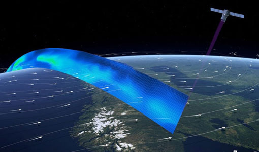
News - Success Stories
Young scientists bid farewell to ESA's wind mission
He recently published research focusing on the validation of Aeolus data and is currently working on a paper investigating
Document - Quality Report

Verification Report of the Third Reprocessing Campaign for First FM-A Period from September 2018 till June 2019
After the successful first and second Aeolus reprocessing campaigns covering the second Flight Model laser (FM-B) from 24 June 2019 to October 2020 ([RD-1] and [RD-2]), efforts were focused on the third reprocessing campaign covering the first operation period of Flight Model laser (FM-A) from 31 August 2018 to 16 June 2019
Document - Quality Report
Verification Report of the Second Reprocessing Campaign for FM-B from 24 June 2019 till 9 October 2020
Verification Report of the Second Reprocessing Campaign for FM-B from 24 June 2019 till 9 October 2020
News - Thematic area articles
How satellite data empower sustainable urban growth
Some 56% of the world's population currently reside in cities and the number of urban inhabitants is expected to double by
News - Success Stories
Aeolus enhances volcanic ash forecasts for aviation safety
Current projects supporting PANGEA include the D-TECT ERC, the PANGEA4CalVal TWINNING and the L2A+, ACPV ESA studies.
Document - Product Document

Main-Processor-Improvements-Baseline-16
The document includes the main processor improvements for baseline 16 for the Aeolus mission.
News - Thematic area articles
How scientists use space data to help advance the energy transition
To build on the current project, the research team plans to use data from ESA’s Third Party Missions programme, which are
Document - Algorithms Theoretical Baseline Document
Aeolus_ATBD_Level_1B_Products.pdf
Aeolus L1B Algorithm Theoretical Baseline Document - Level 1B Processor Algorithm Description
News - Success Stories

Drones join the campaign to validate Aeolus data
The heading is symbolic: Askos is the Greek name of the legendary bag that contains all the storm-currents for Aeolus—the
News - Success Stories
ESA’s wind mission could help to forecast tropical storms
delivered by weather balloons, satellites, and aircraft has been shown to improve its projections; however, the wind data currently
News - Thematic area articles

How satellite data help to shape society
Title: Current drought situation in Ebro basin Description: The SMOS soil-moisture-based drought monitor is updated monthly
News - Success Stories

Heritage data trains neural networks to detect urban sprawl
Since they’ve been trained identically, they can help monitor both current and past urban changes.
News - Thematic area articles

Satellites reveal changes to Earth’s icy zones
By combining information collected by current and previous missions, researchers can estimate how the cryosphere is evolving