- All Categories (122)
- News (2)
- Missions (3)
- Events (3)
- Activities (1)
- Documents (113)
Document - Product Cal/Val Plan/Report

Validation Report following the 3rd MERIS data reprocessing
This document prepared by the MERIS Quality Working Group (QWG) corresponds to the Validation Report following the 3rd MERIS data reprocessing. It aims at qualifying and quantifying the accuracy of the MERIS L2 products generated with the version 8.0 of MERIS Ground Segment prototype (MEGS), delivered to the whole community through the ODESA software (http://earth.eo.esa.int/odesa/). It is equivalent to version 6.0 of the Instrument Processing Facilities (IPF) at ESRIN.
News - Thematic area articles
Space data support Earth’s ecosystems
Currently, it is not possible to measure photosynthetic activity from space, but the forthcoming FLuorescence EXplorer (FLEX
Activity - Quality
SEOM CAWA
The product validation and evolution of the algorithm are currently being performed.
Document - Technical Note

MERIS-Level-2-Detailed-Processing-Model.pdf
This document is the Detailed Processing Model document for the MERIS data processing. It covers the MERIS Level 2 processing.
Document - Technical Note
MERIS-Level-1-Detailed-Processing-Model-Parameters-Data-List.pdf
This document is the Detailed Processing Model and Parameters Data List document for the MERIS data processing.
Document - Technical Note
MERIS-Detailed-Instrument-Description.pdf
This document provides information about the Envisat platform, each part of the MERIS instrument and internal data flow. A more detailed description is provided in the MERIS Product Handbook.
Document - Algorithms Theoretical Baseline Document

MERIS-ATBD-2-24.pdf
Vicarious adjustment of the MERIS Ocean Colour Radiometry.
Document - Technical Note
MERIS-3rd-Data-Reprocessing-Software-ADF-Updates.pdf
This document prepared by the MERIS Quality Working Group (QWG) aims at compiling and presenting all Level 1 and Level 2 evolutions implemented in the 3rd MERIS data reprocessing, in term of algorithm and Auxiliary Data File (ADF) changes.
Mission - Heritage Missions
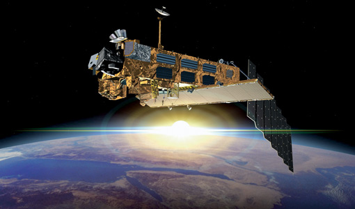
MERIS Overview
Spatial and temporal models of the biosphere are currently being developed to study the mechanics of such complex systems
Document - Product Specifications

MERIS Level-1b & 2 Auxiliary Data Products specification
Specification of the Scientific Contents of the MERIS Level-1b & 2 Auxiliary Data Products
Document - Technical Note
MERIS FR - QUALITY ASSESSMENT
Since February 13th 2015, the bulk processed MERIS FRS L2 dataset is available for users on DissHarm (via MERCI/HTTP and FTP) together with previously released FRS L1b data.
Document - Algorithms Theoretical Baseline Document
MERIS ATBD 2-7
Atmospheric Correction over the Ocean (Case 1 Waters)
Document - Algorithms Theoretical Baseline Document
MERIS ATBD 2-22
MERIS Terrestrial Chlorophyll Index
Document - Algorithms Theoretical Baseline Document
MERIS ATBD 2-15
MERIS aerosol remote sensing over land
Document - Algorithms Theoretical Baseline Document
MERIS ATBD 2-12
Pigment index, sediment and gelbstoff retrieval
Document - Algorithms Theoretical Baseline Document
MERIS ATBD 2-0
Introduction to MERIS Level 2 ATBDs
Mission - Heritage Missions
MERIS Applications
altimeters, have a remarkable sensitivity to the roughness and height of the ocean surface, enabling the detection of ocean currents
News - Success Stories

How Envisat helped to shape global understanding of Earth’s systems
including melting Arctic sea ice, global sea level rise, fluctuations in the extent of the Antarctic ozone hole, and ocean currents
Document - Product Cal/Val Plan/Report
Global-Validation-of-ENVISAT-Wind-Wave-and-Water-Vapour-Products-from-RA-2-MWR-ASAR-and-MERIS.pdf
This report provides information on how products of some ENVISAT instruments (RA-2, ASAR, MWR, MERIS) have been monitored and validated against corresponding parameters from ECMWF (European Centre for Medium Range Weather Forecast) atmospheric and wavemodels., in-situ buoy and platform instruments and other satellites (ERS-2 and Jason).