- All Categories (33)
- News (6)
- Missions (4)
- Events (8)
- Activities (3)
- Documents (12)
News - Thematic area articles
Transforming space data into climate action
By combining high-quality data from both current and previous missions, scientists are improving their understanding of the
News - Success Stories
Trailblazing ERS-2 mission enables climate change applications
Varied elevations of Bachu in western China InSAR is currently one of the most accurate methods to generate digital elevation
Event - Workshop
Space and the Arctic 2009 Workshop
possibilities for the future : Volker Liebig, Director of ESA EO Programme Observations of the Arctic - EUMETSAT's Contribution to Current
News - Infographics
Showcasing success stories from ESA's Heritage Missions
success stories showcased used data from ESA's ERS (European Remote Sensing) and Envisat satellites in combination with current
Event - Workshop
SEASAR 2012
Aouf 14:00 - 14:20 Towards consistent inversion of wind, waves and surface current from SAR Bertrand Chapron (IFREMER, France
Activity - Quality
SCIRoCCo
Author: The SCIRoCCo Team Abstract: The ERS Scatterometers in the Global Climate Observing System report describes the current
News - Data Release news
New reprocessing of datasets celebrates 30 years of ERS
For each surface, the experts will use our current knowledge acquired over 30 years of experience, to improve the ERS altimetric
Activity - Quality
LTDP ALTS: ATSR Long Term Stability Project
TCWV Retrieval Current activities A new atmospheric total column water vapour (TCWV) retrieval algorithm, named AIRWAVE (
News - Thematic area articles
How satellite data help to shape society
Title: Current drought situation in Ebro basin Description: The SMOS soil-moisture-based drought monitor is updated monthly
News - General News
ESA's improved Earth system data records: what is in store for the future?
The current focus is on spectral windows in the Ultraviolet-Visible-Near Infrared regions for the retrieval of atmospheric
Document - Product Document
ERS-1-WSC-DWP-Product-CCT-Format.pdf
This document deals with the Product Specifications for the WSC de-aliased Wind Field Pressure Product.
Document - Product Cal/Val Plan/Report
ERS-1-SAR-Radiometric-Calibration.pdf
This paper describes the status of the ERS-1 SAR radiometric calibration with updated measurements on the radiometric stability. The calibration measurements arc performed using the transponders deployed by ESA/ESTEC in Flevoland, The Netherlands. The calibration measurements are the result of a joint effort between the ESA Processing and Archiving Facilities (PAF) and the ERS Central Facility at ESA/ESRIN.
Document - Technical Note
ERS-1-SAR-Antenna-Pattern-Estimation.pdf
This report covers: Re-estimation of the ERS-1 antenna pattern and analysis of the way the VMP applies the antenna pattern.
Document - General Reference
ERS-1-Mission-Announcement-of-Opportunity.pdf
The ERS-1 Announcement of Opportunity for basic scientific research studies and application-oriented projects issued in 1986 resulted in approximately 250 Proposals Principal Investigators (Pl's) being accepted within the ERS-1 Science and Application Plan.
Document - General Reference
ERS-1-A-keen-eye-on-the-Earth.pdf
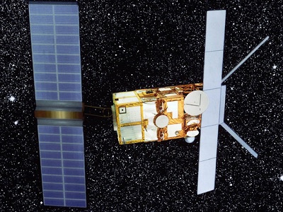
This document presents a brief overview of the ERS mission and the main features of the satellite and its instruments.
Document - User Guide
ERS-1 Altimeter Products User Manual
The Altimeter Products User Manual describes the ERS-1 products for user's reference.
Mission - Heritage Missions
ERS Radar Course 3
Therefore, microwaves easily penetrate clouds, and images can be acquired independently of the current weather conditions
Mission - Heritage Missions
ERS Radar Course 2
Therefore, microwaves easily penetrate clouds, and images can be acquired independently of the current weather conditions
Mission - Heritage Missions
ERS Radar Course 1
Therefore, microwaves easily penetrate clouds, and images can be acquired independently of the current weather conditions


