- All Categories (1249)
- Data (11)
- News (16)
- Missions (3)
- Events (9)
- Tools (4)
- Activities (4)
- Campaigns (2)
- Documents (1200)
NEWS
Discover the latest news on the European Space Agency's Earth Observation activities. Learn all about new data availability and how ESA's missions are performing.
News - Data Release news
8 Mar 2024FDR4ALT - ESA unveils new cutting-edge ERS/Envisat Altimeter and Microwave Radiometer Datasets
The European Space Agency (ESA) has developed a comprehensive suite of innovative Earth system data records as part of the Fundamental Data Records for Altimetry project - FDR4ALT.
News - Operational News
28 Nov 2023Change of access to FTP-S for ERS and Envisat Radar Altimeter data
As of 29 November 2023, access to the ERS-1/2 and Envisat Radar Altimeter data will be changed from simple FTP to FTP-S.
News - Data Release news
22 Feb 2023New BorealScat campaign dataset released
A new dataset has been released for the BorealScat campaign, which took place between 2017 and 2021 in Sweden.
News - Infographics
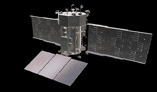
22 Feb 2023Twin satellites - TerraSAR-X and TanDEM-X
DLR's TerraSAR-X and TanDEM-X are twin satellites flying in close formation to acquire SAR data of unique geometric accuracy. Operating together, the missions deliver data that are used to generate Digital Elevation Models of Earth.
News - Events and Proceedings
 26 May 2022
Data preservation takes centre stage at Living Planet Symposium
Against the backdrop of the famed Rhine River, world-class scientists and Earth observation data-users are gathered this week in the historical city of Bonn, at the Living Planet Symposium (LPS).
News - Events and Proceedings
 25 May 2022
National missions in the spotlight at the Living Planet Symposium
In the framework of ESA’s Third Party Missions (TPM) programme, the agency offers access to the full data archives of almost 50 satellite missions, which are owned by organisations around the world.
News - Success Stories
 9 Mar 2022
10 years of Envisat data help to illuminate ocean processes
A decade after Envisat beamed its final image to the planet, the pioneering ESA mission is continuing to foster improved understanding of Earth’s systems.
News - Spotlight on EO community
 4 Mar 2022
Introducing Mirko Albani
In this short introduction, ESA's Heritage Missions Programme Manager describes what he likes most about ESA's long term archive of satellite mission data and his role in the programme.
News - Success Stories
1 Mar 2022How Envisat helped to shape global understanding of Earth’s systems
Twenty years have passed since a ground-breaking European spacecraft designed to deliver unprecedented insight into the planet’s changing environment was lofted into orbit.
News - Success Stories
 11 Feb 2022
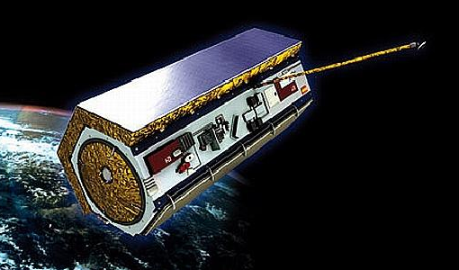
SAOCOM the Argentinean constellation with an Italian twist
Composed of two satellites launched in 2018 and 2019 respectively, the SAOCOM satellite mission, managed and operated by Argentina's Space Agency, CONAE, covers an array of applications that greatly benefit Earth observation and disaster monitoring.
News - Data Release news
 18 Jan 2022
New imaging modes added to PAZ collection
Two new imaging modes, Wide ScanSAR and Staring Spotlight, have been added to the PAZ offering and are now available to users for research and application development following submission of a project proposal subject to evaluation and acceptance by ESA and the data owner.
News - Success Stories
 11 Oct 2021
ERS' Contribution to Altimetry
Satellite radar altimetry missions have transformed the way we see Earth and its oceans. Using the ranging capability of radars, they measure the surface topography profile along a satellite’s track.
News - Data Release news
 22 July 2021
New reprocessing of datasets celebrates 30 years of ERS
The ERS programme celebrated its 30th anniversary on 17 July. Today, we are still exploiting ERS data and experts continue to work on improving the altimeter, radiometer and SAR data the programme acquired.
News - Success Stories
 19 July 2021
ERS Heritage Data allow for 30 years of science
At their time of launch thirty years ago, the two ERS satellites were the most sophisticated Earth observation spacecraft ever developed and launched by Europe.
News - Infographics
 16 July 2021
ERS - ESA’s first Earth observation satellites
To mark the 30th anniversary of ERS, we've released a new infographic summarising the mission.
News - Success Stories
 25 Sept 2018
Spotlight on sea-level rise
Scientists to share findings on how satellite has revealed changes in the height of the sea, ice, inland bodies of water and more.