- All Categories (183)
- Data (4)
- News (13)
- Missions (7)
- Events (10)
- Tools (5)
- Activities (8)
- Campaigns (2)
- Documents (134)
NEWS
Discover the latest news on the European Space Agency's Earth Observation activities. Learn all about new data availability and how ESA's missions are performing.
News - Infographics
28 Mar 2023Discover how RADARSAT scans Earth's surface
Learn about how RADARSAT scans Earth's surface in our new infographic.
News - Data Release news
 6 Oct 2022
ICEYE ESA archive collection now available to users
ICEYE ESA archive collection is now available worldwide through ESA’s Third Party Missions programme. The ESA archive collections consist of products requested by ESA-supported projects worldwide, and, therefore, the products are scattered and dispersed over the territory in different time windows. The datasets regularly grow as ESA collects new products over the years.
News - Events and Proceedings
 28 Sept 2022
Very High Resolution data to take centre stage
In the last few years, European New Space providers have helped strengthen the offering of very high resolution remote sensing data products—a designated workshop this November aims to focus on the latest developments in this arena.
News - Success Stories
 24 May 2022
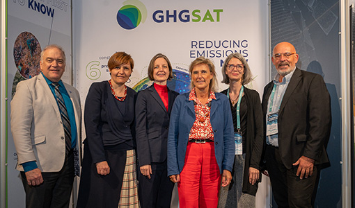
ESA facilitates access to greenhouse gas data
Canadian company GHGSat Inc., which offers high-resolution remote sensing of greenhouse gas emissions, air quality gas, and other trace gas emissions from any point sources in the world, is now an ESA Third Party Mission.
News - Infographics
 24 May 2022
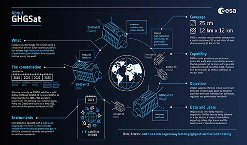
Greenhouse gas monitoring with the GHGSat mission
Find out more about the GHGsat mission in our new infographic.
News - Thematic area articles
 27 Apr 2022
Space data help to unravel the complexities of Earth’s atmosphere
As the impacts of the climate crisis intensify, scientists are using ESA’s Earth observation archives to investigate atmospheric processes and their influences on the planet’s changing environment.
News - Data Release news
 7 Dec 2021
TerraSAR-X/TanDEM-X WorldDEM data now available to users
WorldDEM products have been added to the TerraSAR-X/TanDEM-X offering and are now available to users for research and application development following submission of a project proposal subject to evaluation and acceptance by ESA and the data owner.
News - General News
 10 June 2021
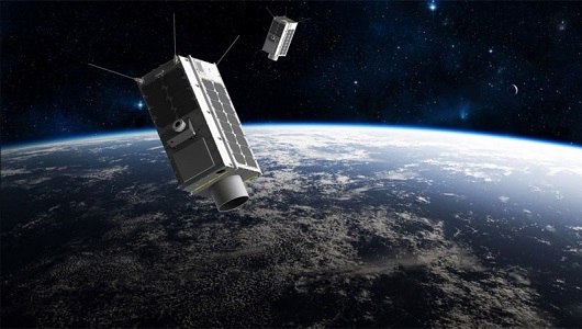
Introducing the newest Third Party Mission: ICEYE
ESA's Earth Observation Programme Board has approved the integration of the ICEYE mission, as a Third Party Mission (TPM) within the framework of the ESA Earthnet programme.
News - Data Release news
 20 Apr 2021
GHGSat data now available through ESA's Earthnet programme
In the framework of the Earthnet programme, ESA is offering, for scientific research and application development, access to archive and new tasking data from the GHGSat mission.
News - Success Stories
 30 Apr 2020
Mission continuity
Long-term availability of Earth observation data from a given instrument is crucial to many data users and their research—but just how does it work?
News - General News
 29 July 2019
Three new Third Party Missions under evaluation
ICEYE, PlanetScope and Spire under evaluation. Interested users can investigate suitability of the data for scientific and R&D activities.
News - Operational News
 4 Jan 2019
Envisat-ERS (A)SAR - Enhanced Dissemination Service
ESA is pleased to announce the release of several new features as part of the ESA On-The-Fly data processing and dissemination service.
News - Success Stories
 25 Sept 2018
Spotlight on sea-level rise
Scientists to share findings on how satellite has revealed changes in the height of the sea, ice, inland bodies of water and more.