- All Categories (64)
- Data (5)
- News (8)
- Missions (9)
- Events (2)
- Activities (5)
- Documents (35)
NEWS
Discover the latest news on the European Space Agency's Earth Observation activities. Learn all about new data availability and how ESA's missions are performing.
News - Thematic area articles
14 Sept 2023Cloud-free collections key for land monitoring
Satellite imagery is a crucially important tool for monitoring the land, but cloud cover can often block parts of Earth’s surface from view, limiting subsequent analyses.
News - Thematic area articles
9 Dec 2022Global understanding of Earth's land surfaces greatly boosted by satellite data
ESA perform land surface monitoring with a range of instruments onboard satellites acquiring optical and radar data. Collections of data from these missions are freely available for research purposes.
News - Success Stories
 17 Nov 2022
New worldwide dataset captures the planet in fine detail
Scientists have developed an open source planetwide dataset of high-resolution Earth observation imagery, thanks to commercial data delivered by ESA’s Third Party Missions (TPM) programme.
News - Events and Proceedings
 13 June 2022
Highlights from Living Planet Symposium
As remote sensing scientists and data-users from around the world converged at the Living Planet Symposium (LPS) in Bonn recently, a common thread was evident in many scientific sessions and meetings – the right environmental data can accelerate our understanding of the rapid changes in Earth’s system.
News - Success Stories
 13 Dec 2021
Ship trails in the Bay of Biscay observed using PROBA-V imagery
Ship trails have been perceived as convincing evidence of aerosol-cloud interaction. Ship emissions have been proven to contribute by about 1.9% and 2.9% to the increase in the global total and fine-mode aerosol optical thickness (AOT) respectively over a five year period (Peters et al. 20212).
News - Operational News
 15 May 2019
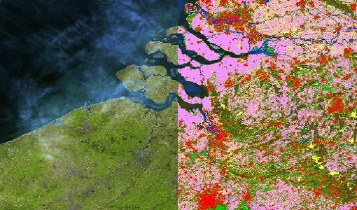
PROBA-V global land cover maps released
Copernicus Global Land Service team have released their new set of global land cover layers for the year 2015.
News - Data Release news
 7 Mar 2019
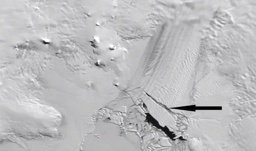
PROBA-V 2018-2019 Antarctica data now available
For the second consecutive austral summer season, PROBA-V observed Antarctica and its ongoing changes.
News - Data Release news
 5 Mar 2018
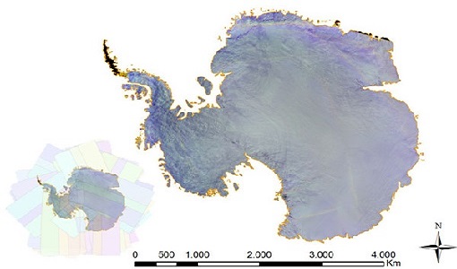
PROBA-V data available over Antarctica
Due to a huge amount of interest, it was decided to acquire PROBA-V data over Antarctica from November 2017 to February 2018.