- News
- PROBA-V global land cover maps...
PROBA-V global land cover maps released
15 May 2019
At ESA's Living Planet symposium in Milan this week, the Copernicus Global Land Service team have released their new set of global land cover layers for the year 2015.
The main classification with 23 classes, 10 flexible fractional cover layers, the forest type layer and associated quality indicators are primarily based on fused 100 m and 300 m PROBA-V satellite observations.
The observations are combined with a few renowned external datasets from JRC and DLR, for surface water and settlement layers, and crowd-sourced information from IIASA's Geo-Wiki for classification training and independent validation.
The entire computation runs on the technology of PROBA-V's Mission Exploitation Platform (MEP) and is still expanding, to provide annual updates.
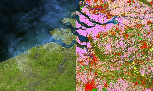
The image below, acquired in April 2015, covers parts of Belgium and the Netherlands and this data is available in the new Land Cover classification.