- All Categories (24)
- Data (2)
- News (8)
- Missions (1)
- Events (10)
- Activities (2)
- Documents (1)
News - Events and Proceedings
Featuring the power of Earth observation data at EGU
The European Geosciences Union General Assembly 2024 brings together geoscientists from all over the world, aiming to provide a forum where scientists and early career researchers can present their work and discuss their ideas with experts, in all fields of geoscience.
News - Operational News
Transition from FTP to FTPS for SMOS, Aeolus and Campaign data dissemination systems
As of 15 April 2024 access to the SMOS, Aeolus and Campaign data will be changed from simple FTP to FTPS.
News - Thematic area articles
How to use space data to probe humankind’s ancient past
Data disseminated by ESA’s Third Party Missions (TPM) programme are enabling archaeological investigations that could help to unravel the mysteries of past societies and cultures.
News - Success Stories
Commercial and international data for fire monitoring
As climate change sparks a surge in the frequency and intensity of wildfires, satellite data disseminated through ESA’s Third Party Missions (TPM) programme are helping scientists to track and investigate these potentially damaging natural events.
News - Thematic area articles
Remote sensing data map impacts of natural hazards
As climate change increases the frequency and severity of natural disasters, remote sensing data can warn about extreme events and help tackle emergency situations.
News - Events and Proceedings
Scientists to showcase value of Earth observation data at EGU
Remote sensing scientists are getting ready to present innovative and exciting applications of satellite data at the European Geosciences Union general assembly which will take place from 24 to 28 April in Vienna, Austria.
Event - Conference

Living Planet Symposium 2022
Learn about the 2022 edition of ESA's Living Planet Symposium.
News - Data Release news

TerraSAR-X/TanDEM-X WorldDEM data now available to users
WorldDEM products have been added to the TerraSAR-X/TanDEM-X offering and are now available to users for research and application development following submission of a project proposal subject to evaluation and acceptance by ESA and the data owner.
Activity - Projects
Dragon 2 Cooperation Programme
The Dragon 2 Programme focussed on the exploitation of ESA, ESA's Third Party Missions and Chinese Earth observation data for science and applications development in land, ocean and atmospheric applications.
Event - Workshop

Space and the Arctic 2009 Workshop
Temperatures in the Arctic are rising at an unprecedented rate. This workshop looked at the needs and challenges of working and living in the rapidly changing Arctic and explore how space-based services might help to meet those needs.
News - Infographics

An overview of ESA's Third Party Missions programme
ESA’s Third Party Missions programme consists of almost 50 satellite missions, which are owned by organisations around the world. ESA has agreements with these organisations to acquire, process, and distribute data from their missions
Activity - General activities

EO Science for Society
ESA's Earth Observation Science for Society programme aims to promote scientific exploitation of satellite data, forges new scientific discoveries and pioneers new services, stimulating downstream industrial and economic growth.
Event - Training

4th Advanced Training Course in Land Remote Sensing
ESA organised the 4th Advanced Training Course in Land Remote Sensing which took place in Athens, Greece from 1 to 5 July 2013
Event - Training
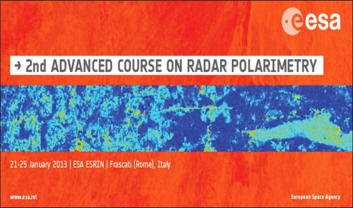
2nd Advanced Course on Radar Polarimetry 2013
The advanced ESA course provided an introduction to the basics and advanced concepts of theory, scattering concepts, systems and applications typical of radar polarimetric remote sensing.
Event - Workshop

POLinSAR 2013
The objectives of the PolInSAR 2013 workshop were to present the latest studies and results of SAR polarimetry and polarimetric interferometry.
Data - Announcement of Opportunity (Restrained)

Announcement of Opportunity for Aeolus Cal/Val
An Announcement of Opportunity call is open for the Aeolus mission. Scientists, new groups and individuals are invited to participate in Aeolus Cal/Val throughout the mission lifetime.
Data - Project Proposal (Restrained)

TerraSAR-X/TanDEM-X full archive and tasking
TerraSAR-X/TanDEM-X full archive and new tasking products can be acquired in six image modes with flexible resolutions (from 0.25 m to 40 m) and scene sizes and are provided in different packages: Staring SpotLight (basic, Interferometric pack, and Maritime pack) High Resolution SpotLight (basic, Interferometric pack, and Maritime pack) SpotLight (basic, Interferometric pack, and Maritime pack) StripMap (basic, Interferometric pack, and Maritime pack) ScanSAR (basic and Maritime pack) Wide ScanSAR (basic and Maritime pack) Product Overview Products SAR-ST SAR-HS SAR-SL SAR-SM SAR-SC SAR-WS Instrument mode Staring Spotlight High Resolution SpotLight SpotLight StripMap ScanSAR Wide ScanSAR Available resolutions (up to) 0.25 m 1 m 2 m 3 m 18 m 40 m Scene size 4x3.7 km2 10x5 km2 10x10 km2 30x50 km2 (up to 30x1650) 100x150 km2 (up to 100x1650) 270x200 km2 (up to 270x1500) Available processing levels SSC (Single Look Slant Range Complex): azimuth - slant range (time domain) MGD (Multi Look Ground Range Detected): azimuth - ground range (without terrain correction) GEC (Geocoded Ellipsoid Corrected): map geometry with ellipsoidal corrections only (no terrain correction performed) EEC (Enhanced Ellipsoid Corrected): map geometry with terrain correction, using a DEM Format SSC: DLR-defined COSAR binary MGD: GeoTiff GEC: GeoTiff EEC: GeoTiff Spatial coverage Worldwide Interferometry package InSAR-ST, InSAR-HS, InSAR-SL, InSAR-SM Only SSC At least five ordered scenes within six months from first order N/A N/A Maritime Monitoring package MmSAR-ST, MmSAR-HS, MmSAR-SL, MmSAR-SM, MmSAR-SC, MmSAR-WS Only SSC, MGD, GEC At least 75% of the scene area is water More than five ordered scenes in three months The following WorldDEM products can be requested: Products Description WorldDEMcore WorldDEMcore is output of interferometric processing of StripMap data pairs without any post-processing WorldDEMTM WorldDEMTM is produced based on WorldDEMcore, representing the surface of the Earth (including buildings, infrastructure and vegetation). Hydrological consistency is ensured WorldDEM DTM In additional editing steps, WorldDEMTMis transformed into a Digital Terrain Model (DTM) representing bare Earth elevation WorldDEM Bundle Includes WorldDEMTM, WorldDEM DTM, and Quality Layers The main specifications of the WorldDEM products are: Horizontal Coordinate Reference System: World Geodetic System 1984 (WGS84-G1150) Vertical Coordinate Reference System: Earth Gravitational Model 2008 (EGM2008) Absolute Horizontal Accuracy: <6 m Vertical Accuracy: 2 m Relative, 4 m Absolute Quality Layers (including water body mask) can be requested as an option with the WorldDEM and WorldDEM DTM Auxiliary Layers are delivered together with the WorldDEMcore product As per ESA policy, very high-resolution data over conflict areas cannot be provided.
Mission - Third Party Missions

TerraSAR-X and TanDEM-X
The TerraSAR-X and TanDEM-X satellites feature a unique geometric accuracy that is unmatched by any other spaceborne sensor.
Event - Conference

IGARSS 2019
World-class scientists, engineers and educators in geoscience and remote sensing gathered in Yokohama, Japan, for the 39th annual IGARSS symposium.
Event - Meeting

VH-RODA and CEOS SAR workshop
The workshop provided an open forum for the presentation and discussion of current status and future developments related to the calibration and validation of space borne very high-resolution SAR and optical sensors and data products.