- All Categories (505)
- Data (6)
- News (6)
- Missions (2)
- Events (4)
- Tools (6)
- Activities (2)
- Documents (479)
Document - Proceedings
1st MSG RAO Workshop
Proceedings of the workshop organised by ESA and EUMETSAT held in CNR of Bologna, Italy in May 2000.
Document - Proceedings
2004 Envisat and ERS Symposium
The 2004 Envisat and ERS Symposium was held in Salzburg - Austria from 6 to 10 September 2004. The 2004 Envisat and ERS Symposium provided a forum for investigators to present results of ongoing research project activities and assess the development of applications and services.
Document - General Reference
2007 Dragon Symposium - Abstract book
The Dragon Programme concerns the exploitation of BSA and Chinese BO data particularly from the ERS and Envisat satellites for monitoring and mapping applications in 16 thematic application areas in the P.R. China. The abstracts presented herein detail the results achieved since the Lijiang Symposium that was held in July 2006 in P.R. China.
Document - General Reference
2013 Dragon 3 Brochure
The 2013 Dragon 3 cooperation brochure presents the activities undertaken since the formal start of programme in June 2012.
Event - Training
2nd Advanced Training Course on Ocean Remote Sensing 2009
This advanced training course focused on ocean remote sensing theory and applications.
Document - Publication - Paper
Advanced Scatterometer Processing System for ERS data
ASPS System and Product description presented at the ERS-ENVISAT Symposium Salzburg 2004: The Advanced Scatterometer Processing System for ERS Data: Design, Products, and Performances
Event - Training
Advanced Training Course in Ocean Remote Sensing 2011
Within the framework of the Dragon Programme, a joint collaboration between the European Space Agency (ESA) and the Chinese Ministry of Science and Technology (MOST), ESA and NRSCC are providing a series of advanced thematic training courses on remote sensing applications hosted by university and research institutions in P.R. China.
Document - Publication - Paper
Assessment of scatterometer wind retrieval model by ERS and ADEOS cyclone tracking
Document - Publication - Paper
Assimilation of reprocessed ERS scatterometer data into ECMWF weather analysis on the Mediterranean Sea
Event - Conference
Atmospheric Science Conference 2006
The 2006 conference was dedicated the theme atmosphere to provide scientists and data users with the opportunity to present first-hand and up-to-date results from their ongoing research activities ESA Mission instruments.
Tools - Processing
Atmospheric Toolbox
The Atmospheric Toolbox (previously known as BEAT) is a collection of executable tools and API, developed to facilitate the utilisation, viewing and processing of e.g. GOMOS, MIPAS, SCIAMACHY and GOME data.
Mission - Third Party Missions
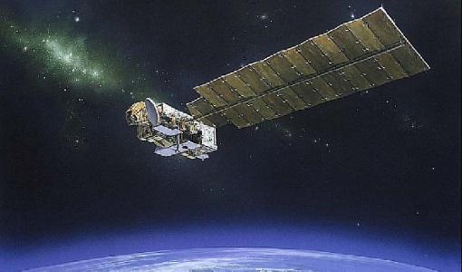
Aura
NASA's Aura mission studies the chemistry and dynamics of Earth's atmosphere from the ground through the mesosphere.
Data - External Data (Restrained)
Aura OMI complete NASA dataset
The OMI observations provide the following capabilities and features: A mapping of ozone columns at 13 km x 24 km and profiles at 13 km x 48 km A measurement of key air quality components: NO2, SO2, BrO, HCHO, and aerosol The ability to distinguish between aerosol types, such as smoke, dust and sulfates The ability to measure aerosol absorption capacity in terms of aerosol absorption optical depth or single scattering albedo A measurement of cloud pressure and coverage A mapping of the global distribution and trends in UV-B radiation. The OMI data are available in the following four levels: Level 0, Level 1B, Level 2, and Level 3. Level 0 products are raw sensor counts. Level 0 data are packaged into two-hour "chunks" of observations in the life of the spacecraft (and the OMI aboard it) irrespective of orbital boundaries. They contain orbital swath data. Level 1B processing takes Level 0 data and calibrates, geo-locates and packages the data into orbits. They contain orbital swath data. Level 2 products contain orbital swath data. Level 3 products contain global data that are composited over time (daily or monthly) or over space for small equal angle (latitude longitude) grids covering the whole globe.
Data - Announcement of Opportunity (Restrained)
Closed ESA announcement of opportunities
Find out about closed ESA announcement of opportunities and what these opportunities involved, for historical reference.
Event - Workshop
Copernicus Sentinel-5 Precursor Validation Team Workshop
The purpose of the workshop was to gather feedback from the Sentinel-5P Validation Team (S5PVT) about the uncertainty characterisation of all Copernicus Sentinel-5P products.
Document - General Reference
Dragon Programme - Brochure 2006
The Dragon Programme focuses on science and applications development in P.R. China exploiting mainly data from ESA ERS and Envisat missions. This brochure describes the programme, projects and partners.

