- All Categories (49)
- Data (5)
- News (25)
- Missions (3)
- Events (1)
- Tools (2)
- Activities (2)
- Documents (11)
Document - Product Document
LANDSAT_Products_Description_Document.pdf
This document acts as a User Guide to the Landsat MSS, TM and ETM+ archives, focussing more specifically on the Landsat TM and ETM+ products from the Kiruna, Maspalomas and Matera archives (including from the Matera, Fucino, Neustralitz, O’Higgins, Malindi, Libreville and Bishkek ground stations) that have been generated as part of the ESA archive bulk-reprocessing project.
Mission - Third Party Missions
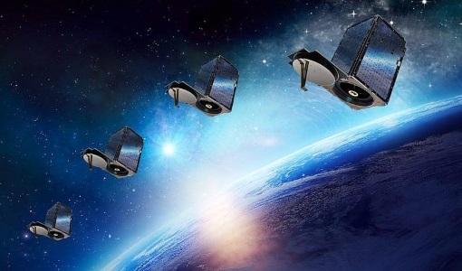
SkySat
SkySat is a constellation of high-resolution Earth imaging satellites from the commercial company Planet Labs.
Event - Meeting
VH-RODA and CEOS SAR workshop
The workshop provided an open forum for the presentation and discussion of current status and future developments related to the calibration and validation of space borne very high-resolution SAR and optical sensors and data products.
Activity - Quality
SLAP
The SLAP (Systematic Landsat Archive Processing) project covers the MSS, TM and ETM+ products from Landsat missions 1 – 7, and is the first systematic reprocessing of the ESA Landsat archive.
News - Data Release news
PlanetScope and SkySat data now available
PlanetScope and SkySat missions under evaluation. Interested users can investigate suitability of the data for scientific and R&D activities.
News - General News
Three new Third Party Missions under evaluation
ICEYE, PlanetScope and Spire under evaluation. Interested users can investigate suitability of the data for scientific and R&D activities.
Activity - Quality
EDAP
The ESA Earthnet Data Assessment Pilot (EDAP) project will perform assessments for various missions to ensure the delivered data is fit for purpose.
Mission - Heritage Missions
Landsat-1 to Landsat-3
The Landsat-1 to 3 satellites were the first in the United States' Landsat programme, dedicated to monitoring the Earth's land mass.
Mission - Heritage Missions
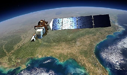
Landsat Series
The Landsat Series is the world's longest running system of satellites for moderate-resolution optical remote sensing for land, coastal areas and shallow waters.
Tools - Analysis
Sentinel-2 Toolbox
The Toolbox consists of a rich set of visualisation, analysis and processing tools for the exploitation of optical high-resolution products including the Sentinel-2 MSI sensor.
Data - Project Proposal (Restrained)
SkySat Full Archive and New Tasking
The SkySat Level 2B Basic Scene, Level 3B Ortho Scene and Level 3B Consolidated full archive and new tasking products are available as part of Planet imagery offer. The SkySat Basic Scene product is uncalibrated and in a raw digital number format, not corrected for any geometric distortions inherent in the imaging process. Rational Polynomial Coefficients (RPCs) is provided to enable orthorectification by the user. Basic Scene Product Components and Format Processing Levels Analytic (unorthorectified, radiometrically corrected, multispectral BGRN) Analytic DN (unorthorectified, multispectral BGRN) Panchromatic DN (unorthorectified, panchromatic) Product Components and Format Image File (GeoTIFF format) Metadata File (JSON format) Rational Polynomial Coefficients (Text File) UDM File (GeoTIFF format) Image Configuration 4-band Analytic DN Image (Blue, Green, Red, NIR) 1-band Panchromatic DN Image (Pan) Ground Sampling Distance 3.7 m at nadir (average at reference altitude 475 km) Ground Sampling Distance (nadir) Panchromatic 0.86m and Multispectral 1.0m for SkySat-1&2 Panchromatic 0.65m and Multispectral 0.8m for SkySat-3 to 13 (0.72 m and 1.0m for data acquired before 30/06/2020) Accuracy <50 m RMSE The SkySat Ortho Scene is sensor- and geometrically-corrected (by using DEMs with a post spacing of between 30 and 90 meters) and is projected to a cartographic map projection; the accuracy of the product will vary from region to region based on available GCPs. Different products are available: The SkySat Visual Ortho Scene product is orthorectified, pansharpened, and color-corrected (using a color curve) 3-band RGB Imagery The SkySat Pansharpened Multispectral Scene product is orthorectified, pansharpened 4-band BGRN Imagery The SkySat Analytic DN Ortho Scene product is orthorectified, multispectral BGRN, uncalibrated, digital number imagery product. The product has been processed to remove distortions caused by terrain; It eliminates the perspective effect on the ground (not on buildings), restoring the geometry of a vertical shot. Transformation to at-sensor radiance is not included The SkySat Panchromatic DN Ortho Scene product is orthorectified, panchromatic, uncalibrated, digital number imagery product. It has a finer GSD than the Analytic Product. Transformation to at-sensor radiance is not included. The SkySat Analytic Ortho Scene are calibrated multispectral imagery products with radiometric corrections applied to correct for any sensor artifacts and transformation to top-of-atmosphere radiance. The SkySat Consolidated Product are Ortho Collect product created by composing ~60 SkySat Ortho Scenes (Visual, Pansharpened Multispectral, Analytic DN, Panchromatic DN) along an imaging strip into segments Ortho Scene Product Components and Format Visual Ortho Pansharpened Multispectral Analytic DN Ortho Panchromatic DN Ortho Analytic Ortho Product Components and Format Image File (GeoTIFF format) Metadata File (JSON format) Rational Polynomial Coefficients (Text File) UDM File (GeoTIFF format) Image File (GeoTIFF) Metadata File (JSON format) Rational Polynomial Coefficients (Text File) UDM File (GeoTIFF format) Image File (GeoTIFF format) Metadata File (JSON format) Rational Polynomial Coefficients (Text File) UDM File (GeoTIFF format) Image File (GeoTIFF format) Metadata File (JSON format) Rational Polynomial Coefficients (Text File) UDM File (GeoTIFF format) Image File (GeoTIFF format) Metadata File (JSON format) Rational Polynomial Coefficients (Text File) UDM File (GeoTIFF format) Image Configuration 3-band Pansharpened Image (PS Red, PS Green, PS Blue) 4-band Pansharpened Image (PS Blue, PS Green, PS Red, PS NIR) 4-band Analytic DN Image (B, G, R, N) 1-band Panchromatic Image 4-band Analytic Image (B, G, R, N) Ground Sampling Distance 50 cm 50 cm 50 cm 50 cm 50 cm Projection UTM WGS84 UTM WGS84 UTM WGS84 UTM WGS84 UTM WGS84 Accuracy <10 m RMSE <10 m RMSE <10 m RMSE <10 m RMSE radiometric accuracy: +/- 5% Relative accuracy at < 10 degrees off-nadir angle As per ESA policy, very high-resolution imagery of conflict areas cannot be provided.
News - Success Stories
New life for Landsat historical data
45 years of data, more than 1.8 million images, these are the numbers of an adventure started 48 years ago with the launch of the first Landsat satellite.
Document - User Guide
TPM-L-OADS-dissemination-service-User-Manual.pdf
This guide describes the Third Party Missions Dissemination System.
News - General News
Improved resolution for SkySat data and extension of Planet data availability
The SkySat satellites orbits has been lowered from 500km to 450km altitude and various processing improvements have been implemented by Planet.
Document - Product Specifications
Planet-combined-imagery-product-specs-2020.pdf
This document describes Planet satellite imagery products.
News - General News
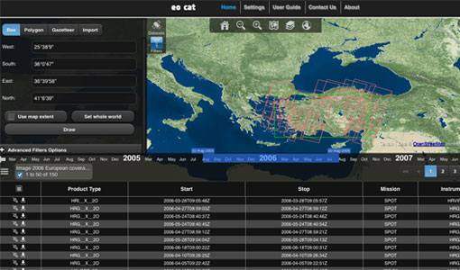
ESA’s Earth Observation Catalogue and its services
EO-CAT is the EO Catalogue tool allowing users to search ESA and Third Party Mission collections.
News - General News
ESA's new DataCube service is now available
ESA is pleased to announce the deployment of a new service, called ESA PDGS-DataCube, enabling multi-temporal and pixel-based access to a subset of the data available in the European Space Agency dissemination services.
Tools - Analysis
ESA PDGS Jupyter Notebook
A series of Jupyter Notebooks are available, in order to understand how to exploit the API that provides the data access service for different types of datasets included in the ESA PDGS datacube.
