- All Categories (15)
- Data (1)
- News (3)
- Missions (3)
- Events (3)
- Tools (2)
- Campaigns (1)
- Documents (2)
News - Success Stories
Commercial and international data for fire monitoring
As climate change sparks a surge in the frequency and intensity of wildfires, satellite data disseminated through ESA’s Third Party Missions (TPM) programme are helping scientists to track and investigate these potentially damaging natural events.
News - Thematic area articles

How satellite data help to shape society
Data from ESA’s Earth observation archives are improving understanding of the interactions between human activities and the environment, helping to power green economic development and boosting prosperity in Europe and beyond.
Event - Training

EO Summer School 3
ESA's series of summer schools, on Monitoring of the Earth System, aims to promote the exploitation of Earth observation data.
Event - Conference

Living Planet Symposium 2022
Learn about the 2022 edition of ESA's Living Planet Symposium.
News - Data Release news
New Landsat-8 Collection-2 Level 1 and Level 2 data now available
Within ESA’s Landsat offering, access to the European coverage of Landsat-8 Collection-2 Level 1 and Level 2 data is now available.
Tools - Other

Hydrology TEP
The Hydrology Thematic Exploitation Platform (TEP) enables access, processing, uploading, visualisation, manipulation and comparison of hydrological data.
Tools - Other

Forestry TEP
The Forestry Thematic Exploitation Platform (TEP) enables users in the forestry sector to access satellite data based processing services and tools for generating value-added forest information products.
Data - Campaigns (Open)

BACCHUS-DOC
The BACCHUS-DOC Radar and Optical Campaign was an area mapping project of vineyards near Frascati (Italy). ESA required high resolution geo-referenced airborne SAR data of different wavelength and polarisation (preferably polarimetric).
Campaign
BACCHUS-DOC
The BACCHUS-DOC Radar and Optical Campaign was an area mapping project of vineyards near Frascati (Italy). ESA required high resolution geo-referenced airborne SAR data of different wavelength and polarisation (preferably polarimetric).
Mission - Heritage Missions

Landsat Series
The Landsat Series is the world's longest running system of satellites for moderate-resolution optical remote sensing for land, coastal areas and shallow waters.
Mission - Heritage Missions

Landsat-1 to Landsat-3
The Landsat-1 to 3 satellites were the first in the United States' Landsat programme, dedicated to monitoring the Earth's land mass.
Event - Workshop

IDEAS+ Cal/Val Workshop 7
The 7th IDEAS+ Cal/Val Workshop took place on 4 and 5 June 2019 and it was hosted at the Wageningen University and Research (WUR) in The Netherlands.
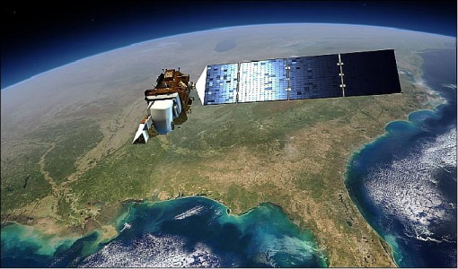
Mission - Third Party Missions

Landsat-8
Landsat-8 is an Earth-imaging satellite from USGS and NASA which launched in 2013. The Landsat programme provides a global archive of satellite imagery.
Document - General Reference

PREMIER-Report-for-Mission-Selection-An-Earth-Explorer-to-observe-atmospheric-composition.pdf
The objective of the PREMIER mission is to quantify the processes controlling global atmospheric composition in the mid/upper troposphere and lower stratosphere (5-25 km height range), which is a region of particular importance for climate change.
Document - Proceedings

Advances-in-Atmospheric-Science-and-Applications.pdf
Proceedings in Advances in Atmospheric Science and Applications held in 18-22 June 2012 in Bruges, Belgium.