- All Categories (38)
- Data (1)
- News (1)
- Missions (1)
- Events (4)
- Activities (2)
- Campaigns (1)
- Documents (28)
News - Thematic area articles
Space helps monitor Earth’s changing biosphere
Earth’s biosphere is continually changing. Through its pioneering Earth observation missions, ESA is making critical contributions to monitor these changes and their impacts on Earth’s water and carbon cycles.
Mission - Third Party Missions
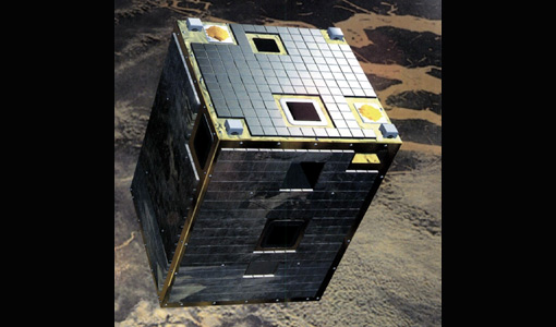
PROBA-1
PROBA-1 is a technology demonstration satellite that later became an operational Earth observation mission.
Activity - Instrument characterisation and algorithm studies
ESA satellites and instruments calibration landing page
ESA satellites and instruments calibration landing page.
Data - Campaigns (Open)
BACCHUS-DOC
The BACCHUS-DOC Radar and Optical Campaign was an area mapping project of vineyards near Frascati (Italy). ESA required high resolution geo-referenced airborne SAR data of different wavelength and polarisation (preferably polarimetric).
Campaign
BACCHUS-DOC
The BACCHUS-DOC Radar and Optical Campaign was an area mapping project of vineyards near Frascati (Italy). ESA required high resolution geo-referenced airborne SAR data of different wavelength and polarisation (preferably polarimetric).
Activity - Quality
EDAP
The ESA Earthnet Data Assessment Pilot (EDAP) project will perform assessments for various missions to ensure the delivered data is fit for purpose.
Document - Proceedings
1st MSG RAO Workshop
Proceedings of the workshop organised by ESA and EUMETSAT held in CNR of Bologna, Italy in May 2000.
Event - Conference
IGARSS 2019
World-class scientists, engineers and educators in geoscience and remote sensing gathered in Yokohama, Japan, for the 39th annual IGARSS symposium.
Event - Meeting
VH-RODA and CEOS SAR workshop
The workshop provided an open forum for the presentation and discussion of current status and future developments related to the calibration and validation of space borne very high-resolution SAR and optical sensors and data products.
Event - Workshop
3rd CHRIS PROBA Workshop
This 2005 workshop was on the treatment of Compact High Resolution Images Spectrometer (CHRIS) data.
Event - Workshop
2nd CHRIS PROBA Workshop
This 2004 workshop was on the treatment of Compact High Resolution Images Spectrometer (CHRIS) data.
Document - Product Document
Leaf-area-index-from-CHRIS-satellite-data-and-applications-in-plant-yield-estimation.pdf
This paper focuses on the optical remote sensing aspects of the ISIES project.
Document - Product Readme Note
Fine-Resolution-Air-Quality-Monitoring-from-a-Small-Satellite-CHRIS-PROBA.pdf
This paper was published in "Sensors" and demonstrates the ability of the European Space Agency's small satellite sensor CHRIS/PROBA to provide reliable AOT estimates at a spatially detailed level over Hong Kong, using a modified version of the dense dark vegetation (DDV) algorithm devised for MODIS.
Document - Product Readme Note
Retrieving-Canopy-Structure-from-Hyperspectral-Multi-Angular-Satellite-Data.pdf
This article was presented at the 5th EARSeL SIG IS workshop Imaging Spectroscopy : Innovation in Environmental Research held on 23-25 April 2007 in Bruges, Belgium, ed. By I. Reusen and J. Cools. EARSEL, 2007. 7 p.
Document - Proceedings
3rd-MSG-RAO-Workshop.pdf
Proceedings of the 3rd MSG RAO Workshop held on 5 June 2006 in Helsinki, Finland
Document - Proceedings
Topographic mapping from small satellites- a case study of CHRIS-PROBA data
This paper presents a study on the use of various empirical models for satellite orientation and terrain modelling using multidirectional CHRIS data, and evaluates the potential of small satellites with multidirectional viewing capabilities for topographic mapping.
Document - Proceedings
Advances-in-Atmospheric-Science-and-Applications.pdf
Proceedings in Advances in Atmospheric Science and Applications held in 18-22 June 2012 in Bruges, Belgium.
Document - Proceedings
2nd-MSG-RAO-Workshop.pdf
Proceedings of the 2nd MSG RAO Workshop, held on 9-10 September 2004 in Salzburg, Austria
Document - Proceedings
3rd-CHRIS-Proba-Workshop.pdf
Proceedings of the 3rd CHRIS/Proba Workshop, held from 21-23 March 2005 at ESA-ESRIN in Frascati, Italy.
Document - General Reference
BIOMASS-Report-for-Mission-Selection-An-Earth-Explorer-to-observe-forest-biomass.pdf
The objective of the BIOMASS Mission is to determine the global distribution of forest biomass by reducing the uncertainty in the calculation of carbon stock and fluxes associated with the terrestrial biosphere.


