- All Categories (74)
- Data (2)
- News (10)
- Missions (5)
- Events (2)
- Tools (2)
- Activities (7)
- Documents (46)
Data - Announcement of Opportunity (Restrained)
Announcement of Opportunity for S3VT (Sentinel-3 Validation Team)
In the framework of a Copernicus collaborative agreement ESA and EUMETSAT invite interested groups and individuals to support the Sentinel-3 Validation Team (S3VT).
Document - Product Cal/Val Plan/Report
APVE2-airborne-hyperspectral-vegetation-products.pdf
APVE II Workshop presentations - Airborne Hyperspectral Vegetation Products over Mer Bleue, Canada
Document - Product Cal/Val Plan/Report
APVE2-MBASSS.pdf
APVE II Workshop presentations - Airborne Hyperspectral Vegetation Products over Mer Bleue, Canada
Activity - Projects
Auroral Electrojet and auroral Boundaries estimated from Swarm observations
In the Swarm-AEBS project, a set of new Swarm data products that characterise the auroral electrojets and auroral oval boundaries will be derived from Swarm magnetic field measurements.
News - Success Stories
Commercial and international data for fire monitoring
As climate change sparks a surge in the frequency and intensity of wildfires, satellite data disseminated through ESA’s Third Party Missions (TPM) programme are helping scientists to track and investigate these potentially damaging natural events.
Mission - Copernicus Sentinels
Copernicus Sentinel-3
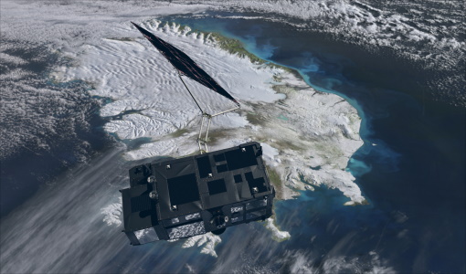
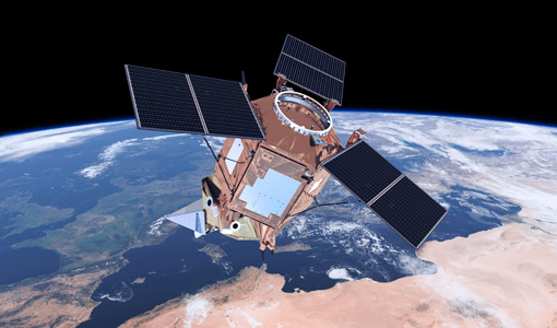
Copernicus Sentinel-3 is an European Earth Observation satellite mission developed to support Copernicus ocean, land, atmospheric, emergency, security and cryospheric applications.
Activity - Projects
Dragon 2 Cooperation Programme
The Dragon 2 Programme focussed on the exploitation of ESA, ESA's Third Party Missions and Chinese Earth observation data for science and applications development in land, ocean and atmospheric applications.
Activity - Quality
EDAP
The ESA Earthnet Data Assessment Pilot (EDAP) project will perform assessments for various missions to ensure the delivered data is fit for purpose.
Document - Proceedings
ERS-Envisat-symposium-proceedings.pdf
This document contains the proceedings of the ERS-Envisat Symposium, which took place in 2000.
Tools - Visualisation
EVDC Orbit Prediction Tool
The EVDC Orbit Prediction and Overpass Tool generates and visualises satellite's overpasses.
Document - Product Cal/Val Plan/Report
Field-Campaign-Report-Speulderbos-forest-Cal-Val-Site.pdf
IDEAS Field Campaign Report Speulderbos Cal/Val Site
News - Data Release news
Full European Landsat data collection now available under the same catalogue
The Full European Landsat data collection, from Landsat-1 to Landsat-8, is now available under the same catalogue
Mission - Earth Explorers
GOCE
ESA's Gravity field and Ocean Circulation Explorer (GOCE) mission mapped Earth's geoid very accurately, opening a window into Earth's interior structure as well as the currents circulating within the depths of its oceans.
Event - Conference
GRSG 2015 Conference
The 26th Annual GRSG Conference 'Challenges in Geological Remote Sensing' focused on a wide range of remote sensing applications, tools, latest developments and sensors.
Activity - General activities
GSCB and LTDP
The Copernicus programme is based on a fleet of European Earth observation satellites, built and operated by ESA, member states and commercial entities. Copernicus will also offer data from non-European satellites.
News - Success Stories
How Envisat helped to shape global understanding of Earth’s systems
Twenty years have passed since a ground-breaking European spacecraft designed to deliver unprecedented insight into the planet’s changing environment was lofted into orbit.
Document - Product Cal/Val Plan/Report
Land-Product-Validation-Evolution-2018-Arroyo_Mora.pdf
Land Product Validation Evolution (LPVE) 2018 workshop presentations
Document - Product Cal/Val Plan/Report
Land-Product-Validation-Evolution-2018-Kalacska.pdf
Land Product Validation Evolution (LPVE) 2018 workshop presentations
Document - Product Cal/Val Plan/Report
Land-Product-Validation-Evolution-2018-poster.pdf
Land Product Validation Evolution (LPVE) 2018 workshop presentations
Document - Product Cal/Val Plan/Report
Land-Product-Validation-Evolution-2018-Soffer.pdf
Land Product Validation Evolution (LPVE) 2018 workshop presentations


