- All Categories (330)
- Data (12)
- News (18)
- Missions (4)
- Events (5)
- Tools (4)
- Activities (2)
- Campaigns (6)
- Documents (279)
News - Events and Proceedings

Very High Resolution data to take centre stage
In the last few years, European New Space providers have helped strengthen the offering of very high resolution remote sensing data products—a designated workshop this November aims to focus on the latest developments in this arena.
Campaign

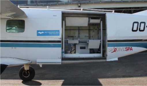
TropiSAR 2009
The TropiSAR campaign objectives were the evaluation of P-Band radar imaging over tropical forests for biomass and forest height estimation.
News - Thematic area articles

Transforming space data into climate action
ESA’s Earth observation activities are playing a key role in the revitalised global drive to combat climate change.
Document - Proceedings

The Use and Applications of ERS in Latin America-Uso y Applicaciones de ERS en America Latina
Proceedings of the International Seminar on the use and applications of ERS in Latin America, held on 25-29 November 1996 in Vina del Mar, Chile. In English and Spanish.
Campaign

TerraSARSIM
The objectives of the TerraSAR SIM project were to quantify the impact of the time intervals between SAR acquisitions at different wavelengths on agricultural applications.
News - Success Stories

Studying forest biomass from space
Forestry expert Maurizio Santoro, senior researcher at Gamma Remote Sensing and one of the leaders of ESA projects related to the Climate Change Initiative (CCI), explains how the use of various data.
News - Data Release news

Spot Extended Area mode added to ICEYE on-demand portfolio
As an evolution of Spot mode, Spot Extended Area products are now available with the same resolution of Spot data (ground resolution of 1 m) but enabling to cover the area of 225 km2 (15 x 15 km) in a single SAR image.
News - Infographics
Showcasing the NovaSAR-1 radar satellite
Learn about the NovaSAR-1 mission in our new infographic.
Document - General Reference

Sentinel-3-The-Ocean-and-Medium-Resolution-Mission-for-GMES-Operational-Services.pdf
This article is extracted from ESA Bulletin Nr. 131.
Document - General Reference
Sentinel-2-The-Optical-High-Resolution-Mission-for-GMES-Operational-Services.pdf
This article is extracted from ESA Bulletin Nr. 131.
Document - General Reference
Satellite-radar-in-agriculture-Experience-with-ERS-1.pdf
This document has been prepared by an ESA Specialist Panel charged with the task of reviewing research work and progress so far, and making recommendations for future developments and integration of satellite radar data into operational crop monitoring systems.
Campaign
SARSense 2019
The SARSense campaign in the Jülich area (Germany) in summer 2019 was performed to support the ESA Copernicus high priority mission ROSE-L.
Data - Campaigns (Open)
SARSense 2019
The SARSense campaign in the Jülich area (Germany) in summer 2019 was performed to support the ESA Copernicus high priority mission ROSE-L.
News - Success Stories
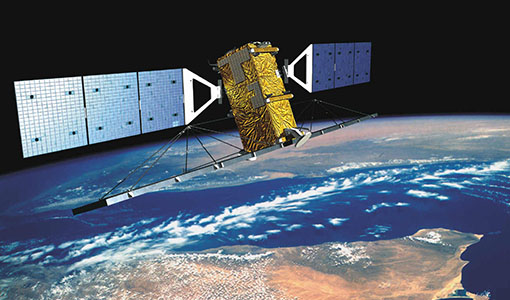
SAOCOM the Argentinean constellation with an Italian twist
Composed of two satellites launched in 2018 and 2019 respectively, the SAOCOM satellite mission, managed and operated by Argentina's Space Agency, CONAE, covers an array of applications that greatly benefit Earth observation and disaster monitoring.
Mission - Third Party Missions

SAOCOM
The SAOCOM (SAtélite Argentino de Observación COn Microondas) satellite series represents Argentina's approved polarimetric L-band SAR constellation of two spacecraft. It's objective is to provide an effective Earth observation and disaster monitoring capability.
News - Data Release news
RADARSAT-2 ESA archive online collection
The RADARSAT-2 ESA archive collection is now available on TPM LOADS Dissemination server.
News - Data Release news

RADARSAT data on demand
In the framework of the Earthnet programme, ESA is distributing RADARSAT data on-demand to support EO science and research activities.
Activity - Projects
PUMAS Initiative
The Promotion of Utilisation and Mission Applications and Science (PUMAS) is a joint initiative between ESA and CONAE (the Argentinian Space Agency). Established in 2021, PUMAS organises collaborative activities between the two agencies in the field of Earth observation.
Data - Project Proposal (Restrained)
NovaSAR-1 new tasking
NovaSAR-1 new acquisition data are available in two baseline acquisition modes: Stripmap – provides the highest resolution of 6 metres with up to 20 km swath selected from a 150 km field of regard, available in single polarisation. ScanSAR – has a 20 - 30 metre resolution and up to 150 km swath. Available in single polarisation. Within each of the baseline modes there are a variety of mode options that vary according to ground range resolution, incidence angles, swath width and the number of looks: Acquisition Mode Polarisation Resolution (m) Swath Width (km) Incidence Angles Number of Looks Stripmap Single: HH 6 20 16.0 – 25.38° 3 (1 range, 3 azimuth) 13 – 20 21.29 – 31.2° Single: VV 6 20 16.0 – 25.38° 3 (1 range, 3 azimuth) 13 – 20 21.29 – 31.2° ScanSAR Single: HH 20 100 15.0 - 24.66° 4 (2 range, 2 azimuth) 50 24.51 - 28.94° Single: VV 20 100 15.0 – 24.66° 4 (2 range, 2 azimuth) 50 24.51 - 28.94° Single: HH 30 150 11.29 – 25.93° 4 (2 range, 2 azimuth) 55 27.35 - 32.01° Single: VV 30 150 11.29 – 25.93° 4 (2 range, 2 azimuth) 55 27.35 - 32.01° NovaSAR-1 data are provided as a Level 2 (ARD) product as standard, but the accompanying Level 1 data may also be requested. Level 1 – delivered as reconstructed, unprocessed instrument data at full resolution. Level 2 (ARD) – delivered as a processed product with applied radiometric and geometric corrections i.e. orthorectification and spatial registration: Geocoded Ellipsoid Corrected (GEC) – Maritime and ocean applications Geocoded Terrain Corrected (GTC) – Land applications and change detection Where available, associated automatic identification system (AIS) data may be requested alongside the NovaSAR-1 data products.