- All Categories (23)
- Data (9)
- News (6)
- Missions (2)
- Events (2)
- Tools (2)
- Campaigns (1)
- Documents (1)
Mission - Heritage Missions
DMC First Generation
The Disaster Monitoring Constellation (DMC) is a constellation of microsatellites formerly coordinated by DMCii to provide frequent observations of the Earth for monitoring natural disasters.
Document - General Reference

DMC-Data-Product-Manual.pdf
This document is the DMC Data Product Manual (Issue 02)
Tools - Catalogues

EO CAT
EO CAT is a data catalogue, offering a Next Generation Earth Observation system designed to manage end-user Earth Observation services.
Event - Workshop
EO for Agriculture Under Pressure 2024
EO for Agriculture Under Pressure 2024 Workshop follows up from previous events, bringing together the large community working on EO-based science and solutions for agriculture.
Tools - Catalogues

FedEO
FedEO is a data catalogue that provides a unique entry point to a number of scientific catalogues and services for, but not limited to, European and Canadian missions.
Mission - Earth Explorers

FLEX
The FLEX mission will provide global maps of vegetation fluorescence, which can be converted into an indicator of photosynthetic activity.
Campaign
FLEXSense 2018
The 2018 Fluorescence Explorer Sense (FLEXSense) campaign combined various field activities in preparation for the FLEX satellite mission.
Data - Campaigns (Open)
FLEXSense 2018
The 2018 Fluorescence Explorer Sense (FLEXSense) campaign combined various field activities in preparation for the FLEX satellite mission.
Event - Meeting

Fluorescence (FLEX) 2019
The FLEX 2019 meeting consisted of a series of events addressing remote sensing of vegetation fluorescence.
News - General News
GEOSAT collaborates with ESA to boost understanding of the planet
Researchers around the world are exploring innovative scientific applications of high quality satellite data from commercial provider GEOSAT, thanks to a successful collaboration between the firm and ESA’s Third Party Missions (TPM) programme.
Data - Fast Registration with approval (Restrained)
GEOSAT-1 and 2 ESA archive
GEOSAT-1 and 2 dataset is composed of products acquired by the GEOSAT-1 and GEOSAT-2 Spanish satellites. The dataset regularly grows as ESA collects new products. GEOSAT-1 standard products offered are: SL6_22P: SLIM6, 22m spatial resolution, from bank P SL6_22S: SLIM6, 22m spatial resolution, from bank S SL6_22T: SLIM6, 22m spatial resolution, 2 banks merged together. GEOSAT-1 products are available in two different processing levels: Level 1R: All 3 Spectral channels combined into a band-registered image using L0R data. Geopositioned product based on rigorous sensor model. Coefficients derived from internal and external satellite orientation parameters coming from telemetry and appended to metadata. Level 1T: Data orthorectified to sub-pixel accuracy (10 metres RMS error approximately) with respect to Landsat ETM+ reference data and hole-filled seamless SRTM DEM data V3, 2006 (90 m). The use of the GCPs, it is not automatic, as it is done manually, which gives greater precision. (GCPs by human operators). GEOSAT-2 standard products offered are: Pan-sharpened (HRA_PSH four-band image, HRA_PS3 321 Natural Colours, HRA_PS4 432 False Colours): a four-band image, resulting from adding the information of each multispectral band to the panchromatic band. The fusion does not preserve all spectral features of the multispectral bands, so it should not be used for radiometric purposes. Panchromatic (HRA_PAN): a single-band image acquired by the panchromatic sensor. Multispectral (HRA_MS4): a four-band image acquired by the multispectral sensor, with band co-registration. Bundle (HRA_PM4): a five-band image contains the panchromatic and multispectral products packaged together, with band co-registration. Stereo Pair (HRA_STP): The image products obtained from two acquisitions of the same target performed from different viewpoints in the same pass by using the agility feature of the platform. It can be provided as a pair of pan sharpened or panchromatic images. GEOSAT-2 products are available in two different processing levels: Level 1B: A calibrated and radiometrically corrected product, but not resampled. The product includes the Rational Polynomial Coefficients (RPC), the metadata with gain and bias values for each band, needed to convert the digital numbers into radiances at pixel level, and information about geographic projection (EPGS), corners geolocation, etc. Level 1C: A calibrated and radiometrically corrected product, manually orthorectified and resampled to a map grid. The geometric information is contained in the GeoTIFF tags. Spatial coverage: Check the spatial coverage of the collection on a map available on the Third Party Missions Dissemination Service. As per ESA policy, very high-resolution imagery of conflict areas cannot be provided.
Data - Project Proposal (Restrained)
GEOSAT-1 full archive and tasking
GEOSAT-1 full archive and new tasking products are available at 22 m resolution in two processing levels. L1R (Basic Geopositioned): All 3 spectral channels combined into a band-registered image. Geopositioned product based on sensor model. Coefficients derived from satellite orientation parameters coming from telemetry and appended to metadata L1T (L1R orthorectified): Orthorectified to sub-pixel accuracy (10 metres RMS error approximately) with respect to Landsat ETM+ reference data and hole-filled seamless SRTM DEM data V3, 2006 (90 m). GEOSAT-1 products are provided in DIMAP format. The image products are delivered in the TIFF and GeoTIFF image formats by default. All products can be provided in False Colours (R,G,NIR) or Natural Colours (R, G, Synthetic Blue).
Data - Sample Data (Open)
GEOSAT-1 sample data
Download free GEOSAT-1 sample datasets to preview products available for this mission.
News - Thematic area articles
Global understanding of Earth's land surfaces greatly boosted by satellite data
ESA perform land surface monitoring with a range of instruments onboard satellites acquiring optical and radar data. Collections of data from these missions are freely available for research purposes.
Data - Fast Registration with approval (Restrained)
Image 2007 European coverage
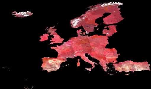
The Image 2007 collection is composed by products acquired by Disaster Monitoring Constellation 1st generation (DMC-1) satellites over European countries (plus Turkey) in 2007. The data provided in this collection are 32m multispectral images captured by the DMC SLIM-6 imager sensor, with two processing levels: L1R Band registered product derived from the L0R product L1T Orthorectified product derived from the L1R product using manually collected GCPs from Landsat ETM+ data and SRTM DEM V31 data Data disseminated come from the following satellites belonging to DMC-1 constellation: UK-DMC-1 Bejing-1 NigeriaSat-1 Spatial coverage: Check the spatial coverage of the collection on a map available on the Third Party Missions Dissemination Service.
News - Data Release news
Image 2007 European coverage available
The "Image 2007" European Coverage collection is now available to users.
News - Infographics

Measuring photosynthetic fluorescence - ESA's FLEX mission
Learn about ESA's upcoming FLEX mission, which is dedicated to gathering information about photosynthetic activity to shed light on the functioning of Earth's vegetation, in our latest infographic.
News - Data Release news
New FLEX-related campaign datasets released
New datasets have been released for three campaigns, covering activities supporting the upcoming FLEX mission.
News - Thematic area articles

Satellite data central to ocean monitoring
Over 95% of Earth’s water is found in our oceans, and yet sadly, oceans are under stress from climate change and pollution. Monitoring our oceans is vital for Earth’s survival and satellites are the primary means of long-term and independent observation of our vast ocean bodies and their associated coastal zones.
Data - Campaigns (Open)

SoyFLEX 2015
SoyFLEX 2015 took place over the agricultural area around Jülich, Germany and Rzecin wetland site, Poland