- All Categories (101)
- Data (9)
- News (58)
- Missions (4)
- Events (10)
- Tools (6)
- Campaigns (8)
- Documents (6)
News - Success Stories

10 years of Envisat data help to illuminate ocean processes
A decade after Envisat beamed its final image to the planet, the pioneering ESA mission is continuing to foster improved understanding of Earth’s systems.
Event - Conference

15 Years of Progress in Radar Altimetry Symposium
A Symposium on "15 Years of Progress in Radar Altimetry" and the annual meeting of the Ocean Surface Topography Science Team, the International Doris Service Workshop and the ARGO Workshop.
News - Data Release news

2015 CryoSat Ice Baseline D reprocessed data now available
The reprocessed CryoSat Ice Baseline D data for all of 2015 has now been published on the Science Server.
News - Data Release news

2016 CryoSat Ice Baseline D reprocessed data now available
The reprocessed CryoSat Ice Baseline D data for 2016 has now been published on the Science Server.
Event - Training

2nd Advanced Training Course on Ocean Remote Sensing 2009
This advanced training course focused on ocean remote sensing theory and applications.
Event - Training

3rd Advanced Training Course on Ocean Remote Sensing 2013
The 3rd Advanced Training Course on Ocean Remote Sensing was held from 23 to 27 September 2013 in Cork, at the National Maritime College of Ireland.
News - Operational News
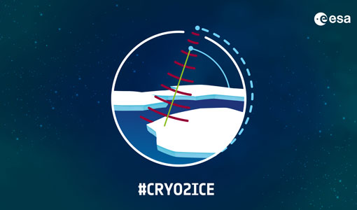
A Closer Look at CRYO2ICE Manoeuvres
Between 16 and 31 July 2020, ESA raised the orbit of Earth Explorer CryoSat-2 to periodically align with NASA’s ICESat-2 in a campaign dubbed CRYO2ICE.
Event - Training
Advanced Training Course in Ocean Remote Sensing 2011
Within the framework of the Dragon Programme, a joint collaboration between the European Space Agency (ESA) and the Chinese Ministry of Science and Technology (MOST), ESA and NRSCC are providing a series of advanced thematic training courses on remote sensing applications hosted by university and research institutions in P.R. China.
Event - Training
Advanced Training Course on Ocean Remote Sensing 2006
The objective of the course was to provide first-hand information on a broad range of ocean research topics including key principles of SAR, Radar Altimetry, Ocean Colour and Sea Surface Temperature measurements, processing algorithms, data products and their use in oceanographic applications.
News - Operational News

Announcement for CryoSat Quaternions Product users
CryoSat users who use the Quaternions Products should be aware that the method to access these products is changing.
Event - Workshop

Applications of the ERS Along Track Scanning Radiometer Workshop 1999
The workshop on ERS mission's Along Track Scanning Radiometer (ATSR) instrument gathered researchers and specialists working on different applications of the mission.
News - Data Release news

Back-processed data from 2010 now available for CryoTEMPO-EOLIS Baseline 2
Following on from the release of new Baseline 2 point and gridded products for CryoTEMPO-EOLIS, the data for several regions have now been back-processed to 2010 and are available from the CryoSat Science Server.
News - Data Release news
Brand new Cryo-TEMPO Baseline-B boosts CryoSat research
New datasets have been released for the Cryo-TEMPO thematic products.
News - Data Release news

Complete CryoSat Ice Baseline D reprocessed dataset now available
We're pleased to inform the CryoSat scientific community that the full reprocessed CryoSat Ice Baseline D data are now available on the Science Server for download
Mission - Copernicus Sentinels

Copernicus Sentinel-3
Copernicus Sentinel-3 is an European Earth Observation satellite mission developed to support Copernicus ocean, land, atmospheric, emergency, security and cryospheric applications.
News - Data Release news
Cryo-TEMPO gets new Summer Sea Ice product
CryoSat’s remarkable 14-year record of global ice and sea levels got another upgrade with the release of Cryo-TEMPO baseline C, which includes lots of new features and improvements.
News - General News
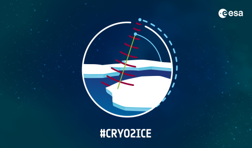
CRYO2ICE is now on Earth Online
On 16 July, ESA is kicking off the CRYO2ICE campaign that will raise the orbit of its CryoSat-2 satellite to periodically align with NASA’s ICESat-2.
News - Success Stories
CRYO2ICE over Antarctica: revealing further insight on changing ice
The CryoSat-2 satellite is currently being aligned with ICESat-2 over Antarctica, unlocking fresh possibilities in the wealth of new information being delivered by the near-synchronous orbit of the two satellites.
Mission - Earth Explorers

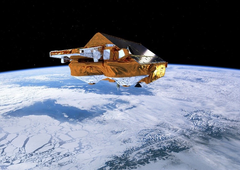
CryoSat
CryoSat determines variations in the thickness of continental ice sheets and marine ice cover. Europe's first ice mission is an advanced radar altimeter specifically designed to monitor the most dynamic sections of Earth's cryosphere.
News - Infographics
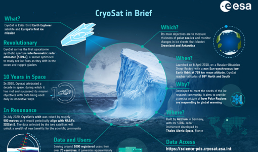
CryoSat - ESA’s cryosphere satellite mission
CryoSat - ESA's ice mission - recently celebrated ten years in space, during which it has provided invaluable data for research. To mark the anniversary we put together an infographic about the mission and its many achievements.