- All Categories (35)
- Data (3)
- Missions (1)
- Events (2)
- Tools (6)
- Activities (3)
- Campaigns (1)
- Documents (19)
Tools - Catalogues

FedEO
FedEO is a data catalogue that provides a unique entry point to a number of scientific catalogues and services for, but not limited to, European and Canadian missions.
Tools - Catalogues

ESA PDGS DataCube
ESA's DataCube is a data catalogue that enables multi-temporal and pixel-based access to a subset of data available from ESA
Tools - Catalogues

EO CAT
EO CAT is a data catalogue, offering a Next Generation Earth Observation system designed to manage end-user Earth Observation services.
Document - Proceedings

EO-Summer-School-2-Overview-of-land-surface-parameters-from-EO.pdf
Overview of land surface parameters from Earth Observation
Activity - General activities

MUltisource data package tools and SErvices (MUSE)
The MUSE project aims to develop and integrate a tool to simultaneously manipulate geospatial data products, satellite, model and in-situ data.
Event - Workshop

ESA/MERIS Workshop 2008
The ESA/MERIS Workshop 2008 covered the use of Envisat/MERIS data and the wider ESA-NASA-NOAA plans and collaboration.
Tools - Visualisation
EVDC Orbit Prediction Tool
The EVDC Orbit Prediction and Overpass Tool generates and visualises satellite's overpasses.
Data - Fast Registration with approval (Restrained)
IKONOS ESA archive
ESA maintains an archive of IKONOS Geo Ortho Kit data previously requested through the TPM scheme and acquired between 2000 and 2008, over Europe, North Africa and the Middle East. The imagery products gathered from IKONOS are categorised according to positional accuracy, which is determined by the reliability of an object in the image to be within the specified accuracy of the actual location of the object on the ground. Within each IKONOS-derived product, location error is defined by a circular error at 90% confidence (CE90), which means that locations of objects are represented on the image within the stated accuracy 90% of the time. There are six levels of IKONOS imagery products, determined by the level of positional accuracy: Geo, Standard Ortho, Reference, Pro, Precision and PrecisionPlus. The product provided by ESA to Category-1 users is the Geo Ortho Kit, consisting of IKONOS Black-and-White images with radiometric and geometric corrections (1-metre pixels, CE90=15 metres) bundled with IKONOS multispectral images with absolute radiometry (4-metre pixels, CE90=50 metres). IKONOS collects 1m and 4m Geo Ortho Kit imagery (nominally at nadir 0.82m for panchromatic image, 3.28m for multispectral mode) at an elevation angle between 60 and 90 degrees. To increase the positional accuracy of the final orthorectified imagery, customers should select imagery with IKONOS elevation angle between 72 and 90 degrees. The Geo Ortho Kit is tailored for sophisticated users such as photogrammetrists who want to control the orthorectification process. Geo Ortho Kit images include the camera geometry obtained at the time of image collection. Applying Geo Ortho Kit imagery, customers can produce their own highly accurate orthorectified products by using commercial off the shelf software, digital elevation models (DEMs) and optional ground control. Spatial coverage: Check the spatial coverage of the collection on a map available on the Third Party Missions Dissemination Service.
Data - External Data (Restrained)

ADAM Surface Reflectance Database v4.0
ADAM enables generating typical monthly variations of the global Earth surface reflectance at 0.1° spatial resolution (Plate Carree projection) and over the spectral range 240-4000 nm. The ADAM product is made of gridded monthly mean climatologies over land and ocean surfaces, and of a companion API toolkit that enables the calculation of hyperspectral (at 1 nm resolution over the whole 240-4000 nm spectral range) and multidirectional reflectances (i.e. in any illumination/viewing geometry) depending on user choices. The ADAM climatologies that feed the ADAM calculation tools are: For ocean: Monthly chlorophyll concentration derived from SeaWiFS-OrbView-2 (1999-2009); it is used to compute the water column reflectance (which shows large spectral variations in the visible, but is insignificant in the near and mid infrared). Monthly wind speed derived from SeaWinds-QuikSCAT-(1999-2009); it is used to calculate the ocean glint reflectance. For land: Monthly normalized surface reflectances in the 7 MODIS narrow spectral bands derived from FondsdeSol processing chain of MOD09A1 products (derived from Aqua and Terra observations), on which relies the modelling of the hyperspectral/multidirectional surface (soil/vegetation/snow) reflectance. Uncertainty variance-covariance matrix for the 7 spectral bands associated to the normalized surface reflectance. For sea-ice: Sea ice pixels (masked in the original MOD09A1 products) have been accounted for by a gap-filling approach relying on the spatial-temporal distribution of sea ice coverage provided by the CryoClim climatology for year 2005.
Tools - Analysis

Sentinel-3 Toolbox
The Toolbox consists of a set of visualisation, analysis and processing tools for the exploitation of OLCI and SLSTR data.
Tools - Analysis

Sentinel-2 Toolbox
The Toolbox consists of a rich set of visualisation, analysis and processing tools for the exploitation of optical high-resolution products including the Sentinel-2 MSI sensor.
Data - Campaigns (Open)

THERMOPOLIS
The THERMOPOLIS 2009 campaign mainly served the DUE “Urban Heat islands (UHI) and Urban Thermography (UT) Project”
Campaign
THERMOPOLIS
The THERMOPOLIS 2009 campaign mainly served the DUE “Urban Heat islands (UHI) and Urban Thermography (UT) Project”
Document - Algorithms Theoretical Baseline Document

cawa-requirements-baseline.pdf
CAWA (Advanced Clouds, Aerosols and WAter vapour products for Sentinel-3/OLCI) requirements baseline document provides information about the physical background, technical structure and the functional principle of the CAWA total column water vapour retrieval as defined within the CAWA project, which aims to the development and improvement of advanced atmospheric retrieval algorithms for the Envisat/MERIS and Sentinel-3/OLCI mission.
Activity - Quality
SEOM CAWA
The Advanced Clouds, Aerosols and WAter vapour products for Sentinel-3/OLCI project aims to develop and improve the advanced atmospheric retrieval algorithms developed for MERIS and OLCI instruments.
Mission - Heritage Missions
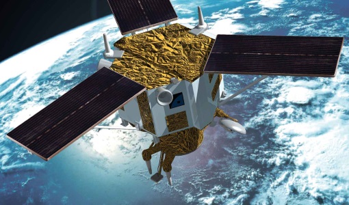
IKONOS-2
At the time of its launch, IKONOS-2 brought imagery rivalling that of military satellites to the commercial market.
Event - Workshop
CEOS-IVOS Workshop on Inter-comparison of Large Scale Optical and Infrared Sensors
The 2004 workshop was an opportunity to present and exchange experiences and knowledge from work on inter-comparing large scale optical sensors at different product levels.
Document - Algorithms Theoretical Baseline Document
cawa-algorithm-theoretical-basis-water-vapor.pdf
This document provides information about the physical background, technical structure and the functional principle of the CAWA total column water vapour retrieval as defined within the SEOM CAWA 'advanced Clouds, Aerosols and WAter vapour products for Sentinel-3/OLCI' project.
Document - Proceedings
EO-Summer-School-2-Earth-Observation-techniques-and-the-carbon-cycle.pdf
Earth Observation Measurements in Terrestrial Carbon Cycle Science