- All Categories (98)
- Data (11)
- News (42)
- Missions (5)
- Events (16)
- Tools (1)
- Activities (2)
- Campaigns (8)
- Documents (13)
News - Success Stories
Young scientists bid farewell to ESA's wind mission
Students and early career researchers are saying an emotional goodbye to Aeolus ahead of its upcoming reentry.
Campaign
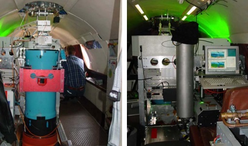
WindVal II
The objectives for the WindVal II campaign in 2016 were derived from the results, experience and lessons learnt from these last airborne campaigns in 2009 and 2015.
News - Infographics
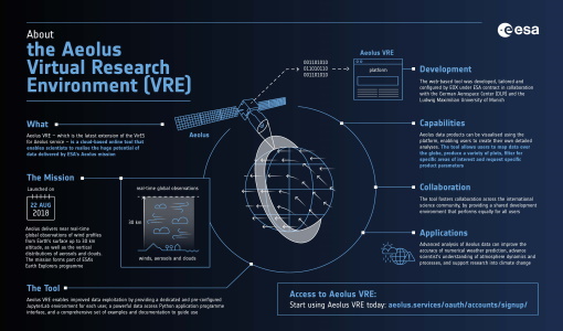
What is Aeolus VRE?
Learn more about the the Aeolus Virtual Research Environment (VRE), the latest extension to the VirES for Aeolus service, in this infographic.
Campaign
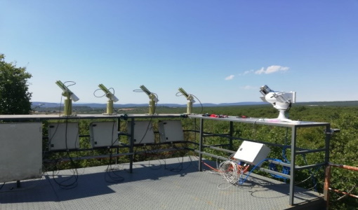
WALEX
The objective of the airborne campaign Water Vapour Lidar Experiment (WALEX) is to collect valuable data to provide representative lidar measurements of water vapour and aerosol properties in different climatic zones.
Data - Campaigns (Open)
WALEX
The objective of (WALEX) was to collect valuable data to provide representative lidar measurements of water vapour and aerosol properties in different climatic zones.
News - Success Stories
Traceability of AERONET-EUROPE to the GAWPFR WMO reference for Aerosol Optical Depth
Within the IDEAS-QA4EO ESA project a precision filter radiometer (PFR) travelling standard was installed at the European calibration site of AERONET to provide continuous traceability of aerosol optical depth measurements to the World reference maintained at Davos through a PFR Triad.
News - Operational News
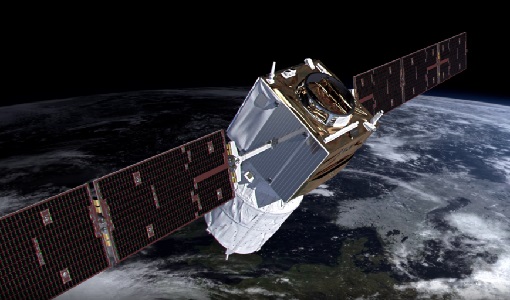
The divine keeper of the winds retires
ESA’s fifth Earth Explorer - Aeolus - is due to retire soon, but will provide fully nominal data up to the end of operations on 30 April.
Mission - Third Party Missions
TanSat
The TanSat mission is one of the Earth Observation projects managed by the Ministry of Science and Technology of China and is dedicated to detecting and monitoring carbon dioxide in the atmosphere.
News - Events and Proceedings
Submit your abstracts for EarthCARE Pre-Launch Science and Validation Workshop
Invitations are now open for the EarthCARE Pre-Launch Science and Validation Workshop, which will take place at ESRIN in Frascati, Italy, from 13 to 17 November.
News - Infographics
Showcasing the atmosphere-studying Odin mission
Learn about the Odin mission in our new infographic.
News - Success Stories

Ship trails in the Bay of Biscay observed using PROBA-V imagery
Ship trails have been perceived as convincing evidence of aerosol-cloud interaction. Ship emissions have been proven to contribute by about 1.9% and 2.9% to the increase in the global total and fine-mode aerosol optical thickness (AOT) respectively over a five year period (Peters et al. 20212).
News - Success Stories

Satellites track the health of the ozone layer
ESA’s Earth observation activities are contributing to international efforts to monitor and preserve the layer of stratospheric ozone that blankets the planet.
News - Success Stories
Rome supersite helps validate atmospheric space data
In the sprawling, urban area of Rome, where atmospheric composition is impacted by complex coastal weather and pollution, ESA supports a powerful observatory spread across several locations.
News - Infographics

PROBA-1 - From technology demonstration to long-term Earth observation
Learn about ESA's PROBA-1 (Project for On-Board Autonomy) mission in our new infographic.
Mission - Third Party Missions

PROBA-1
PROBA-1 is a technology demonstration satellite that later became an operational Earth observation mission.
News - Infographics
Overview of the Aeolus Level-1B wind product
Learn about the Aeolus Level-1B wind product, which supports applications for the weather, atmospheric processes and climate research, in our latest infographic.
News - Infographics
Overview of Aeolus Level-2b scientific wind data
Learn more about the Aeolus Level-2b scientific wind product in our latest infographic.
Data - External Data (Restrained)
Odin OSIRIS data products
The Odin OSIRIS (Optical Spectrograph and Infra-Red Imaging System) data provides vertical profiles measures of spectrally dispersed, limb scattered sunlight from the upper troposphere into the lower mesosphere. The data products are regularly processed and provide Ozone density vertical profiles (both Level 2 and Level 3), vertical profiles of stratospheric Aerosol (both Level 2 and Level 3), slant column densities of nitrogen dioxide NO2 profiles (Level 2), stratospheric BrO profiles (Level 2).
Mission - Heritage Missions

NOAA POES
NOAA's AVHRR sensor is carried on the POES mission, a constellation of polar orbiting weather satellites.
News - Data Release news

New Campaign datasets available
A new set of datasets is available, acquired during airborne campaigns conducted between 2014 and 2019