- All Categories (34)
- Data (5)
- News (13)
- Missions (1)
- Tools (6)
- Documents (9)
Document - Proceedings

Advances-in-Atmospheric-Science-and-Applications.pdf
Proceedings in Advances in Atmospheric Science and Applications held in 18-22 June 2012 in Bruges, Belgium.
Document - General Reference

BIOMASS-Report-for-Mission-Selection-An-Earth-Explorer-to-observe-forest-biomass.pdf
The objective of the BIOMASS Mission is to determine the global distribution of forest biomass by reducing the uncertainty in the calculation of carbon stock and fluxes associated with the terrestrial biosphere.
Document - General Reference
PREMIER-Report-for-Mission-Selection-An-Earth-Explorer-to-observe-atmospheric-composition.pdf
The objective of the PREMIER mission is to quantify the processes controlling global atmospheric composition in the mid/upper troposphere and lower stratosphere (5-25 km height range), which is a region of particular importance for climate change.
Document - General Reference
CoReH2O-Report-for-Mission-Selection-An-Earth-Explorer-to-observe-snow-and-ice.pdf
This report describes the CoReH2O (Cold Regions Hydrology high-resolution Observatory) mission, which was selected for feasibility study in the third cycle of Earth Explorers.
Mission - Heritage Missions
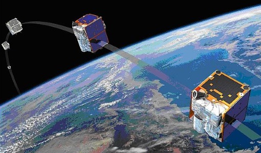
RapidEye
Together, the five RapidEye satellites were capable of collecting over 4 million square kilometres of 5 m resolution, 5-band colour imagery every day.
Document - General Reference
The International Charter- Space and Major Disasters
The Charter is an important step forward in linking the needs of disaster and relief organisations with space technology solutions to help mitigate the effects of disaster on human life, property and the environment.
News - General News

Three new Third Party Missions under evaluation
ICEYE, PlanetScope and Spire under evaluation. Interested users can investigate suitability of the data for scientific and R&D activities.
Tools - Analysis

SNAP
SNAP is a common architecture for all Sentinel Toolboxes. It is ideal for Earth observation processing and analysis.
Tools - Analysis

Sentinel-2 Toolbox
The Toolbox consists of a rich set of visualisation, analysis and processing tools for the exploitation of optical high-resolution products including the Sentinel-2 MSI sensor.
Data - EO Sign In Authentication (Open)
RapidEye time series for Sentinel-2
The European Space Agency, in collaboration with BlackBridge collected two time series datasets with a five day revisit at high resolution: February to June 2013 over 14 selected sites around the world April to September 2015 over 10 selected sites around the world. The RapidEye Earth Imaging System provides data at 5 m spatial resolution (multispectral L3A orthorectified). The products are radiometrically and sensor corrected similar to the 1B Basic product, but have geometric corrections applied to the data during orthorectification using DEMs and GCPs. The product accuracy depends on the quality of the ground control and DEMs used. The imagery is delivered in GeoTIFF format with a pixel spacing of 5 metres. The dataset is composed of data over: 14 selected sites in 2013: Argentina, Belgium, Chesapeake Bay, China, Congo, Egypt, Ethiopia, Gabon, Jordan, Korea, Morocco, Paraguay, South Africa and Ukraine. 10 selected sites in 2015: Limburgerhof, Railroad Valley, Libya4, Algeria4, Figueres, Libya1, Mauritania1, Barrax, Esrin, Uyuni Salt Lake. Spatial coverage: Check the spatial coverage of the collection on a map available on the Third Party Missions Dissemination Service.
Data - EO Sign In Authentication (Open)
RapidEye South America
ESA, in collaboration with BlackBridge, has collected this RapidEye dataset of level 3A tiles covering more than 6 million km2 of South American countries: Paraguay, Ecuador, Chile, Bolivia, Peru, Uruguay and Argentina. The area is fully covered with low cloud coverage. Spatial coverage: Check the spatial coverage of the collection on a map available on the Third Party Missions Dissemination Service.
Data - Fast Registration with approval (Restrained)
RapidEye ESA archive
The RapidEye ESA archive is a subset of the RapidEye Full archive that ESA collected over the years. The dataset regularly grows as ESA collects new RapidEye products. Spatial coverage: Check the spatial coverage of the collection on a map available on the Third Party Missions Dissemination Service.
News - Success Stories
RapidEye constellation retirement
After 11 years in operation, surpassing a design lifetime of 7 years, the RapidEye constellation will be retired in March 2020.
Document - User Guide

TPM-L-OADS-dissemination-service-User-Manual.pdf
This guide describes the Third Party Missions Dissemination System.
News - General News

ESA’s Earth Observation Catalogue and its services
EO-CAT is the EO Catalogue tool allowing users to search ESA and Third Party Mission collections.
News - General News

ESA's new DataCube service is now available
ESA is pleased to announce the deployment of a new service, called ESA PDGS-DataCube, enabling multi-temporal and pixel-based access to a subset of the data available in the European Space Agency dissemination services.
Tools - Analysis

ESA PDGS Jupyter Notebook
A series of Jupyter Notebooks are available, in order to understand how to exploit the API that provides the data access service for different types of datasets included in the ESA PDGS datacube.
Tools - Other

Forestry TEP
The Forestry Thematic Exploitation Platform (TEP) enables users in the forestry sector to access satellite data based processing services and tools for generating value-added forest information products.
News - Infographics

ESA Third Party Missions timeline
We've released a new timeline to illustrate the history of the ESA Third Party Missions.
Data - Project Proposal (Restrained)
RapidEye Full archive
The RapidEye Level 3A Ortho Tile, both Visual (in natural colour) and Analytic (multispectral), full archive products are available as part of Planet imagery offer. The RapidEye Ortho Tile product (L3A) is radiometric, sensor and geometrically corrected (by using DEMs with a post spacing of between 30 and 90 metres) and aligned to a cartographic map projection. Ground Control Points (GCPs) are used in the creation of every image and the accuracy of the product will vary from region to region based on available GCPs. Product Components Image File – GeoTIFF file that contains image data and geolocation information Metadata File – XML format metadata file Unusable Data Mask (UDM) file – GeoTIFF format Bands 3-band natural color (blue, green, red) or 5-band multispectral image (blue, green, red, red edge, near-infrared) Ground Sampling Distance 6.5 m at nadir (average at reference altitude 475 km) Projection UTM WGS84 Accuracy Depends on the quality of the reference data used (GCPs and DEMs) The products are available as part of the Planet provision from RapidEye, Skysat and PlanetScope constellations. RapidEye collection has worldwide coverage: the Planet Explorer Catalogue can be accessed (Planet registration requested) to discover and check the data readiness. All details about the data provision, data access conditions and quota assignment procedure are described in the Terms of Applicability. As per ESA policy, very high-resolution imagery of conflict areas cannot be provided.