- All Categories (1905)
- Data (24)
- News (78)
- Missions (6)
- Events (24)
- Tools (13)
- Activities (23)
- Campaigns (7)
- Documents (1730)
Campaign
WIVERNEX-UK
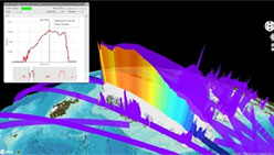
This campaign was designed to extend the Chilbolton ground measurement record that involved analysis of radar observations made by the 94 GHZ radar from the ground at Chilbolton to quantify the accuracy expected for the algorithms for deriving, winds, clouds and precipitation properties for the proposed WIVERN satellite.
Document - General Reference

WATS - Water Vapour and Temperature in the Troposphere and Stratosphere.pdf
This report describes the WATS mission, one of the candidate Earth Explorers in the second cycle in 2001.
Document - Technical Note

WALES - Water Vapour Lidar Experiment in Space
This report describes the WALES mission, one of the candidate Earth Explorers in the second cycle in 2001.
Tools - Analysis
VtCryoSat
VtCryoSat is a tool for easily browsing and downloading CryoSat products through an interactive and graphical web interface.
Data - EO Sign In Authentication (Open)

VT GOCE Data
This collection contains the VT GOCE software and associated data set needed to run the software that is used for GOCE data visualisation.
Event - Workshop

VH-RODA 2024
The 2024 VH-RODA workshop provides an open forum (for the new space, commercial and institutional space sectors) for presenting and discussing the current status and future developments related to Earth Observation data quality, calibration and validation of space-borne very high-resolution SAR and Optical sensors and data products.
Event - Workshop
VH-RODA 2023
The 2023 VH-RODA workshop provided an open forum (for the new space, commercial and institutional space sectors) for presenting and discussing the current status and future developments related to Earth Observation data quality, calibration and validation of space-borne very high-resolution SAR and Optical sensors and data products.
Event - Workshop

VH-RODA 2022
The 2022 VH-RODA workshop will provide an open forum (for the new space, commercial and institutional space sectors) for presenting and discussing the current status and future developments related to Earth Observation data quality, calibration and validation of space-borne very high-resolution SAR and Optical sensors and data products.
Event - Workshop
VH-RODA 2021 Workshop
The Very High-resolution Radar & Optical Data Assessment (VH-RODA) 2021 workshop was held online from 20–23 April 2021.
News - Data Release news
Version 2.0 of GOCE thermosphere reprocessed data released
Version 2.0 of the GOCE thermosphere dataset is now available on the GOCE Online Dissemination Service.
Document - Software Verification Plan/Report

User Toolbox Requirements Document - GOCE User Toolbox Specifications (GUTS)
Deliverable: WP2000: This document provides user requirement for the GOCE User Toolbox, designed around the GOCE mission.
News - Data Release news

Updated Precise Orbit data (POD) for the full ERS-1 and ERS-2 mission available
The Precise Orbit files (ERS.ORB.POD) for the entire ERS-1 and ERS-2 mission periods have been reprocessed with up-to-date standards.
News - Operational News

Update on Swarm Field-Aligned Current Dual (FAC_AC) data missing from 7 November 2021
As a follow-up of the news published on 23 November 2021, we want to update Swarm users about the missing Field-Aligned Current Dual (FAC_TMS_2F) data since 7 November 2021.
News - Operational News
Update on Swarm Field-Aligned Current Dual (FAC_AC) data issue
As a follow-up of the news published on 23 November 2021 and on 16 December 2021, we want to update Swarm users about the issue affecting Field-Aligned Current Dual (FAC_TMS_2F) data.
Document - General Reference
Understanding our Planet - the Earth Observation Envelope Program
This brochure describes the Earth Observation Envelope Programme.
Document - General Reference
Understanding climate change from space
This document describes ESA's Climate Change Initiative, and how it is intended to contribute towards monitoring and understanding the Earth's climate.
News - Infographics
Twin satellites - TerraSAR-X and TanDEM-X
DLR's TerraSAR-X and TanDEM-X are twin satellites flying in close formation to acquire SAR data of unique geometric accuracy. Operating together, the missions deliver data that are used to generate Digital Elevation Models of Earth.
Document - General Reference
Towards the Definitive Space Gravity Mission
This article appeared on the International WOCE Newsletter, issue nr. 33 published on December 1998.
Document - General Reference
Towards More Efficient Use of Radar-Altimeter Data
Twenty years ago, experimental altimeters on NASA's Skylab and Geos-3 were already demonstrating the potential of such instrumentation. This led in turn to the development and launch by NASA in July 1978 of the Seasat oceanographic satellite mission. Both Geos-3 and Seasat were very successful in their pioneering missions, but were limited somewhat by poor coverage in the case of Geos-3 and an abnormally short mission duration in Seasat's case.
Document - Software Verification Plan/Report
Toolbox Functionality and Algorithm Specification Document - GOCE User Toolbox Specifications (GUTS)
Deliverable: WP3000: This report is the output from WP3000 of the GOCE User Toolbox Specification. The study will select the best (in terms of accuracy and computational demands) algorithms to compute the variables listed in the user requirement document [1]. This document will form the basis for the system specification work performed in WP4000 and the prototype and tutorials to be generated in WP5000, all available in this library.