- All Categories (57)
- Data (4)
- News (13)
- Missions (2)
- Events (1)
- Tools (9)
- Activities (1)
- Documents (27)
News - General News
ESA's improved Earth system data records: what is in store for the future?
Fundamental Data Records (FDRs) are instrumental in advancing our understanding of Earth systems and for addressing societal challenges effectively. These long-term records contain uncertainty-quantified, calibrated and geo-located multi-instrument/multi-platform satellite sensor data spanning several decades to support climate-related applications.
News - Spotlight on EO community
Meet the Quality Assurance for EO Team
The Quality Assurance For Earth Observation (also known as QA4EO) Service began its operations on 1 November 2019, providing support to the Data Quality and Algorithms Management Office at ESRIN, within the Sensor Performance, Processing and Algorithm section.
News - General News
International collaboration: Summarising ESA’s Third Party Missions
ESA’s Third Party Missions programme consists of more than 50 missions from around the world. Learn more about the Third Party Missions in this video.
News - General News
Long-term data: Summarising ESA’s Heritage missions
ESA’s Heritage Space Programme preserves data from non-operational missions. Learn more about the Heritage missions in this video.
Tools - Catalogues
FedEO
FedEO is a data catalogue that provides a unique entry point to a number of scientific catalogues and services for, but not limited to, European and Canadian missions.
Tools - Catalogues
EO CAT
EO CAT is a data catalogue, offering a Next Generation Earth Observation system designed to manage end-user Earth Observation services.
News - Thematic area articles
Space helps monitor Earth’s changing biosphere
Earth’s biosphere is continually changing. Through its pioneering Earth observation missions, ESA is making critical contributions to monitor these changes and their impacts on Earth’s water and carbon cycles.
Document - General Reference
Heritage Space Programme interactive brochure
Learn about ESA's Heritage Space Programme in this interactive brochure.
News - Events and Proceedings
Data preservation takes centre stage at Living Planet Symposium
Against the backdrop of the famed Rhine River, world-class scientists and Earth observation data-users are gathered this week in the historical city of Bonn, at the Living Planet Symposium (LPS).
Document - General Reference
Heritage Missions brochure
This brochure describes ESA's Heritage Space Programme and includes infographics describing some of the missions in the programme.
News - Infographics
Timeline to over 40 years of historical satellite missions
ESA's Heritage Space Programme preserves historical data from over 40 years of Earth observation missions.
Event - Workshop
Fringe 2003 Workshop
The third ESA International Workshop on ERS SAR Interferometry and its first Workshop on ASAR interferometry: Advances in SAR interferometry from ERS and Envisat missions.
Activity - Projects
SAFE (Standard Archive Format for Europe)
SAFE is a long-term preservation data format designed to act as a common format for archiving and conveying data within ESA Earth Observation archiving facilities.
News - Success Stories
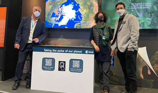
COP26 fuels interest in satellite data
As COP26 stimulates action to reduce global warming, the essential role of satellite data in understanding and monitoring climate change is apparent.
Document - Technical Note
JERS-Products-Comparison-Report.pdf
This Technical Note is in response to an action from the IDEAS+ MTR to assess the quality of JERS-1 SAR data with reference to the corresponding JAXA data.
Document - Mission Status Report
JERS-Mission-Instrument-Characteristics.pdf
This document contains an overview of the JERS mission/instrument characteristics. In particular, this document gives detail about the mission history and background, correction algorithm applied.
Document - Technical Note
IDEAS+-VEG-OQC-REP-2620_JERS_SAR_Reprocessing_QC_V1_4.pdf
This document presents the results of the data quality control (QC) performed by IDEAS+ Task 1 SAR team on the JERS-1 SAR dataset processed using JERS-1 SAR Instrument Processing Facility (IPF) version 2.05 patch 3 (v2.05p3).
News - Success Stories
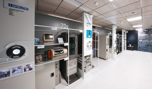
A stroll through Heritage Missions
At ESA's Earth Observation centre—ESRIN—in Frascati, Italy, there is a place where one can walk back in time, to better understand the history and importance of Heritage Missions and their data.
Tools - Other
Forestry TEP
The Forestry Thematic Exploitation Platform (TEP) enables users in the forestry sector to access satellite data based processing services and tools for generating value-added forest information products.
Tools - Analysis
ESA PDGS Jupyter Notebook
A series of Jupyter Notebooks are available, in order to understand how to exploit the API that provides the data access service for different types of datasets included in the ESA PDGS datacube.


