- All Categories (78)
- Data (13)
- News (15)
- Missions (1)
- Events (9)
- Tools (6)
- Activities (2)
- Campaigns (2)
- Documents (30)
Document - Conference Presentation - Poster
04_OCT2013_ESA-EO_programmes.pdf
ESA EO missions and their exploitation for science and applications ESA
News - General News
3D Earth Online Visuals application takes off
A new app has just been launched, enabling you to explore ESA’s satellite missions in 3D and providing a new perspective on how satellite data contribute to our understanding of Earth systems, the climate, and their interactions.
News - Spotlight on EO community
An overview of the EarthCARE mission
In this video, meet Björn Frommknecht, Mission Manager of ESA's upcoming EarthCARE satellite.
Campaign
CLARE
CLARE 2000: Cloud Lidar and Radar Experiments were to provide an extended data base and develop new analysis methods.
Data - Announcement of Opportunity (Restrained)
CLOSED - EarthCARE Calibration and Validation Announcement of Opportunity
ESA offered an announcement of opportunity to support the calibration and validation of EarthCARE products. This opportunity closed in 2017.
Event - Conference
Dragon 3 2014 Symposium
The Dragon 3 2014 Symposium was part of the Dragon 3 Programme, focussed on exploitation of ESA, ESA's Third Party Missions and Chinese Earth observation data for geo-science and applications development in land, ocean and atmospheric applications.
Event - Conference
Dragon 3 2015 Symposium
The Dragon 3 2015 Symposium was part of the Dragon 3 Programme, focussed on exploitation of ESA, ESA's Third Party Missions and Chinese Earth observation data for geo-science and applications development in land, ocean and atmospheric applications.
Event - Conference
Dragon 3 2016 Symposium
The Dragon 3 2016 Symposium served as the close of the Dragon 3 Cooperation Programme (2012 to 2016) and formal kick off for Dragon 4 Cooperation projects.
Activity - Projects
Dragon 3 Cooperation Programme
The Dragon 3 Programme focussed on the exploitation of ESA, ESA's Third Party Missions and Chinese Earth observation data for geo-science and applications development in land, ocean and atmospheric applications.
Document - General Reference
Earth Explorers brochure
This brochure describes ESA's Earth Explorers Space Programme and includes infographics describing some of the missions in the programme.
Tools - Apps
Earth Online Visuals
The Earth Online Visuals app displays interactive 3D models of ESA’s Earth Explorers and the Envisat and GOCE Heritage satellites. The models detail the mission payloads and where the instruments are placed on the satellites.
Mission - Earth Explorers
EarthCARE
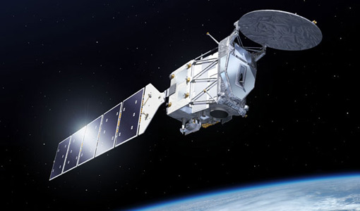
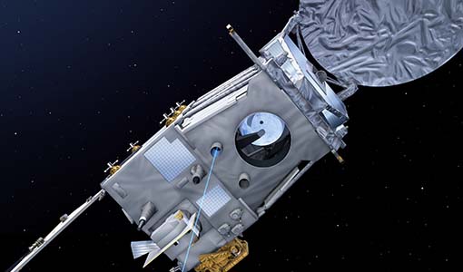
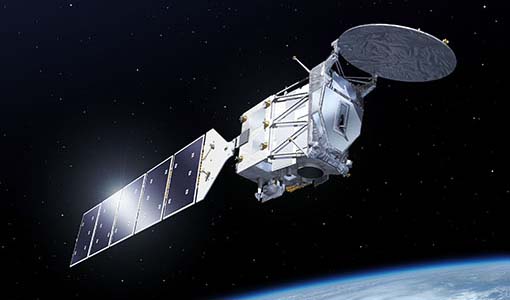
EarthCARE will examine the role clouds and aerosols play in trapping infrared radiation emitted from Earth's surface.
News - Infographics
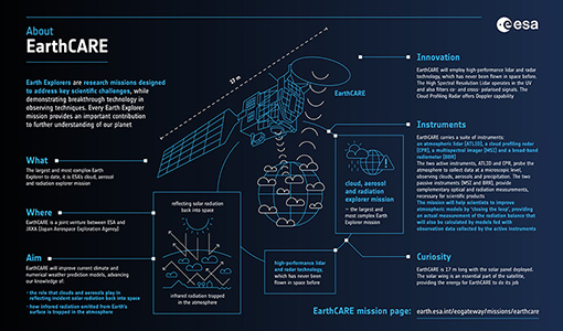
EarthCARE - ESA's cloud, aerosol and radiation explorer mission
Learn about ESA’s upcoming cloud, aerosol and radiation explorer mission – EarthCARE – in our latest infographic.
Data - Restrained Access (Restrained)
EarthCARE Auxiliary Data for Cal/Val Users
EarthCARE data products encompass essential supporting auxiliary (AUX) and orbit data critical for accurate sensor data processing and analysis. AUX data includes datasets used outside the primary Space Segment stream to apply corrections to sensor data. This comprises previously derived calibration parameters, ground control data, and digital elevation data. Calibration parameters ensure measurement accuracy, while ground control data aids in data validation, and digital elevation data enables precise geolocation. Orbit data consists of on-board satellite data and orbital information. For EarthCARE, this includes Reconstructed Orbit and Attitude Files, which provide detailed satellite positioning and orientation information. The integration of AUX and orbit data into EarthCARE's data processing workflow ensures the production of high-quality, scientifically valuable datasets for atmospheric research, climate modelling, and environmental monitoring.
Data - EO Sign In Authentication (Open)
EarthCARE ESA L2 Products
This EarthCARE collection contains the following data products: Level 2a: Single-Instrument Geophysical Products These products are derived from individual instrument data onboard EarthCARE. They provide detailed geophysical parameters and properties specific to each instrument's capabilities for example cloud and aerosol properties derived solely from radar or lidar measurements, offering high-resolution insights into atmospheric phenomena. Level 2b: Synergistic Geophysical Products Level 2b products leverage data from multiple EarthCARE instruments to generate comprehensive, synergistic geophysical datasets. By combining measurements from instruments like radar, lidar, and radiometers, these products offer a more integrated view of cloud-aerosol interactions and atmospheric dynamics. Synergistic products provide enhanced accuracy and depth compared to single-instrument outputs, enabling detailed studies of complex atmospheric processes.
Data - Restrained Access (Restrained)
EarthCARE ESA L2 Products for Cal/Val Users
This EarthCARE collection is restrained, and contains the following data products: Level 2a: Single-Instrument Geophysical Products These products are derived from individual instrument data onboard EarthCARE. They provide detailed geophysical parameters and properties specific to each instrument's capabilities for example cloud and aerosol properties derived solely from radar or lidar measurements, offering high-resolution insights into atmospheric phenomena. Level 2b: Synergistic Geophysical Products Synergistic Geophysical Products Level 2b products leverage data from multiple EarthCARE instruments to generate comprehensive, synergistic geophysical datasets. By combining measurements from instruments like radar, lidar, and radiometers, these products offer a more integrated view of cloud-aerosol interactions and atmospheric dynamics. Synergistic products provide enhanced accuracy and depth compared to single-instrument outputs, enabling detailed studies of complex atmospheric processes.
Data - Restrained Access (Restrained)
EarthCARE ESA L2 Products for the Commissioning Team
This EarthCARE collection contains the following data products: Level 2a: Single-Instrument Geophysical Products These products are derived from individual instrument data onboard EarthCARE. They provide detailed geophysical parameters and properties specific to each instrument's capabilities for example cloud and aerosol properties derived solely from radar or lidar measurements, offering high-resolution insights into atmospheric phenomena. Level 2b: Synergistic Geophysical Products Level 2b products leverage data from multiple EarthCARE instruments to generate comprehensive, synergistic geophysical datasets. By combining measurements from instruments like radar, lidar, and radiometers, these products offer a more integrated view of cloud-aerosol interactions and atmospheric dynamics. Synergistic products provide enhanced accuracy and depth compared to single-instrument outputs, enabling detailed studies of complex atmospheric processes.
Data - EO Sign In Authentication (Open)
EarthCARE JAXA L2 Products
This EarthCARE collection contains the following data products: Level 2a: Single-Instrument Geophysical Products These products are derived from individual instrument data onboard EarthCARE. They provide detailed geophysical parameters and properties specific to each instrument's capabilities for example cloud and aerosol properties derived solely from radar or lidar measurements, offering high-resolution insights into atmospheric phenomena. Level 2b: Synergistic Geophysical Products Level 2b products leverage data from multiple EarthCARE instruments to generate comprehensive, synergistic geophysical datasets. By combining measurements from instruments like radar, lidar, and radiometers, these products offer a more integrated view of cloud-aerosol interactions and atmospheric dynamics. Synergistic products provide enhanced accuracy and depth compared to single-instrument outputs, enabling detailed studies of complex atmospheric processes.
Data - Restrained Access (Restrained)
EarthCARE JAXA L2 Products for Cal/Val Users
This EarthCARE collection is restrained, and contains the following data products: Level 2a: Single-Instrument Geophysical Products These products are derived from individual instrument data onboard EarthCARE. They provide detailed geophysical parameters and properties specific to each instrument's capabilities for example cloud and aerosol properties derived solely from radar or lidar measurements, offering high-resolution insights into atmospheric phenomena. Level 2b: Synergistic Geophysical Products Level 2b products leverage data from multiple EarthCARE instruments to generate comprehensive, synergistic geophysical datasets. By combining measurements from instruments like radar, lidar, and radiometers, these products offer a more integrated view of cloud-aerosol interactions and atmospheric dynamics. Synergistic products provide enhanced accuracy and depth compared to single-instrument outputs, enabling detailed studies of complex atmospheric processes.
