- All Categories (49)
- Data (3)
- News (20)
- Missions (1)
- Events (18)
- Activities (5)
- Documents (2)
Event - Workshop

2007 International Geohazards Week
The ESA event was part of the United Nations International Year of Planet Earth, to increase awareness of the importance of Earth sciences for the advancement of sustainable development.
Event - Conference

3rd ERS Symposium
The ESA Directorate for Observation of the Earth and its Environment held the 3rd ERS Symposium, in 1997, where many of the results from the ERS-1 and ERS-2 missions were presented and discussed by the scientific community.
News - Success Stories
Aeolus enhances volcanic ash forecasts for aviation safety
A new study, using wind data from ESA’s Aeolus mission, highlights the importance of using satellite missions like Aeolus to improve volcanic ash forecasting and ensure aviation safety in the future.
Event - Conference
ALOS 2008 Symposium
The 2008 Joint PI Symposium of the ALOS Data Nodesa was a forum to exchange views on technical and scientific issues on the data exploitation.
News - Infographics

An overview of ESA's Third Party Missions programme
ESA’s Third Party Missions programme consists of almost 50 satellite missions, which are owned by organisations around the world. ESA has agreements with these organisations to acquire, process, and distribute data from their missions
News - Infographics

An overview of the very high-resolution WorldView constellation
Learn about the WorldView constellation, part of ESA’s Third Party Missions programme, in this infographic.
Data - Announcement of Opportunity (Restrained)

Announcement of Opportunity for NoR
ESA invites submissions for the Network of Resources (NoR) call, which aims to support research, development and pre-commercial users to innovate their working practices, moving from a data download paradigm towards a 'bring the user to the data' paradigm.
News - Success Stories

Charter on major disasters celebrates 20 years of operations
The International Charter Space and Major Disasters is now 20 years old.
Activity - Projects

Contribution of Swarm data to the prompt detection of Tsunamis and other natural hazards
The main objective of COSTO (Contribution of Swarm data to the prompt detection of Tsunamis and other natural hazards) project is to better characterise, understand and discover coupling processes and interactions.
News - Events and Proceedings

Data preservation takes centre stage at Living Planet Symposium
Against the backdrop of the famed Rhine River, world-class scientists and Earth observation data-users are gathered this week in the historical city of Bonn, at the Living Planet Symposium (LPS).
Activity - Projects
Dragon Cooperation Programme
The Dragon Programme focussed on science and applications development in China using mainly data from the ERS and Envisat missions. The Prgramme was a cooperation between ESA and the National Remote Sensing Centre of China.
Activity - General activities
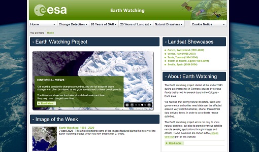
Earth Watching
The Earth Watching project began in 1993 to assist local authorities and to promote the benefits of remote sensing data during natural disasters, but also to promote various satellite remote sensing applications through images and articles.
Mission - Heritage Missions

Envisat
Envisat was ESA's successor to ERS. Envisat carried ten instruments aboard for a wide range of Earth observing fields. The mission was operational from 2002 to 2012.
News - Success Stories
Envisat data show how volcanoes communicate with each other
Using radar data from ESA’s Envisat mission, scientists have recently proven the elastic interaction between two Hawaiian volcanoes.
Data - Fast Registration with immediate access (Open)

Envisat DORIS Doppler [DOR_DOP_1P]
This product was generated by the Centre de Traitement Doris Poseidon (CTDP). The DORIS Doppler product (DOR_DOP_1P) was consolidated offline 2-4 weeks after sensing and stored in the F-PAC archive. The file size is 0.5 Mbytes per orbit.
Data - Fast Registration with immediate access (Open)
Envisat DORIS Precise Orbit [DOR_VOR_AX]
The latest version of the Envisat DORIS Precise Orbit product, DOR_VOR_AX, was generated by the Centre de Traitement Doris Poseidon (CTDP) using the Geophysical Data Records F standards (GDR-F). The product is used to obtain the satellite orbital parameters (latitude, longitude, height and height rate) by using orbit computation routines. The most significant changes related to the GDR-F standards concern the new ocean tide model (FES2014) and the updated Terrestrial Reference Frame (ITRF2014). The new standards significantly improve all Precise Orbit Determination (POD) metrics with respect to GDR-E. The mean difference and variance of Sea Surface Height (SSH) at crossovers is slightly reduced. The DOR_VOR_AX product adopts the Envisat format, and the size is 0.2 Mbytes per orbit. Users are recommended to apply the GDR-F version, but the previous datasets are still available (i.e. GDR-D and GDR-E versions). See further details in the readme file for Envisat DORIS Precise Orbit Determination files. Comparison of Envisat Sea Level Anomaly trends obtained using DORIS Precise Orbit GDR-E and F standards. North/South patterns are evident. Credits: CNES/CLS.
Event - Meeting

EO Exploitation Activities of ESA's Strategic Initiative - Information Day
ESA organised an Information Day on EO Exploitation Activities of the ESA Strategic Initiative in Oslo on the 15 March 2011 for potential bidders from AT, CH, DK, FI, IE and NO.
Event - Training

EO Summer School 7
ESA's series of summer schools, on Monitoring of the Earth System, aims to promote the exploitation of Earth observation data.
Event - Training
EO Summer School 8
ESA's series of summer schools, on Monitoring of the Earth System, aims to promote the exploitation of Earth observation data.
Activity - General activities
EO Summer Schools
ESA's series of summer schools, on Monitoring of the Earth System, aims to promote the exploitation of Earth observation (EO) data.