- All Categories (14)
- Data (1)
- News (5)
- Events (6)
- Tools (1)
- Documents (1)
Document - Newsletter
Earth Online Newsletter - 22 March 2024
This issue of the Earth Online Newsletter covers a selection of the latest news and events from ESA.
News - Success Stories
Commercial and international data for fire monitoring
As climate change sparks a surge in the frequency and intensity of wildfires, satellite data disseminated through ESA’s Third Party Missions (TPM) programme are helping scientists to track and investigate these potentially damaging natural events.
News - Success Stories
Pléiades unlocks information about rock glaciers in central Himalaya
As climate change accelerates the melting of glacial ice, remote sensing scientists are tapping into the potential of Pléiades data to help vulnerable mountainous communities.
News - Thematic area articles
Global understanding of Earth's land surfaces greatly boosted by satellite data
ESA perform land surface monitoring with a range of instruments onboard satellites acquiring optical and radar data. Collections of data from these missions are freely available for research purposes.
Event - Workshop
Fringe 2003 Workshop
The third ESA International Workshop on ERS SAR Interferometry and its first Workshop on ASAR interferometry: Advances in SAR interferometry from ERS and Envisat missions.
News - Infographics
An overview of ESA's Third Party Missions programme
ESA’s Third Party Missions programme consists of almost 50 satellite missions, which are owned by organisations around the world. ESA has agreements with these organisations to acquire, process, and distribute data from their missions
News - Events and Proceedings
Φ-Week Triumphs
In its fourth edition, Φ-Week presented the scientific community with amazing opportunities and projects—thus running alongside innovation at 360 degrees.
Tools - Other
Forestry TEP
The Forestry Thematic Exploitation Platform (TEP) enables users in the forestry sector to access satellite data based processing services and tools for generating value-added forest information products.
Event - Training
4th Advanced Training Course in Land Remote Sensing
ESA organised the 4th Advanced Training Course in Land Remote Sensing which took place in Athens, Greece from 1 to 5 July 2013
Data - Project Proposal (Restrained)
Pléiades full archive and tasking
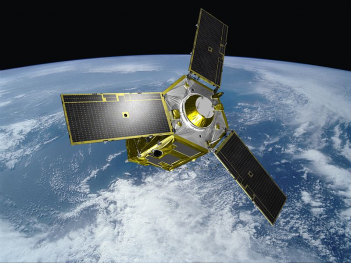
The Pléiades twins (1A and 1B) deliver very high-resolution optical data (up to 0.5 m resolution Panchromatic and Colour and 2 m Multispectral) and offer a daily revisit capability to any point on the globe. The swath width is approximately 20 km (with a nadir footprint). The ortho-products are automatically generated by the Pléiades ground segment, based on SRTM or Reference3D database. The projection available for Pléiades ortho-products is UTM, datum WGS84. Bands combinations:: Pansharpened: colour image at 0.5 m resolution Bundle: (0.5 m panchromatic image + 2 m multispectral image) Processing levels: Primary: The Primary product is the processing level closest to the natural image acquired by the sensor. This product restores perfect collection conditions: the sensor is placed in rectilinear geometry, and the image is clear of all radiometric distortion. Standard Ortho: The Ortho product is a georeferenced image in Earth geometry, corrected from acquisition and terrain off-nadir effects. Tailored Ortho: Aside from the Standard Ortho product, when different specifications are needed, a custom orthorectification, with a more precise 3D model provided by the client or acquired for the purpose, can be provided on demand. As per ESA policy, very high-resolution imagery of conflict areas cannot be provided.
Event - Conference
IGARSS 2019
World-class scientists, engineers and educators in geoscience and remote sensing gathered in Yokohama, Japan, for the 39th annual IGARSS symposium.
Event - Training
3rd Advanced Training Course on Land Remote Sensing 2011
This 2011 advanced ESA training course focused on land remote sensing theory and applications.
Event - Workshop
POLinSAR 2009
The 2009 workshop focused on theory and methods in the fields of SAR Polarimetry and Polarimetric Interferometry
Event - Workshop
POLinSAR 2007
The POLinSAR 2007 workshop was open to ESA Principal Investigators and co-investigators, scientists and students working in the field of SAR Polarimetry and Polarimetric Interferometry, and to representatives from national, European and international space agencies and value adding industry.


