- All Categories (1115)
- Data (7)
- News (15)
- Missions (4)
- Tools (5)
- Activities (4)
- Documents (1080)
DATA
Discover and download the Earth observation data you need from the broad catalogue of missions the European Space Agency operate and support.
Data - Sample Data (Open)
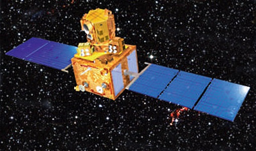
IRS-P6 (ResourceSat-1) Sample Data
Download free IRS-P6 (ResourceSat-1) sample datasets to preview products available for this mission.
Data - Announcement of Opportunity (Restrained)
Announcement of Opportunity for S3VT (Sentinel-3 Validation Team)
In the framework of a Copernicus collaborative agreement ESA and EUMETSAT invite interested groups and individuals to support the Sentinel-3 Validation Team (S3VT).
Data - Announcement of Opportunity (Restrained)
Announcement of Opportunity for S6VT (Sentinel-6 Validation Team)
In the framework of a Copernicus collaborative agreement between ESA and EUMETSAT a call is open to relevant and interested groups and individuals worldwide to join the S6VT.
Data - Project Proposal (Restrained)
ResourceSat-1/IRS-P6 full archive
ResourceSat-1 (also known as IRS-P6) archive products are available as below: Sensor Type Resolution (m) Coverage (km x km) System or radiometrically corrected Ortho corrected (DN) Neustralitz archive Global archive LISS-IV Mono-Chromatic 5 70 x 70 X X 2004 – 2010 2003 - 2013 LISS-III Multi-spectral 20 140 x 140 X X 2004 – 2013 2003 - 2013 AWiFS Multi-spectral 60 370 x 370 X X 2004 – 2013 2003 - 2013 Note: LISS-IV: Mono-Chromatic, the band is selectable. In practice the red is used. For LISS-IV MN and LISS-III ortho corrected: If unavailable, user has to supply ground control information and DEM in suitable quality. For AWiFS ortho corrected: service based on in house available ground control information and DEM. The products are available as part of the GAF Imagery products from the Indian missions: IRS-1C, IRS-1D, CartoSat-1 (IRS-P5), ResourceSat-1 (IRS-P6) and ResourceSat-2 (IRS-R2) missions. 'ResourceSat-1 archive' collection has worldwide coverage: for data acquired over Neustrelitz footprint, the users can browse the EOWEB GeoPortal catalogue to search archived products; worldwide data (out the Neustrelitz footprint) can be requested by contacting GAF user support to check the readiness since no catalogue is not available. All details about the data provision, data access conditions and quota assignment procedure are described in the Terms of Applicability.
Data - Project Proposal (Restrained)
ResourceSat-2 full archive and tasking
ResourceSat-2 (also known as IRS-R2) archive and tasking products are available as below: Sensor Type Resolution (m) Coverage (km x km) System or radiometrically corrected Ortho corrected (DN) Ortho corrected (TOA reflectance) Neustralitz archive Global archive LISS-IV Mono-Chromatic 5 70 x 70 X X 2014 – 2011 - LISS-III Multi-spectral 20 140 x 140 X X X AWiFS Multi-spectral 60 370 x 370 X X X Note: LISS-IV: Mono-Chromatic, the band is selectable. In practice the red is used. For LISS-IV MN and LISS-III ortho corrected: If unavailable, user has to supply ground control information and DEM in suitable quality. For AWiFS ortho corrected: service based on in house available ground control information and DEM. The products are available as part of the GAF Imagery products from the Indian missions: IRS-1C, IRS-1D, CartoSat-1 (IRS-P5), ResourceSat-1 (IRS-P6) and ResourceSat-2 (IRS-R2) missions. 'ResourceSat-2 archive and tasking' collection has worldwide coverage: for data acquired over Neustrelitz footprint, the users can browse the EOWEB GeoPortal catalogue to search archived products; worldwide data (out the Neustrelitz footprint) can be requested by contacting GAF user support to check the readiness since no catalogue is not available. All details about the data provision, data access conditions and quota assignment procedure are described in the Terms of Applicability.
Data - Fast Registration with immediate access (Open)
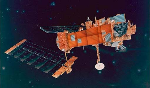
Envisat DORIS Doppler [DOR_DOP_1P]
This product was generated by the Centre de Traitement Doris Poseidon (CTDP). The DORIS Doppler product (DOR_DOP_1P) was consolidated offline 2-4 weeks after sensing and stored in the F-PAC archive. The file size is 0.5 Mbytes per orbit.
Data - Fast Registration with immediate access (Open)
Envisat DORIS Precise Orbit [DOR_VOR_AX]
The latest version of the Envisat DORIS Precise Orbit product, DOR_VOR_AX, was generated by the Centre de Traitement Doris Poseidon (CTDP) using the Geophysical Data Records F standards (GDR-F). The product is used to obtain the satellite orbital parameters (latitude, longitude, height and height rate) by using orbit computation routines. The most significant changes related to the GDR-F standards concern the new ocean tide model (FES2014) and the updated Terrestrial Reference Frame (ITRF2014). The new standards significantly improve all Precise Orbit Determination (POD) metrics with respect to GDR-E. The mean difference and variance of Sea Surface Height (SSH) at crossovers is slightly reduced. The DOR_VOR_AX product adopts the Envisat format, and the size is 0.2 Mbytes per orbit. Users are recommended to apply the GDR-F version, but the previous datasets are still available (i.e. GDR-D and GDR-E versions). See further details in the readme file for Envisat DORIS Precise Orbit Determination files. Comparison of Envisat Sea Level Anomaly trends obtained using DORIS Precise Orbit GDR-E and F standards. North/South patterns are evident. Credits: CNES/CLS.


