- All Categories (350)
- Data (81)
- News (95)
- Missions (16)
- Events (43)
- Tools (5)
- Activities (4)
- Campaigns (31)
- Documents (75)
DATA
Discover and download the Earth observation data you need from the broad catalogue of missions the European Space Agency operate and support.
Data - Campaigns (Open)

AfriSAR 2015
During the AfriSAR 2015 campaign, shared between ONERA (dry season, July 2015) and DLR (wet season 2016), Pol-InSAR and TomoSAR airborne data set were collected over four test sites over Africa, therefore covering different forest structures.
Data - Campaigns (Open)

AfriSAR 2016
In order to further support the BIOMASS mission development, especially concerning the mission concept verification and the development of geophysical algorithms, ESA funded the AfriSAR campaign.
Data - Campaigns (Open)

AIRFIRE
The fires observational campaign was performed during summer 2006 and dedicated to the study of fire emission in the spectral region VNIR-SWIR.
Data - EO Sign In Authentication (Open)
ALOS African Coverage ESA archive
ALOS Africa is a dataset of the best available (cloud minimal, below 10%) African coverage acquired by AVNIR-2 in OBS mode and PRISM in OB1 mode (all Backward, Nadir and Forward views, in separated products), two different collections one for each instrument. The processing level for both AVNIR-2 and PRISM products is L1B. This dataset is a subset of the main ALOS AVNIR-2 and ALOS PRISM ESA collections. ALOS AVNIR-2: https://doi.org/10.5270/AL1-d9cfa6d ALOS PRISM: https://doi.org/10.5270/AL1-5e400fd.
Data - Fast Registration with approval (Restrained)
ALOS AVNIR-2 L1C
This collection provides access to the ALOS-1 AVNIR-2 (Advanced Visible and Near Infrared Radiometer type 2) L1C data acquired by ESA stations in the ADEN zone plus some worldwide data requested by European scientists. The ADEN zone was the area belonging to the European Data node and covered both the European and African continents, a large part of Greenland and the Middle East. The full mission archive is included in this collection, though with gaps in spatial coverage Time window: from 2006-04-28 to 2011-04-20 Orbits: from 1375 to 27898 Path (corresponds to JAXA track number): from 1 to 670 Row (corresponds to JAXA scene centre frame number): from 370 to 5230. One single Level 1C product type is offered for the OBS instrument mode: AV2_OBS_1C. The Level 1C product is a multispectral image (three bands in VIS and one in NIR) in GEOTIFF format with 10 m resolution.
Data - Announcement of Opportunity (Restrained)

Announcement of Opportunity for NoR
ESA invites submissions for the Network of Resources (NoR) call, which aims to support research, development and pre-commercial users to innovate their working practices, moving from a data download paradigm towards a 'bring the user to the data' paradigm.
Data - Announcement of Opportunity (Restrained)
Announcement of Opportunity for NovaSAR-1
ESA is launching an Announcement of Opportunity for the international scientific community to access data from the NovaSAR-1 mission for science and EO-based applications development.
Data - Announcement of Opportunity (Restrained)

Announcement of Opportunity for SAOCOM
In cooperation with CONAE (Comisión Nacional de Actividades Espaciales), ESA is launching an Announcement of Opportunity for the international scientific community to access data from the SAOCOM mission for science and EO-based applications development.
Data - Campaigns (Open)

AquiferEx
The AquiferEx Optical and Radar Campaign was in support of information product generation based on satellite data, harmonisation of satellite data acquisition performed among Aquifer and AquiferEx project partners.
Data - Campaigns (Open)

AROMAT-II
This campaign covers the fields of atmospheric composition: NO2, SO2, aerosols, over Romania (Bucharest and Turceni) and Germany (Berlin).
Data - Campaigns (Open)

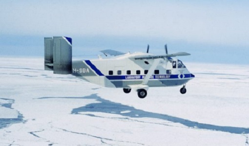
BelSAR 2018
The BelSAR project intended to carry out an airborne campaign for SAR bistatic interferometric measurements at L-band and full polarisation, over a test site in Belgium.
Data - Campaigns (Open)

BioSAR 2007
The BioSAR campaign aimed to support geophysical algorithm development, calibration/validation and the simulation of future spaceborne Earth Observation missions.
Data - Campaigns (Open)

BioSAR 2008
The main objective of BioSAR-2 (BioSAR 2008) campaign was to record SAR data over boreal forests with topographic effects to investigate the effect on biomass retrieval.
Data - Project Proposal (Restrained)
COSMO-SkyMed ESA archive
The COSMO-SkyMed archive collection consists of COSMO-SkyMed products requested by ESA supported projects over their areas of interest around the world. The dataset regularly grows as ESA collects new products over the years. The following list delineates the characteristics of the SAR measurement modes that are disseminated under ESA Third Party Missions (TPM). STRIPMAP HIMAGE (HIM): Achieving medium resolution (3 m x 3 m single look), wide swath imaging (swath extension ≥40 km). STRIPMAP PINGPONG (SPP): Achieving medium resolution (15 m), medium swath imaging (swath ≥30 km) with two radar polarization's selectable among HH, HV, VH and VV. SCANSAR WIDE (SCW): Achieving radar imaging with swath extension of 100 x 100 km2 and a spatial resolution of 30 x 30 m2. SCANSAR HUGE (SCH): Achieving radar imaging with swath extension of 200 x 200 km2 and a spatial resolution selectable of 100 x 100 m2. Processing Levels: Level 1A - Single-look Complex Slant - (SCSB and SCSU): RAW data focused in slant range-azimuth projection, that is the sensor natural acquisition projection; product contains In-Phase and Quadrature of the focused data, weighted and radiometrically equalised.The processing of the 1A_SCSU product differs from that of the 1A_SCSB product for the following features:a non-weighted processing is performed, which means that windowing isn't applied on the processed bandwidth; radiometric equalisation (in terms of compensation of the range antenna pattern and incidence angle) is not performed; hence only compensation of the antenna transmitter gain and receiver attenuation and range spreading loss is applied. Level 1B - Detected Ground Multi-look (DGM): Product obtained detecting, multi-looking and projecting the Single-look Complex Slant data onto a grid regular in ground. Spotlight Mode products are not multi-looked. Level 1C - Geocoded Ellipsoid Corrected (GEC) and Level 1D - Geocoded Terrain Corrected (GTC): Obtained projecting the Level 1A product onto a regular grid in a chosen cartographic reference system. In case of Lev 1C the surface is the earth ellipsoid while for the Lev 1D a DEM (Digital Elevation Model) is used to approximate the real earth surface. Spatial coverage: Check the spatial coverage of the collection on a map available on the Third Party Missions Dissemination Service. As per ESA policy, very high-resolution data over conflict areas cannot be provided.
Data - Project Proposal (Restrained)
COSMO-SkyMed full archive and tasking
The archive and new tasking X-band SAR products are available from COSMO-Skymed (CSK) and COSMO-SkyMed Second Generation (CSG) missions in ScanSAR and Stripmap modes, right and left looking acquisition (20 to 60° incidence angle). COSMO-SkyMed modes: Acquisition Mode Single look Resolution [Az. X. Rg, SCS] (m) Scene size [Az. X. Rg] (km) Polarisation Scene duration (seconds) Number of looks Multilook resolution (m) Geolocation accuracy ±3 s (m) [DGM, GEC, GTC] Stripmap Himage 2.6 x 3 40 x 40 Single: HH, HV, VH, VV 7 3 5 25 Stripmap PingPong 9.7 x 11 30 x 30 Alternate: HH/VV, HH/HV, VV/VH 6 3 20 25 ScanSAR Wide 23 x 13.5 100 x 100 Single: HH, HV, VH, VV 15 4 - 9 30 30 ScanSAR Huge 38 x 13.5 200 x 200 Single: HH, HV, VH, VV 30 25 - 66 100 100 COSMO-Skymed Second Generation Modes: Acquisition Mode Single look Resolution [Az. X. Rg, SCS] (m) Scene size [Az. X. Rg] (km) Polarisation Scene duration (seconds) Number of looks Multilook resolution (m) Geolocation accuracy ±3σ (m) [DGM, GEC, GTC] Stripmap 3 x 3 40 x 40 Single (HH, VV, HV, VH) or Dual (HH+HV, VV+VH) 7 2 x 2 4 x 4 6 x 7 11 x 14 3.75 Stripmap PingPong 12 x 5 30 x 30 Alternate (HH/VV, HH/HV+VV/VH) 6 1 x 2 2 x 5 12 x 10 23 x 26 12 QuadPol 3 x 3 40 x 15 Quad (HH+HV+VV+VH) N/A 2 x 2 4 x 4 6 x 7 11 x 14 3.75 ScanSAR 1 20 x 4 100 x 100 Single (HH, VV, HV, VH) or Dual (HH+HV, VV+VH) 15 1 x 3 1 x 5 2 x 8 20 x 14 23 x 27 35 x 40 12 ScanSAR 2 40 x 6 200 x 200 Single (HH, VV, HV, VH) or Dual (HH+HV, VV+VH) 30 1 x 4 1 x 7 3 x 16 40 x 27 47 x 54 115 x 135 12 Following Processing Levels are available, for both CSK and CSG: SCS (Level 1A, Single-look Complex Slant): Data in complex format, in slant range projection (the sensor's natural acquisition projection) and zero doppler projection, weighted and radiometrically equalised; the coverage corresponds to the full resolution area illuminated by the SAR instrument DGM (Level 1B, Detected Ground Multi-look): Product obtained detecting, multi-looking and projecting the Single-look Complex Slant data onto a grid regular in ground: it contains focused data, amplitude detected, optionally despeckled by multi-looking approach, radiometrically equalised and represented in ground/azimuth projection GEC (Level 1C, Geocoded Ellipsoid Corrected): Focused data, amplitude detected, optionally despeckled by multi-looking approach, geolocated on the reference ellipsoid and represented in a uniform preselected cartographic presentation. Any geometric correction derived by usage of terrain model isn't applied to this product by default GTC (Level 1D, Geocoded Terrain Corrected): Focused data, fully calibrated with the usage of terrain model, amplitude detected, optionally despeckled by multi-looking approach, geolocated on a DEM and represented in a uniform preselected cartographic presentation. The image scene is located and accurately rectified onto a map projection, through the use of Ground Control Points (GCPs) and Digital Elevation Model (DEM); it differs from GEC for the use of the DEM (instead of reference ellipsoid) for the accurate conversion from slant to ground range and to approximate the real earth surface. The list of available data can be retrieved using the CLEOS COSMO-SkyMed products catalogue. User registration is required to use the catalogue. As per ESA policy, very high-resolution data over conflict areas cannot be provided.
Data - Sample Data (Open)
COSMO-SkyMed Sample Data
Download free COSMO-SkyMed sample datasets to preview products available for this mission.
Data - Campaigns (Open)
CoSMOS 2006
ESA conducted an airborne campaign to map sea surface salinity named "CoSMOS-OS" that took place in April 2006 over the Norway Sea off the coast of Stavenger.
Data - Data Description
Envisat ASAR AP Co- and Cross-polar L0 [ASA_APC/APH/APV_0P]
The ASAR Alternating Polarization Mode Level 0 (Co-polar and Cross-polar H and V) products contain time-ordered Annotated Instrument Source Packets (AISPs) corresponding to one of the three possible polarisation combinations: HH & HV, VV & VH and HH & VV, respectively. The echo samples in the AISPs have been compressed to 4 bits/sample using FBAQ. This is a high-rate, narrow swath mode, so data is only acquired for partial orbit segments. There are two co-registered images per acquisition and may be from one of seven different image swaths. The Level 0 product was produced systematically for all data acquired within this mode. Data Size: 56-100 km across track x 100 km along track. There are three AP Mode Level 0 products: ASA_APH_0P: The Cross-polar H Level 0 product corresponds to the polarisation combination HH/HV. ASA_APV_0P: The Cross-polar V Level 0 product corresponds to the polarisation combination VV/VH. ASA_APC_0P: The Co-polar Level 0 product corresponds to the polarisation combination HH/VV= H and H received/V transmit and V received.
Data - EO Sign In Authentication (Open)
Envisat ASAR AP Medium Resolution L1 [ASA_APM_1P]
This ASAR Alternating Polarization Medium Resolution Image product has been generated from Level 0 data collected when the instrument was in Alternating Polarisation Mode. The product has lower geometric resolution but higher radiometric resolution than ASA_APP and contains one or two co-registered images corresponding to one of the three polarisation combination sub modes (HH and VV, HH and HV, VV and VH). This product has been processed using the SPECAN algorithm and contains radiometric resolution good enough for ice applications and covers a continuous area along the imaging swath. The ASAR AP L0 full mission data archive has been bulk processed to Level 1 (ASA_APM_1P) in Envisat format with the IPF-ASAR processor Version 6.03. Spatial Resolution: 150 m ground range x 150 m azimuth.
Data - EO Sign In Authentication (Open)
Envisat ASAR AP Precision L1 [ASA_APP_1P]
This ASAR Alternating Polarisation Mode Precision product is generated from Level 0 data collected when the instrument is in Alternating Polarisation Mode (7 possible swaths). The product contains two CO-registered images corresponding to one of the three polarisation combination submodes (HH and VV, HH and HV, VV and VH). This is a stand-alone multi-look, ground range, narrow swath digital image generated using the SPECAN algorithm and the most up to date auxiliary information available at the time of processing. Engineering corrections and relative calibration (antenna elevation gain, range spreading loss) are applied to compensate for well-understood sources of system variability. Generation of this product uses a technique to allow half the looks of an image to be acquired in horizontal polarisation and the other half in vertical polarisation and processed to 30-m resolution (with the exception of IS1). Absolute calibration parameters are available depending on external calibration activities and are provided in the product annotations. Spatial Resolution: 30 m ground range x 30 m azimuth.