- All Categories (32018)
- Data (64)
- News (116)
- Missions (11)
- Events (64)
- Tools (30)
- Activities (15)
- Campaigns (7)
- Documents (31711)
CAMPAIGNS
Learn about the ground-based, ship-borne, balloon-borne, and airborne campaigns and small satellite field experiments that validate orbiting ESA EO satellites and support future mission development.
Campaign
 2015 - 2016
PolarGap
The primary objective of the PolarGap campaign was to carry out an airborne gravity survey covering the southern polar gap of the gravity field mission GOCE, beyond the coverage of the GOCE orbit.
Campaign
 2013
2013DOMECair (GOCE)
The airborne survey DOMECair 2013 and its instrumentation was designed to obtain calibration and validation data for two different satellite missions of ESA’s Earth Explorer mission, for satellites SMOS and GOCE.
Campaign
 2013
2013SEN2EXP
In the SEN2EXP campaign, the data gap for broad leaf forests is addressed as suitable reference datasets of sufficient quality do not exist.
Campaign
 2009
2009SEN3EXP
The main objective of Sen3Exp (Sentinel-3 Experimental Campaign) was to provide a comprehensive dataset that covers all Sentinel-3 OLCI and SLSTR bands that is to be used for the algorithm prototype and ground segment processor development.
Campaign
 2009
2009THERMOPOLIS
The THERMOPOLIS 2009 campaign mainly served the DUE “Urban Heat islands (UHI) and Urban Thermography (UT) Project”
Campaign
 2005
2005BACCHUS-DOC
The BACCHUS-DOC Radar and Optical Campaign was an area mapping project of vineyards near Frascati (Italy). ESA required high resolution geo-referenced airborne SAR data of different wavelength and polarisation (preferably polarimetric).
Campaign
 2002
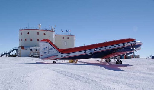
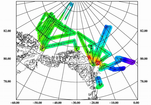
2002ESAG
The European Survey of Arctic Gravity (ESAG) campaign objective was to acquire measurements of the Arctic Ocean, in support of GOCE mission; and acquire scanning laser ranging data and profiling laser altimetry over sea-ice north of Greenland.