- All Categories (160)
- Data (23)
- News (54)
- Missions (3)
- Events (6)
- Tools (3)
- Activities (4)
- Campaigns (7)
- Documents (60)
Data - Restrained Access (Restrained)

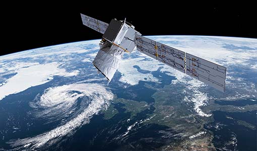
EarthCARE ESA L2 Products for Cal/Val Users
This EarthCARE collection is restrained, and contains the following data products: Level 2a: Single-Instrument Geophysical Products These products are derived from individual instrument data onboard EarthCARE. They provide detailed geophysical parameters and properties specific to each instrument's capabilities for example cloud and aerosol properties derived solely from radar or lidar measurements, offering high-resolution insights into atmospheric phenomena. Level 2b: Synergistic Geophysical Products Synergistic Geophysical Products Level 2b products leverage data from multiple EarthCARE instruments to generate comprehensive, synergistic geophysical datasets. By combining measurements from instruments like radar, lidar, and radiometers, these products offer a more integrated view of cloud-aerosol interactions and atmospheric dynamics. Synergistic products provide enhanced accuracy and depth compared to single-instrument outputs, enabling detailed studies of complex atmospheric processes.
Data - Restrained Access (Restrained)
EarthCARE JAXA L2 Products for Cal/Val Users
This EarthCARE collection is restrained, and contains the following data products: Level 2a: Single-Instrument Geophysical Products These products are derived from individual instrument data onboard EarthCARE. They provide detailed geophysical parameters and properties specific to each instrument's capabilities for example cloud and aerosol properties derived solely from radar or lidar measurements, offering high-resolution insights into atmospheric phenomena. Level 2b: Synergistic Geophysical Products Level 2b products leverage data from multiple EarthCARE instruments to generate comprehensive, synergistic geophysical datasets. By combining measurements from instruments like radar, lidar, and radiometers, these products offer a more integrated view of cloud-aerosol interactions and atmospheric dynamics. Synergistic products provide enhanced accuracy and depth compared to single-instrument outputs, enabling detailed studies of complex atmospheric processes.
Data - Restrained Access (Restrained)

EarthCARE ESA L2 Products for the Commissioning Team
This EarthCARE collection contains the following data products: Level 2a: Single-Instrument Geophysical Products These products are derived from individual instrument data onboard EarthCARE. They provide detailed geophysical parameters and properties specific to each instrument's capabilities for example cloud and aerosol properties derived solely from radar or lidar measurements, offering high-resolution insights into atmospheric phenomena. Level 2b: Synergistic Geophysical Products Level 2b products leverage data from multiple EarthCARE instruments to generate comprehensive, synergistic geophysical datasets. By combining measurements from instruments like radar, lidar, and radiometers, these products offer a more integrated view of cloud-aerosol interactions and atmospheric dynamics. Synergistic products provide enhanced accuracy and depth compared to single-instrument outputs, enabling detailed studies of complex atmospheric processes.
Data - Restrained Access (Restrained)

EarthCARE L0 and L1 Products for the Commissioning Team
This EarthCARE collection for the Commissioning Team contains the following data products: Level 0: Annotated Raw Instrument Source Packets These packets contain unprocessed data as generated by EarthCARE's instruments, annotated with basic metadata in front of each packet Level 1b: Fully Calibrated and Geolocated Instrument Measurements Level 1b products are fully processed, calibrated, and geolocated measurements from EarthCARE's instruments. Each measurement is aligned with the native instrument grid. For the Broadband Radiometer (BBR), measurements are also spatially integrated to various ground pixel sizes. Level 1C (MSI only): MSI Level 1b Data Interpolated to a Common Spatial Grid Specifically for the Multi-Spectral Imager (MSI), Level 1c data involves interpolating Level 1b measurements onto a standardised spatial grid that is consistent across all MSI bands. This grid closely matches the spacing used in MSI Level 1b data. Level 1D: Joint Standard Grid (JSG) for all Instruments and ECMWF Meteorological Fields Level 1d data provide a spatial grid to enable easy collocation and synergistic use of the data from all EarthCARE instruments, named the "joint standard grid." Additionally, this level incorporates ECMWF (European Centre for Medium-Range Weather Forecasts) meteorological fields limited to the EarthCARE swath, enabling comprehensive analysis and modelling of atmospheric conditions within the satellite's coverage area.
Data - Restrained Access (Restrained)

EarthCARE L1 Products for Cal/Val Users
This EarthCARE collection is restrained, and contains the following data products: Level 1B: Fully Calibrated and Geolocated Instrument Science Measurements Level 1b data represents the fully processed, calibrated, and geolocated measurements from EarthCARE's instruments. Each measurement is aligned with the native instrument grid. For the Broadband Radiometer (BBR), measurements are also spatially integrated to various ground pixel sizes. Level 1C (MSI only): MSI Level 1b Data Interpolated to a Common Spatial Grid Specifically for the Multi-Spectral Imager (MSI), Level 1c data involves interpolating Level 1b measurements onto a standardised spatial grid that is consistent across all MSI bands. This grid closely matches the spacing used in MSI Level 1b data. Level 1D: Joint Standard Grid (JSG) for all instruments with ECMWF Meteorological Fields. Level 1d data provides a spatial grid to enable easy collocation and synergistic use of the data from all EarthCARE instruments, named the "joint standard grid." Additionally, this level incorporates ECMWF (European Centre for Medium-Range Weather Forecasts) meteorological fields limited to the EarthCARE swath, enabling comprehensive analysis and modelling of atmospheric conditions within the satellite's coverage area.
Data - Restrained Access (Restrained)

EarthCARE JAXA L2 Products for the Commissioning Team
This EarthCARE collection contains the following data products: Level 2a: Single-Instrument Geophysical Products These products are derived from individual instrument data onboard EarthCARE. They provide detailed geophysical parameters and properties specific to each instrument's capabilities for example cloud and aerosol properties derived solely from radar or lidar measurements, offering high-resolution insights into atmospheric phenomena. Level 2b: Synergistic Geophysical Products Level 2b products leverage data from multiple EarthCARE instruments to generate comprehensive, synergistic geophysical datasets. By combining measurements from instruments like radar, lidar, and radiometers, these products offer a more integrated view of cloud-aerosol interactions and atmospheric dynamics. Synergistic products provide enhanced accuracy and depth compared to single-instrument outputs, enabling detailed studies of complex atmospheric processes.
Data - EO Sign In Authentication (Open)

EarthCARE ESA L2 Products
This EarthCARE collection contains the following data products: Level 2a: Single-Instrument Geophysical Products These products are derived from individual instrument data onboard EarthCARE. They provide detailed geophysical parameters and properties specific to each instrument's capabilities for example cloud and aerosol properties derived solely from radar or lidar measurements, offering high-resolution insights into atmospheric phenomena. Level 2b: Synergistic Geophysical Products Level 2b products leverage data from multiple EarthCARE instruments to generate comprehensive, synergistic geophysical datasets. By combining measurements from instruments like radar, lidar, and radiometers, these products offer a more integrated view of cloud-aerosol interactions and atmospheric dynamics. Synergistic products provide enhanced accuracy and depth compared to single-instrument outputs, enabling detailed studies of complex atmospheric processes.
Data - EO Sign In Authentication (Open)
EarthCARE L1 Products
This EarthCARE collection contains the following data products: Level 1b: Fully Calibrated and Geolocated Instrument Science Measurements Level 1b data represents the fully processed, calibrated, and geolocated measurements from EarthCARE's instruments. Each measurement is aligned with the native instrument grid. For the Broadband Radiometer (BBR), measurements are also spatially integrated to various ground pixel sizes. Level 1c (MSI only): MSI Level 1b Data Interpolated to a Common Spatial Grid Specifically for the Multi-Spectral Imager (MSI), Level 1c data involves interpolating Level 1b measurements onto a standardised spatial grid that is consistent across all MSI bands. This grid closely matches the spacing used in MSI Level 1b data. Level 1d: Joint Standard Grid (JSG) for all instruments with ECMWF Meteorological Fields. Level 1d data provides a spatial grid to enable easy collocation and synergistic use of the data from all EarthCARE instruments, named the "joint standard grid." Additionally, this level incorporates ECMWF (European Centre for Medium-Range Weather Forecasts) meteorological fields limited to the EarthCARE swath, enabling comprehensive analysis and modelling of atmospheric conditions within the satellite's coverage area. CPR level 1b: C-NOM products is generated and provided by JAXA. This product is used as input, in combination with the X-MET aux file, for different processors in the EarthCARE production chain. AUX_MET_1D: meteorological analysis and forecast fields X-MET provided by ECMWF. This product is used as input, in combination with the C-NOM product, for different processors in the EarthCARE production chain.
Data - Restrained Access (Restrained)

EarthCARE Auxiliary Data for Cal/Val Users
EarthCARE data products encompass essential supporting auxiliary (AUX) and orbit data critical for accurate sensor data processing and analysis. AUX data includes datasets used outside the primary Space Segment stream to apply corrections to sensor data. This comprises previously derived calibration parameters, ground control data, and digital elevation data. Calibration parameters ensure measurement accuracy, while ground control data aids in data validation, and digital elevation data enables precise geolocation. Orbit data consists of on-board satellite data and orbital information. For EarthCARE, this includes Reconstructed Orbit and Attitude Files, which provide detailed satellite positioning and orientation information. The integration of AUX and orbit data into EarthCARE's data processing workflow ensures the production of high-quality, scientifically valuable datasets for atmospheric research, climate modelling, and environmental monitoring.
Data - EO Sign In Authentication (Open)
EarthCARE JAXA L2 Products
This EarthCARE collection contains the following data products: Level 2a: Single-Instrument Geophysical Products These products are derived from individual instrument data onboard EarthCARE. They provide detailed geophysical parameters and properties specific to each instrument's capabilities for example cloud and aerosol properties derived solely from radar or lidar measurements, offering high-resolution insights into atmospheric phenomena. Level 2b: Synergistic Geophysical Products Level 2b products leverage data from multiple EarthCARE instruments to generate comprehensive, synergistic geophysical datasets. By combining measurements from instruments like radar, lidar, and radiometers, these products offer a more integrated view of cloud-aerosol interactions and atmospheric dynamics. Synergistic products provide enhanced accuracy and depth compared to single-instrument outputs, enabling detailed studies of complex atmospheric processes.
Data - EO Sign In Authentication (Open)
EarthCARE Orbit Data
EarthCARE data products encompass essential supporting auxiliary (AUX) and orbit data critical for accurate sensor data processing and analysis. Orbit data consists of on-board satellite data and orbital information predicted or determined by the Flight Operations Segment (FOS). For EarthCARE, this includes Reconstructed Orbit and Attitude Files, which provide detailed satellite positioning and orientation information. The integration of AUX and orbit data into EarthCARE's data processing workflow ensures the production of high-quality, scientifically valuable datasets for atmospheric research, climate modelling, and environmental monitoring.
Campaign
WIVERNEX-UK
This campaign was designed to extend the Chilbolton ground measurement record that involved analysis of radar observations made by the 94 GHZ radar from the ground at Chilbolton to quantify the accuracy expected for the algorithms for deriving, winds, clouds and precipitation properties for the proposed WIVERN satellite.
News - Events and Proceedings
Featuring the power of Earth observation data at EGU
The European Geosciences Union General Assembly 2024 brings together geoscientists from all over the world, aiming to provide a forum where scientists and early career researchers can present their work and discuss their ideas with experts, in all fields of geoscience.
News - Operational News
Transition from FTP to FTPS for SMOS, Aeolus and Campaign data dissemination systems
As of 15 April 2024 access to the SMOS, Aeolus and Campaign data will be changed from simple FTP to FTPS.
News - General News
Aeolus wind data boosts innovative new global wind comparison tool
A new system for comparing wind data from multiple observing platforms, including ESA’s Aeolus wind satellite, puts global wind data - and the tools needed to analyse them - all in one place.
News - Events and Proceedings
EarthCARE pre-launch science workshop a success
Held between 13 and 17 November 2023, in ESA’s Earth Observation facility in Frascati, Italy, the ESA-JAXA pre-launch EarthCARE science and validation workshop brought together nearly 250 participants, representing a vibrant worldwide scientific community that is eagerly awaiting the mission’s launch.
News - General News
Aeolus data and lessons learned: what happens next for ESA’s wind mission?
The Aeolus satellite returned to Earth on 28 July 2023, in an assisted reentry that marked the end of nearly five years in space. For scientists working with Aeolus data, however, the mission lives on.
News - Success Stories
Commercial and international data for fire monitoring
As climate change sparks a surge in the frequency and intensity of wildfires, satellite data disseminated through ESA’s Third Party Missions (TPM) programme are helping scientists to track and investigate these potentially damaging natural events.
News - Success Stories
Young scientists bid farewell to ESA's wind mission
Students and early career researchers are saying an emotional goodbye to Aeolus ahead of its upcoming reentry.
News - Events and Proceedings
Last call for EarthCARE workshop abstracts
The abstract submission deadline for the EarthCARE Pre-Launch Science and Validation Workshop is just a week away. If you would like to present your work at the workshop, submit your abstract by 10 July.