- All Categories (146)
- Data (12)
- News (32)
- Missions (9)
- Events (17)
- Tools (16)
- Activities (5)
- Campaigns (6)
- Documents (49)
News - Thematic area articles
How to use space data to probe humankind’s ancient past
Data disseminated by ESA’s Third Party Missions (TPM) programme are enabling archaeological investigations that could help to unravel the mysteries of past societies and cultures.
Tools - Catalogues
Copernicus Data Space Ecosystem
The Copernicus Data Space Ecosystem provides free instant access to a wide range of data and services from the Copernicus Sentinel missions.
News - Thematic area articles
Cloud-free collections key for land monitoring
Satellite imagery is a crucially important tool for monitoring the land, but cloud cover can often block parts of Earth’s surface from view, limiting subsequent analyses.
Activity - Fiducial Reference Measurements
FRM4SM: Fiducial Reference Measurements for Soil Moisture
Fiducial Reference Measurements for Soil Moisture (FRM4SM) is a European Space Agency (ESA) managed project focused, on one hand, on defining procedures and protocols to qualify in situ soil moisture measurements as “FRMs” and, on the other hand, on addressing specific concerns intrinsic to the satellite soil moisture validation strategy (e.g., in situ measurement’s spatial representativeness, and the identification of committed areas for satellite soil moisture validation).
News - Success Stories
Commercial and international data for fire monitoring
As climate change sparks a surge in the frequency and intensity of wildfires, satellite data disseminated through ESA’s Third Party Missions (TPM) programme are helping scientists to track and investigate these potentially damaging natural events.
News - Events and Proceedings
GLOC 2023: Democratising data access key to climate action
The need for easy access to remote sensing data and making them more digestible to the local user community, were take home messages from the first Global Space Conference on Climate Change (GLOC), held in Oslo, Norway, last week.
News - Thematic area articles
How satellite data empower sustainable urban growth
Earth observation is a vital tool for facilitating the sustainable development of the world's cities, helping to ensure that urban centres keep spurring collaboration, innovation and opportunity as they continue to expand.
News - Success Stories
PROBA-V data improve surface albedo products in Africa
As ESA’s PROBA-V satellite marks its 10-year launch milestone, data tasked during the mission’s lifetime are still being used to assess changes in land cover.
News - Events and Proceedings
Scientists to showcase value of Earth observation data at EGU
Remote sensing scientists are getting ready to present innovative and exciting applications of satellite data at the European Geosciences Union general assembly which will take place from 24 to 28 April in Vienna, Austria.
Campaign
WaddenSAR
The “WaddenSAR – Airborne bistatic C-band SAR experiment to demonstrate different acquisition geometries” was initiated to support the development of the Earth Explorer 10 Harmony mission.
News - General News
Stunning new features for ESA and NASA altimetry portal cs2eo.org
Working with combined ESA and NASA altimetry data is easier than ever thanks to a range of handy new features on cs2eo.org.
News - General News
International collaboration: Summarising ESA’s Third Party Missions
ESA’s Third Party Missions programme consists of more than 50 missions from around the world. Learn more about the Third Party Missions in this video.
News - General News
Long-term data: Summarising ESA’s Heritage missions
ESA’s Heritage Space Programme preserves data from non-operational missions. Learn more about the Heritage missions in this video.
News - Success Stories
Showcasing success stories from ESA's Third Party Missions
ESA’s Third Party Missions programme consists of more than 50 missions from around the world.
News - Thematic area articles
Global understanding of Earth's land surfaces greatly boosted by satellite data
ESA perform land surface monitoring with a range of instruments onboard satellites acquiring optical and radar data. Collections of data from these missions are freely available for research purposes.
News - Success Stories
New worldwide dataset captures the planet in fine detail
Scientists have developed an open source planetwide dataset of high-resolution Earth observation imagery, thanks to commercial data delivered by ESA’s Third Party Missions (TPM) programme.
News - Success Stories
Long-term satellite data show wind farms can affect local air currents
Decades of satellite data have allowed for the first long-term study of the impact of offshore wind farms on downstream wind flow in coastal areas.
Document - Data Access Information
ESA-archive-third-party-mission-collections.pdf
Discover the ESA archive data collections offered for the Third Party Missions programme.
Tools - Catalogues
FedEO
FedEO is a data catalogue that provides a unique entry point to a number of scientific catalogues and services for, but not limited to, European and Canadian missions.
Tools - Catalogues
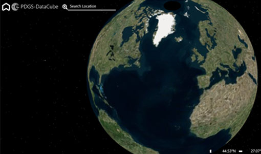
ESA PDGS DataCube
ESA's DataCube is a data catalogue that enables multi-temporal and pixel-based access to a subset of data available from ESA


