- News & Events
- CryoSat’s unparalleled record ...
CryoSat’s unparalleled record of global ice continues to 2025
03 Apr 2023
CryoSat, ESA’s ice mission, has been a key to what the cryosphere community regards as a golden era for satellite altimetry. Described affectionately as “a gift that keeps on giving”, there are plenty more presents in store as CryoSat has been extended to 2025.
“CryoSat set the template by which modern radar altimeters, such as those of the Copernicus Sentinel series, now measure ice and sea levels,” says Alessandro Di Bella, CryoSat and CRISTAL Data Quality Engineer at ESA.
“It remains the only satellite radar altimeter that can measure at latitudes above 82° north and south, and is therefore uniquely capable of recording the contribution of ice sheets, glaciers and ice caps to global sea-level rises, as well as to monitor changes in sea ice thickness. Its continuous data record of 13 years is unprecedented.”
A comprehensive satellite record of global ice
CryoSat monitors around 95% of total sea ice in the Arctic, and more than 95% of areas where the ice mass is changing over ice sheet margins, which is five times greater than any other radar altimeter.
Its unbroken 13 year record of global ice is the longest ever and has been invaluable for improving our understanding of the effects of climate change on Earth’s cryosphere.
A recent study highlights the value of CryoSat measurements, with the first ever continuous, year-round altimetry measurements of sea-ice thickness in the Arctic Ocean. Previous research using CryoSat data indicated Greenland and Antarctica were losing ice at a rate six times faster than in the 1990s, mirroring the Intergovernmental Panel on Climate Change’s worst case scenarios.
The extension to 2025 will maintain this critical record for as long as possible until ESA’s future Copernicus Polar Ice and Snow Topography Altimeter (CRISTAL) mission, which is set to launch in 2027, can continue CryoSat’s legacy.
A pioneering instrument
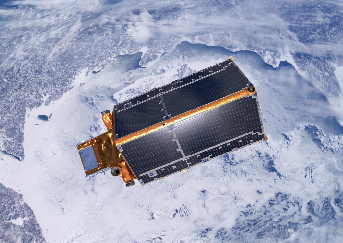
Launched in 2010, as an Earth Explorer CryoSat was born to innovate.
Its primary instrument is the first ever spaceborne synthetic aperture interferometric radar altimeter (SIRAL). With a drifting orbit, across-track interferometry capabilities (SARIn), and a novel technique called “swath” processing, CryoSat marked a paradigm shift in satellite altimetry.
A product known as Cryo-TEMPO EOLIS, developed by Earthwave, introduced the novel swath processing technique that greatly improves our ability to measure ice sheet elevation. Using two antennas and its SARIn mode, CryoSat can measure echoes across its track rather than just directly underneath, providing 2D maps of surface elevation.
The technique has enabled improved measurement of polar ice sheets, mountain glaciers in Asia and Patagonia, and has also been used to survey subglacial lakes in Antarctica. Other features have also been revealed, including ice shelf surface cracks, deep meltwater channels, and changes in the calving front.
The swath processing technique is employed by CryoSat alone, and only the future CRISTAL mission will offer a comparable capability.
An expanding portfolio
Whilst the initial objectives for CryoSat were to monitor marine ice in the polar oceans and variations of ice sheets in Greenland and Antarctica, the mission has hugely increased its portfolio.
Due to the much increased coverage of its SIRAL instrument, CryoSat was able to set a new standard for measuring sea levels on the coast. It’s also uniquely capable of measuring sea levels in the polar oceans, being the only radar altimeter monitoring up to 88° north and south.
Through Cryo-TEMPO, the mission’s data are available to a wide range of users who can access thematic products covering both land ice and sea ice, as well as polar oceans, coastal oceans, and inland waters.
Cryo-TEMPO offers state-of-the-art processing methods, including uncertainty parameters that permit data to be assimilated into forecasting systems.
Weather forecasters and operational marine service providers that have integrated CryoSat near-real time data include NOAA/NCEP, Météo-France, the European Centre for Medium-Range Weather Forecasts (ECMWF) and the Copernicus Marine Service. Applications include sea level, ocean circulation, sea state and safety at sea, ocean winds, and forecasting storm surges and hurricanes.
A recent update to Cryo-TEMPO, which is led by UK Centre for Polar Observation & Modelling (CPOM), and the Lancaster University-UKCEH Centre of Excellence in Environmental Data Science (CEEDS), provides enhanced SARIn processing and extended regional coverage.
Another surprise package of CryoSat has been its magnetometer, which provides such good data that scientists of the fellow Earth Explorer Swarm Mission use the data as part of a product known as CryoMAGNET.
CryoSat to 2025
A major development for CryoSat in recent years has been a pioneering collaboration with NASA’s ICESat-2 mission, which flies an innovative photon-counting laser. Through a series of orbit manoeuvres, it was possible to increase the number of coincident tracks over the poles.
The combination of radar and lidar measurements, known as CRYO2ICE, will significantly improve estimates of snow depth on top of ice. In theory, ICESat-2’s lidar reflects mostly off the snow/air boundary, while CryoSat penetrates the snow layer to reach the ice/snow interface below.
A 2022 study using the combined data found that Arctic sea ice had lost a third of its total volume in the last 18 years.
Along with airborne campaigns such as CryoVEx, which provided the first ever measurements underneath a coincident CryoSat/ICESat-2 orbit this winter, CRYO2ICE measurements will lay the groundwork for future dual-frequency altimetry missions such as CRISTAL.
“We’re excited for what the next few years have in store for CryoSat,” says CryoSat Mission Manager, Tommaso Parrinello.
“This extension is vital to continue our long term record of global ice, for as long as possible until CRISTAL is operational. In the meantime, the continued CRYO2ICE collaboration also opens up key new avenues of research that will improve our climate models and predictions, such as understanding the very different behaviour of sea ice in the Arctic and Antarctic.”