- Learn & Discover
- CryoSat's Swath Processing Tec...
CryoSat's Swath Processing Technique
15 Oct 2021
For more than 30 years, satellite radar altimetry has been used to continuously monitor the state of the cryosphere and to investigate the impact of global warming on sea level rise. Owing to this, maps of ice sheet elevation and elevation change were derived.
At first, satellite radar altimetry was not reliable when it came to elevation data over small ice caps and could only be used in a limited capacity when it came to the sloping edges of large ice caps.
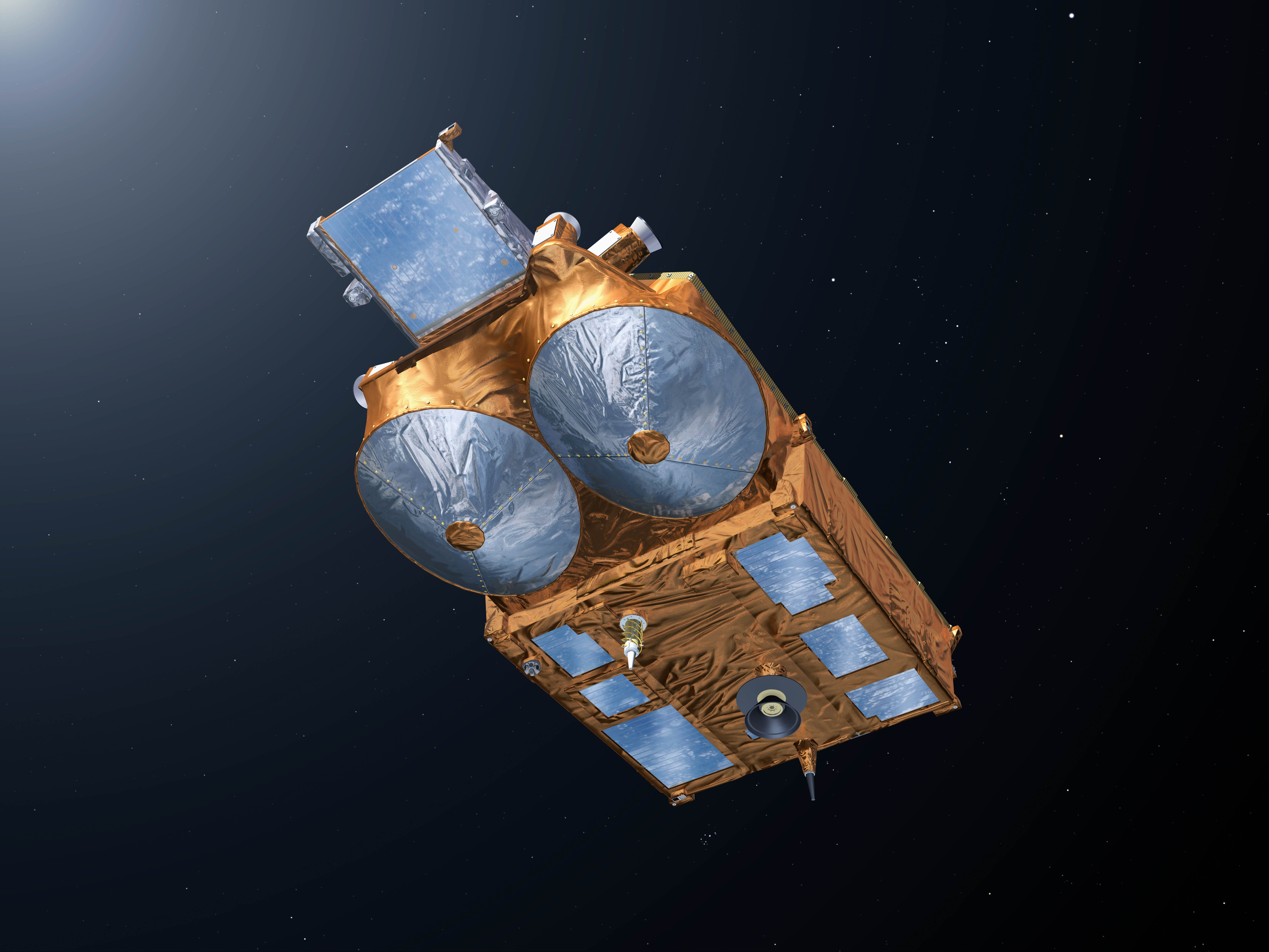
ESA’s CryoSat mission was designed to address these blind spots and provide improved measurements for elevation data over smaller ice caps, glaciers and the edges of ice sheets, as well as sea ice parameters. CryoSat also ensured that a comprehensive global survey of ice could finally be conducted.
CryoSat’s Synthetic Aperture Interferometric Radar Altimeter (SIRAL) instrument provides an improved spatial resolution compared to its predecessors. SIRAL comes with twin antennas that can work in an interferometric mode (SARIn), detecting both the distance to a spot below and the angle to that location, allowing for accurate echo location. This means it can map steep slopes and the valleys at the edges of ice sheets effectively.
Being able to measure these areas is especially important in the context of global warming, as they are the places where melting and thinning are most pronounced. Since CryoSat was launched in 2010, the SARIn mode has been used extensively to map the sloping ice at the edges of the Greenland and Antarctic ice sheets, and over all other glaciated areas on Earth.
A further improvement of resolution for CryoSat data was obtained through the novel swath processing technique.
The Swath Processing Technique at a Glance
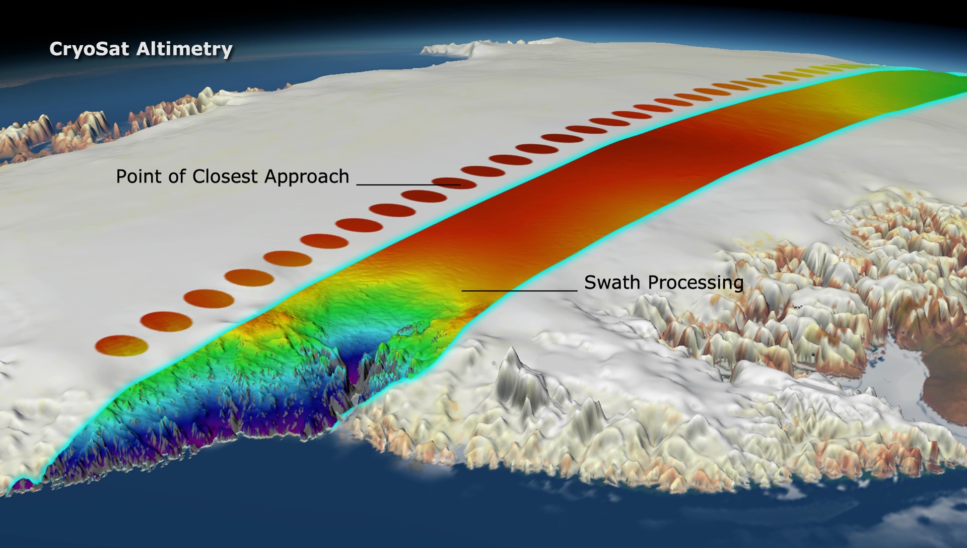
Normally, radar altimetry retrieves surface elevation by determining a Point-Of-Closest-Approach (POCA), meaning that a single elevation is sampled beneath the satellite. SIRAL’s SARIn mode, however, can accurately determine the arrival direction of echoes both along and across the satellite track, due to its two antennas, by comparing the phase of one antenna to the other. This information is used to derive the height of the surface from the range measurement of the radar.
Swath processing of CryoSat data determines ice elevation across extended swaths of terrain, using the information contained within these SARIn echoes. The accurate echo location is used to map broad swaths of surface elevation with fine spatial resolution, as the radar signal scans Earth’s surface. This leads to a 10 to a 100 folds increase in elevation measurement, providing a sharper view of ice thickness change and a virtual global coverage of ice across the globe. Swath elevations allow for a more dense, statistically robust time series of elevation change, to be formed with temporal resolution five times higher than for POCA.
Ground-breaking research

Since it was first introduced, the swath processing technique has been at the heart of some of the most exciting research into the cryosphere in recent years. Using the novel technique, researchers from Earthwave led by Livia Jakob were able to investigate ice loss in the Gulf of Alaska and High Mountain Asia. Looking at ice trends at exceptionally high resolution in space and time enabled scientists to discover changes in trends, such as the increased ice loss from 2013 onwards in parts of the Gulf of Alaska, which is linked to climatic changes.
Patagonia is home to some of the southern hemisphere’s biggest glaciers, but some are retreating faster than anywhere else in the world, which makes the need to monitor their changes all the more urgent. The swath processing technique made it possible for researchers from the University of Edinburgh, led by student Luca Foresta, to map glaciers in Patagonia in fine detail. This was not previously possible because the footprint of satellite radar altimeters was too large to monitor smaller mountain glaciers.
“Over the last decade we developed and fine-tuned a swath processor and applied it to ice caps in Patagonia and over the entire arctic, over high mountain glaciers in Asia, Gulf of Alaska and the Antarctic Peninsula, and to survey subglacial lakes and ice shelves in Antarctica,” says Noel Gourmelen, Reader in Remote Sensing of the Cryosphere at the University of Edinburgh, and Scientific Director at Earthwave.
“Swath-derived elevation is now an official product provided to the community via ESA’s supported programme CryoTEMPO and covers land-ice globally. Swath processing will also be a routine product provided by CRISTAL, the candidate radar altimetry mission to the Copernicus expansion programme."
As part of its CryoSat ThEMatic PrOducts (Cryo-TEMPO) activity that supports end-users working in the areas of sea ice, polar oceans, land ice, coastal areas and hydrology, ESA launched the CryoTEMPO-EOLIS (Elevation Over Land Ice from Swath) dataset in 2020 that consists of the entire CryoSat data archive reprocessed using the swath processing technique.