

Featured
About GHGSat
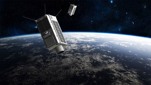
GHGSat is a global reference for the remote sensing, identification, and facility attribution of greenhouse gas (GHG) emissions from global sources. No other active commercial or government satellite mission is specifically designed for detecting and quantifying GHG emissions from point sources as small as individual oil and gas wells.
The GHGSat constellation currently consists of 12 satellites: GHGSat-D (GHGSat's technology demonstrator satellite) launched in June 2016, and a commercial fleet, GHGSat-C1 to GHGSat-C11, launched from 2020 to 2023.
Each satellite is equipped with a wide-angle Fabry-Perot (WAF-P) imaging spectrometer designed to measure the vertical column abundances of greenhouse gases. GHGSat-D and GHGSat-C1 are capable of measuring both methane and carbon dioxide, but the entire constellation is optimised for methane measurements.
GHGSat have plans to grow their constellation 16 in total.
| GHGSat-D Claire | GHGSat-C1 Iris | GHGSat-C2 Hugo | GHGSat-C3 Luca | GHGSat-C4 Penny | GHGSat-C5 Diako | GHGSat-C6 Mey-Lin | GHGSat-C7 Gaspard | GHGSat-C8 Océane | |
| Launch Date | 22 June 2016 | 2 September 2020 | 24 January 2021 | 25 May 2022 | 15 April 2023 | 15 April 2023 | 15 April 2023 | ||
| Nominal Altitude | 512 km | 523 km | 530 km | 550 km | 534 km | 534 km | 496 km | 496 km | 496 km |
| Inclination | 97.3° | 97.5° | |||||||
| Orbital Period | 95 minutes | ||||||||
| Equator Crossing | 09:30 LTDN | 10:30 LTDN | 10:30 LTDN | 13:08 LTDN | 10:31 LTDN | 10:31 LTDN | 10:31 LTDN | ||
| Orbits per Day | 15 | ||||||||
| Repeat Cycle | 14 days | ||||||||
| Design Lifetime | 4 years (exceeded) | 4 years (minimum) | |||||||
| Mission Status | On-orbit | ||||||||
GHGSat Objectives
GHGSat's overall mission objective is provide actionable information to operators, regulators, and other stakeholders interested in understanding, controlling, and ultimately reducing facility-level emissions of greenhouse gases.
GHGSat Instruments
Each GHGSat satellite carries a proprietary imaging spectrometer for measuring facility-level greenhouse gas emissions.
| Property | GHGSat-D Information | GHGSat-CX1 Information |
| Primary Sensor | ||
| Name | Wide-Angle Fabry-Perot (WAF-P) Imaging Spectrometer | |
| Sensor Type | Optical | |
| Bands and spectral ranges | SWIR 1600-1700 nm, multiple bands in a proprietary configuration, unpolarized | |
| Methane column density precision (% of background) | 13% | 1% |
| Detection Threshold | 1,000 kg/hour in 3 m/s wind (for methane) | 100 kg/hour in 3 m/s wind (for methane) |
| Field-of-View | 12 km × 12 km | |
| On-Board Calibration | No | Yes |
| Spatial Resolution | < 50 m | Approximately 30 m |
| Swath width | < 15 km | |
| Depth of imaging | 12 bit | |
| Along-track imaging capacity | Yes | Yes |
| Sensor Pointing | +/- 15 degrees from nadir along & cross-track | +/- 20 degrees from nadir along & cross-track |
| Geometric accuracies | < 5 m | < 5 m |
| Secondary Sensor | ||
| Name | C&A-1: Clouds and Aerosols Sensor | VIS-1: Visible Sensor |
| Sensor Type | Optical | Optical |
| Bands and spectral ranges | Visible and Near-Infrared | Visible |
| Spatial Resolution | <150 m | <20 m |
| Swath width | <30 km | <35 km |
| Sampling Depth | 12 bit | 12 bit |
1Instrument parameters common to GHGSat commercial satellites, which are generally referred to as "CX".
The primary sensor on all GHGSat satellites is a Wide-Angle Fabry-Perot (WAF-P) Imaging Spectrometer. This primary sensor produces a hypercube consisting of a stack of overlapping, spectrally selected images acquired within <30 seconds. This hypercube embeds, for each ground pixel, information equivalent to hundreds of wavelengths from the top-of-the-atmosphere spectral radiance. Once downloaded, the hypercube is corrected for sensor response and instrument optics. The gas column density and surface reflectance information are then retrieved for each ground pixel using a measurement model which includes surface, instrument and atmospheric contributions to radiance. The resulting arrays are georeferenced, giving the "Surface Reflectance Image" and one "Abundance Dataset" for methane.
GHGSat satellites typically have a spatial resolution of 25 m (>50 m for GHGSat-D) and the Field of View (FOV) of approximately 12 km x 12 km of these datasets allow gas plumes emitted from industrial sources to be captured and distinguished from the surrounding background concentrations, constituting a differential measurement.
The reflectance and abundance products can be combined into a high readability "Concentration Map" for human interpretation.
The abundance datasets from multiple observations of a given site can be combined to form a monitoring product for semi-automatic detection of emitter activity or large changes in emission rates using pre-determined thresholds.
Abundance datasets also allow emission rates to be estimated for individual sources. Plume dispersion is modelled using site information and weather data from global meteorological models or local weather stations and matched to the measured datasets.
GHGSat Data
DATA COLLECTIONS
ESA is offering, for scientific research and application development, access to archive and new tasking data from the GHGSat mission upon submission and acceptance of a project proposal.
ESA will support as many high-quality and innovative projects as possible within the quota limit available, therefore only a limited amount of products can be made available to each project.