- All Categories (32124)
- Data (70)
- News (163)
- Missions (132)
- Events (73)
- Tools (8)
- Activities (19)
- Campaigns (30)
- Documents (31629)
Document - General Reference

Land and Sea - ERS-1 Applications
The information sheets in this brochure describe just some of the many projects utilising data products and images from ERS
Document - General Reference
ERS-1-SAR-Sea-Ice-Catalogue.pdf
This catalogue contains a selection of ERS-1 synthetic aperture radar (SAR) images to illustrate various sea-ice conditions
Mission - Heritage Missions

ERS
The ERS programme was composed of two missions, ERS-1 and ERS-2, which together observed the Earth for 20 years, from 1991
Document - General Reference
Advances in Oceanography and Sea Ice Research Using ERS Observations
Special section of the Journal of Geophysical Research devoted to Oceanography and sea ice research, using observations from
Document - Publication - Paper

Assimilation of reprocessed ERS scatterometer data into ECMWF weather analysis on the Mediterranean Sea
Data - Fast Registration with immediate access (Open)
ERS-1/2 SCATTEROMETER Ocean Wind field and Sea Ice probability [ASPS20.H/ASPS20.N]
Please consult the Product Quality Readme file before using the ERS ASPS data.
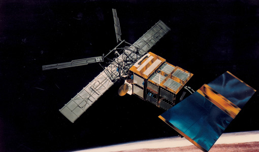
Mission - Heritage Missions

Wind Scatterometer (WS)
Scatterometer (WS) instrument, on board the ERS-1 and ERS-2 missions, obtained information on wind speed and direction over the sea
Mission - Heritage Missions

Envisat
Envisat was ESA's successor to ERS. Envisat carried ten instruments aboard for a wide range of Earth observing fields.
Mission - Heritage Missions
Wind Scatterometer (WS) Overview
Scatterometer (WS) instrument, on board the ERS-1 and ERS-2 missions, obtained information on wind speed and direction over the sea
Data - EO Sign In Authentication (Open)
Sea Ice Thematic Data Product [ALT_TDP_SI]
This is the Sea Ice Thematic Data Product (TDP) V1 resulting from the ESA FDR4ALT project and containing the sea ice related
Document - Publication - Paper
Calibration strategy for ERS scatterometer data reprocessing.pdf
Paper included in the Proceedings of SPIE Remote Sensing of the Ocean and Sea Ice 2005 - vol.5977- Brugge (Belgium): Calibration
News - Success Stories

Spotlight on sea-level rise
Scientists to share findings on how satellite has revealed changes in the height of the sea, ice, inland bodies of water
Data - EO Sign In Authentication (Open)
SMOS L3 Sea Ice Thickness
The SMOS Level 3 Sea Ice Thickness product, in NetCDF format, provides daily estimations of SMOS-retrieved sea ice thickness
Document - Algorithms Theoretical Baseline Document

Cryo-TEMPO-ATBD-Sea-Ice.pdf
Cryo-TEMPO-ATBD-Sea-Ice-v2.1.pdf
Document - Conference Presentation - Poster

Sea-Surface-Salinities-GLOSCAL-project.pdf
SMOS Validation and Retrieval Team Workshop 2010 presentation
Event - Conference
International Symposium on Sea Ice 2023
The International Glaciological Society, the Alfred-Wegener-Institute, Helmholtz-Zentrum für Polar- und Meeresforschung, and the University of Bremen jointly organize the symposium which will be held in Bremerhaven, Germany from 4 to 9 June 2023.
Mission - Earth Explorers

CryoSat
interferometry techniques from standard imaging radar missions to sharpen its accuracy over rugged ice sheet margins and sea
News - Success Stories
ESA missions deliver new long-term perspective on sea ice decline
A 29-year timeseries of polar sea ice thickness and volume that draws on altimetry data from a succession of ESA missions
Document - Product Document

FDR4ALT-Validation-Report-TDP-Sea-Ice
FDR4ALT Product Validation Report: Sea-Ice TDP
Data - Data Description
ERS-1/2 ATSR Meteo Product [AT1/AT2_MET_2P]
SST record, 10 arc min cell) of the AST product, with the addition of Average Brightness Temperature (ABT) fields (BT/TOA sea