- All Categories (26101)
- News (41)
- Missions (30)
- Events (19)
- Activities (4)
- Campaigns (2)
- Documents (26005)
MISSIONS
Explore the European Space Agency's Earth Observation satellite missions. Learn all about ESA's dedicated Earth Explorers or collaborations with other agencies through the Third Party Missions programme.
Mission - Heritage Missions

SAR (ERS) Processor Releases
It should be noted that for SAR, each product ordered is processed directly from the raw data, using the current version
Mission - Earth Explorers
Geographical Mode Mask
The current operational Geographical Mode Mask v5.0 The current version of the geographical mode mask v5.0 has been in operation
Mission - Heritage Missions
ASAR Processor Releases
August 2009 5.03L03 9 October 2009 5.04 17 September 2010 6.00 16 December 2011 6.02 30 April 2012 6.03 3 July 2015 (current
Mission - Earth Explorers

Special Datasets Overview
CryoSat Antarctic Digital Elevation Model - Download the current CryoSat product Antarctic DEM.
Mission - Heritage Missions

RA (ERS)
the RA provided information on significant wave height; surface wind speed; sea surface elevation, which relates to ocean currents
Mission - Heritage Missions
SAR (ERS)
Processor Releases It should be noted that for SAR, each product ordered is processed directly from the raw data, using the current
Mission - Heritage Missions

ERS Radar Course 1
Therefore, microwaves easily penetrate clouds, and images can be acquired independently of the current weather conditions
Mission - Earth Explorers

Products Information
here, these are intended for the purpose of becoming familiar with the format of the CryoSat Science Products from the current
Mission - Earth Explorers
About CRYO2ICE
The measurements will also help map snow over the poles and advance our understanding of currents in polar oceans, with further
Mission - Earth Explorers

Ground Tracks
CryoSat instruments and it is generated at the beginning of every orbital repetition cycle around two months before the current
Mission - Earth Explorers

SIRAL
Access is provided to all CryoSat systematic data acquired according to the current geographical mode mask.
Mission - Earth Explorers
CryoSat Objectives
The density increase causes the surface waters to sink – in essence acting as a pump, driving cold, deep ocean currents from
Mission - Heritage Missions
ASAR Products Information
Higher level products (Level 2) can then be derived from L1 products; however, this is currently only done with Wave mode
Mission - Heritage Missions

RA (ERS) Overview
demanding constraints and had the following major objectives: Precise altitude (ocean surface elevation for the study of ocean currents
Mission - Earth Watch
SIRAL Overview
It is also operated over some geostrophic ocean currents and major hydrological basins.
Mission - Heritage Missions
MERIS Applications
altimeters, have a remarkable sensitivity to the roughness and height of the ocean surface, enabling the detection of ocean currents
Mission - Heritage Missions
SAR (ERS) Interferometry
addition, components of the interferometric signal such as anomalous signal path lengths introduced by atmospheric effects are currently
Mission - Heritage Missions

RA (ERS) Products Information
data showed a clear improvement in terms of accuracy over the tandem periods between ERS-1, ERS-2 and Envisat missions (currently
Mission - Heritage Missions

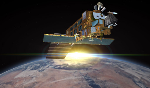
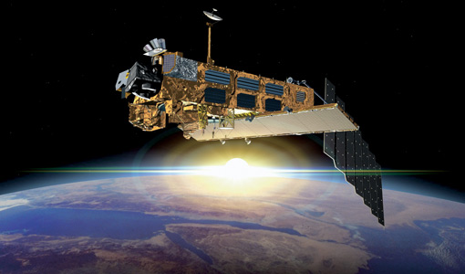
Envisat Objectives
x x Turbidity x Wave Characteristics x x Near Surface Wind x x Current
Mission - Third Party Missions

Multi Spectral Scanner (MSS) Processor Releases
GCP displacement B TM radiometric calibration Update to radiometric calibration strategy for TM reflective bands (Dark Current