- All Categories (67)
- Data (1)
- News (5)
- Missions (7)
- Events (6)
- Activities (2)
- Documents (46)
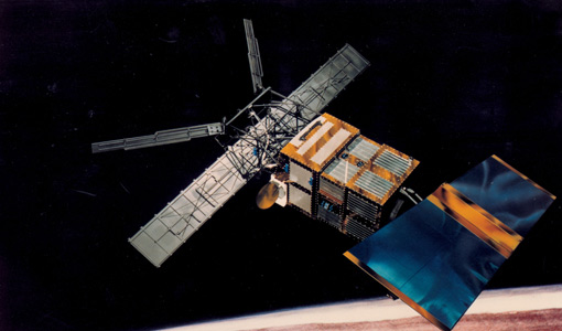
Mission - Heritage Missions

Wind Scatterometer (WS) Quality Control Reports
The data includes instrument working modes, temperatures, currents and voltages of the transmitter and calibration chain,
Mission - Heritage Missions
Wind Scatterometer (WS) Processor Releases
The current processor software version for the operational ground segment is ASPS v 10.04.
Mission - Heritage Missions
Wind Scatterometer (WS) Cal/Val
ERS-2 Scatterometer: Mission Performances and Current Reprocessing Achievements Calibration strategy for ERS scatterometer
News - Success Stories
Trailblazing ERS-2 mission enables climate change applications
Varied elevations of Bachu in western China InSAR is currently one of the most accurate methods to generate digital elevation
Document - General Reference

The International Charter- Space and Major Disasters
The Charter is an important step forward in linking the needs of disaster and relief organisations with space technology solutions to help mitigate the effects of disaster on human life, property and the environment.
Document - General Reference
Taking-the-Measure-of-Earth-Fifteen-Years-of-Progress-in-Radar-Altimetry.pdf
This article is extracted from ESA Bulletin Nr. 128.
Document - General Reference
Spill-Science-and-Technology-Bulletin-Special-issue-on-ERS-oil-pollution-monitoring.pdf
This special issue of the Spill Science and Technology Bulletin provides a feature on the ERS SAR contribution to oil pollution monitoring in the Mediterranean.
Document - General Reference
spaceborne-radar-applications-in-geology-an-introduction.pdf
This document is intended for geologists who are interested in broadening their knowledge of interpretation of imaging radar data. It introduces imaging radar as it may be used by technicians and image interpreters. Interferometric SAR is briefly treated, with some basic and practical hints. An illustrated application study on land subsidence is included.
Event - Workshop

Space and the Arctic 2009 Workshop
possibilities for the future : Volker Liebig, Director of ESA EO Programme Observations of the Arctic - EUMETSAT's Contribution to Current
News - Infographics
Showcasing success stories from ESA's Heritage Missions
success stories showcased used data from ESA's ERS (European Remote Sensing) and Envisat satellites in combination with current
Event - Workshop

SEASAR 2012
Aouf 14:00 - 14:20 Towards consistent inversion of wind, waves and surface current from SAR Bertrand Chapron (IFREMER, France
Activity - Quality
SCIRoCCo
Author: The SCIRoCCo Team Abstract: The ERS Scatterometers in the Global Climate Observing System report describes the current
Document - General Reference
Remote-Sensing-and-Humanitarian-Aid-A-life-saving-combination.pdf
This article was published in the ESA Bulletin Nr. 122 and describes how Earth Observation activities may answer to the requirements of humanitarian and aid workers.
Document - General Reference
In-action-around-the-world-the-International-Charter-Space-and-Major-Disasters.pdf
This is an article extracted from the ESA Bulletin Nr.143.
Document - General Reference
Hydrological-Processes-An-International-Journal-Special-issue-on-Remote-Sensing.pdf
This special issue of Hydrological Processes contains a selection of the most significant reports presented at the Flood Monitoring Workshop held at the ESA/ESRIN premises in Frascati, Italy on 26-27 June 1995. It is intended to provide the reader with an overall assessment of the capability of remote sensing to contribute to flood risk management, including the advantages and limitations, as well as critical areas, for further improvement.
News - Thematic area articles

How satellite data help to shape society
Title: Current drought situation in Ebro basin Description: The SMOS soil-moisture-based drought monitor is updated monthly
News - Thematic area articles
How satellite data empower sustainable urban growth
Some 56% of the world's population currently reside in cities and the number of urban inhabitants is expected to double by
News - Success Stories

Heritage data still widely used today
Current satellite missions collect data with high frequency, with some able to systematically revisit the same location in
Document - General Reference
Healing-the-Earth-Earth-Observation-Supporting-International-Environmental Conventions.pdf
This article is extracted from ESA Bulletin Nr. 128.
Document - General Reference
From-ERS-1-to-ERS-2-Destination-Earth.pdf
This booklet presents a small fraction of ERS-1 results. The "ERS System" is also described in five background briefing notes.