- All Categories (37)
- News (6)
- Missions (2)
- Events (3)
- Tools (1)
- Activities (3)
- Documents (22)
News - Thematic area articles
How satellite data empower sustainable urban growth
Some 56% of the world's population currently reside in cities and the number of urban inhabitants is expected to double by
News - Success Stories
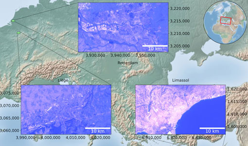
Heritage data trains neural networks to detect urban sprawl
Since they’ve been trained identically, they can help monitor both current and past urban changes.
Activity - Projects
Dragon 3 Cooperation Programme
Surveying and Mapping China Mirjam Bilker-Koivula, Hannu Ruotsalainen Finnish Geodetic Institute Finland 10677 - GSM4GCM Current
Event - Training
EO Summer School 5
Keynote lectures on global change issues are also given to discuss the current state of the science of global change and
Event - Training
EO Summer School 3
In line with observations it shows anti-cyclonically rotating surface currents and cyclonically rotating bottom currents.
News - Infographics
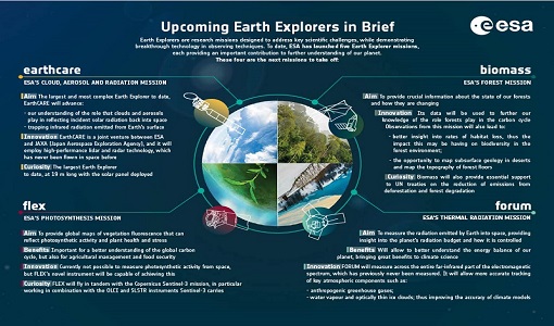
What are the next Earth Explorers?
Four more missions are currently planned - EarthCARE, Biomass, FLEX, and FORUM - which will further our understanding of
News - Events and Proceedings
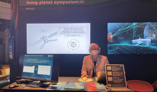
Highlights from Living Planet Symposium
ESA will continue to pursue recovery and reprocessing of heritage data to extend time series and complement data from current
Document - General Reference
Heritage Missions brochure
This brochure describes ESA's Heritage Space Programme and includes infographics describing some of the missions in the programme.
Document - General Reference
Earth Explorers brochure
This brochure describes ESA's Earth Explorers Space Programme and includes infographics describing some of the missions in the programme.
News - Thematic area articles
Space data help to unravel the complexities of Earth’s atmosphere
mission delivered unprecedented insight into the global distributions of methane and carbon dioxide, helping to underpin current
News - Thematic area articles
Satellite data central to ocean monitoring
microwave monitoring instruments, optical imagers, and infrared radiometers, which can map ocean variables related to ocean currents
Document - Technical Note
Technical Note on Quality Assessment for Landsat 1-7
Technical Note on Quality Assessment for Landsat 1-7
Event - Workshop
Space and the Arctic 2009 Workshop
possibilities for the future : Volker Liebig, Director of ESA EO Programme Observations of the Arctic - EUMETSAT's Contribution to Current
Document - Product Document
EarthCARE-Project-SRD-Phases-B-C-D-E1.pdf
This document provides the system requirements for the EarthCARE system for the phases B, C/D and E.
Document - Product Document
EarthCARE-Validation-Requirements.pdf
This document describes the validation requirements for EarthCARE Level 1b (L1b), Level 1c (L1c), Level 2a (L2a) and Level 2b (L2b) products.
Document - Product Document
EarthCARE-Production-Model.pdf
This document presents the Production Model for EarthCARE science data products.
Document - Product Document
EarthCARE-MSI-PDD.pdf
This document has been produced in the frame of the “EarthCARE Ground Processor” project and its purpose is to describe the format and content of the L1 nominal and regridded products for the EarthCARE MSI processor.
Document - Product Document
EarthCARE-JAXA-Research-Announcement.pdf
This document covers JAXA's 1st EarthCARE Research and Validation Plan.
Document - Algorithms Theoretical Baseline Document
EarthCARE-ATLID-L1-ATBO.pdf
This document provides the main processing steps required to generate EarthCARE ATLID Level 1B products and an overview of the algorithm. It is an Algorithm Theoretical Baseline Overview Document.
Document - Product Document
EarthCARE-CPR-L1B-PDD.pdf
The purpose of this document is to specify the format and content of the L1 products for the EarthCARE CPR (Cloud Profiling Radar).


