- All Categories (95)
- News (6)
- Missions (5)
- Events (2)
- Tools (2)
- Activities (2)
- Documents (78)
News - General News
Go-to guide to Third Party Mission data offering
Data Access Guide has been published, providing technical details and information on available data collections for all current
Activity - Quality

EDAP
The following missions are currently being considered as part of the Automatic Identification System (AIS) and Radio Frequency
Event - Workshop

SEASAR 2012
Aouf 14:00 - 14:20 Towards consistent inversion of wind, waves and surface current from SAR Bertrand Chapron (IFREMER, France
Mission - Heritage Missions
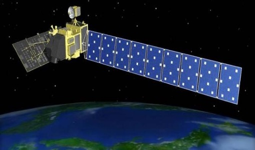
PALSAR
A small percentage of ALOS-1 PALSAR products processed by the current installed ESA IPF are affected by a known quality issue
Mission - Heritage Missions

PALSAR Processor Releases
The current ALOS-1 PALSAR IPF integrated within the ESA On-The-Fly system is v4.16p9, installed on 24 January 2017.
Document - Product Document

ALOS-PALSAR-Quality-Disclaimer.pdf
This document provides a quality disclaimer for an ALOS PALSAR IPF failure.
Document - General Reference

The Earth Observation Handbook, 2010 Update - Key Tables
This is the 2010 update of the CEOS Earth Observation Handbook. You can browse the live database at http://database.eohandbook.com/ or download the printable PDF of key tables based on the 2010 database contents for a handy reference.
Tools - Visualisation
HEDAVI
ESA’s Heritage EO data currently cover more than 30 years of observations and enable the analysis of spatio-temporal dynamics
Document - Product Specifications

OceanSat-2-Level-1-Product-Specifications.pdf
Oceansat-II OCM data products are generated in HDF-4. HDF is the hierarchical representation of one or more data sets be it Meta Data or Image Data enabling quick access and efficient storage. In short it is a multi object file format for sharing scientific data in a distributed environment.
News - Thematic area articles

Satellite data central to ocean monitoring
microwave monitoring instruments, optical imagers, and infrared radiometers, which can map ocean variables related to ocean currents
Event - Workshop

Fringe 2011 Workshop
The Fringe series of workshops started in 1992 and they are currently organised by ESA every two years.
Document - General Reference
PREMIER-Report-for-Mission-Selection-An-Earth-Explorer-to-observe-atmospheric-composition.pdf
The objective of the PREMIER mission is to quantify the processes controlling global atmospheric composition in the mid/upper troposphere and lower stratosphere (5-25 km height range), which is a region of particular importance for climate change.
News - Data Release news

ESA will continue to provide ocean colour data from Indian mission
"The key space segment of the OCR-VC consists of the current and future polar-orbiting global OC satellite missions.
Document - General Reference
BIOMASS-Report-for-Mission-Selection-An-Earth-Explorer-to-observe-forest-biomass.pdf
The objective of the BIOMASS Mission is to determine the global distribution of forest biomass by reducing the uncertainty in the calculation of carbon stock and fluxes associated with the terrestrial biosphere.
Document - General Reference
CoReH2O-Report-for-Mission-Selection-An-Earth-Explorer-to-observe-snow-and-ice.pdf
This report describes the CoReH2O (Cold Regions Hydrology high-resolution Observatory) mission, which was selected for feasibility study in the third cycle of Earth Explorers.
News - Spotlight on EO community

Meet a young researcher who studies the behaviour of volcanoes worldwide
to apply for a scholarship offered by the Chilean government to pursue PhD studies abroad, and eventually, led me to the current
Document - Technical Note

Technical Note on Quality Assessment for OceanSat-2 (3 Jul 19)
Technical Note on Quality Assessment for OceanSat 2 OCM (Quarterly report for Q2 2019)
Document - Technical Note
Technical Note on Quality Assessment for OceanSat-2 (4 Jan 20)
Technical Note on Quality Assessment for OceanSat-2 OCM (Quarterly report for Q3 and Q4 2019)
Document - Proceedings

Preliminary-Radiometric-Calibration-Assessment-of-ALOS-AVNIR-2.pdf
This paper was presented at IGARSS 2007 (23-27 July 2007 - Barcelona, Spain). It summarizes the activities carried out in the frame of the data quality activities of the Advanced Visible and Near Infrared Radiometer type 2 (AVNIR-2) sensor on board the Advanced Land Observing Satellite (ALOS).
