- All Categories (25)
- Data (1)
- News (2)
- Missions (2)
- Activities (1)
- Documents (19)
Data - Project Proposal (Restrained)

Spire live and historical data
The data also provides interesting research opportunities on topics as varied as ocean currents and GNSS-based planetary
Activity - Quality
SLAP
Currently, in excess of 701,000 Level 1 TM and 84,000 Level 1 ETM+ products have been reprocessed and released under the
Document - Product Cal/Val Plan/Report

Landsat-Product-Radiometric-Calibration.pdf
This document reports the new calibration procedures for Landsat.
Document - Technical Note

Landsat 4-5 TM Image Assessment System Radiometric Algorithm Theoretical Basis Document
Document - General Reference

BIOMASS-Report-for-Mission-Selection-An-Earth-Explorer-to-observe-forest-biomass.pdf
The objective of the BIOMASS Mission is to determine the global distribution of forest biomass by reducing the uncertainty in the calculation of carbon stock and fluxes associated with the terrestrial biosphere.
Document - Technical Note
Landsat 7 ETM Image Assessment System Radiometric Algorithm Theoretical Basis Document
Document - Technical Note
Landsat 7 ETM+ Image Assessment System Radiometric Algorithm Theoretical Basis Document
Document - General Reference
CoReH2O-Report-for-Mission-Selection-An-Earth-Explorer-to-observe-snow-and-ice.pdf
This report describes the CoReH2O (Cold Regions Hydrology high-resolution Observatory) mission, which was selected for feasibility study in the third cycle of Earth Explorers.
News - Events and Proceedings

National missions in the spotlight at the Living Planet Symposium
two sessions tomorrow, Thursday 26 May, to introduce attendees to the profusion of national Earth observation missions currently
Document - Technical Note
Landsat-1-3-MSS-Standard-Interface-Document.pdf
Landsat 1-3: MSS Standard Interface Document.
Document - Technical Note
Landsat 7 ETM Image Assessment System Geometric Algorithm Theoretical Basis Document
Document - Technical Note
Landsat 7 ETM+ Image Assessment System Geometric Algorithm Theoretical Basis Document
Mission - Third Party Missions
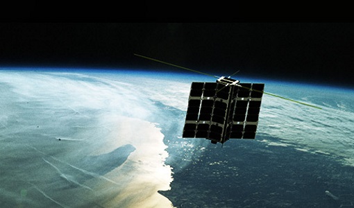
Spire Overview
It currently commercialises its platform on a "Space-as-a-Service" offering with aerospace and defence customers.
Document - Technical Note
Landsat-4-Multispectral-scanner-MSS-subsystem-radiometric-characterization.pdf
Landsat 4: Multispectral scanner (MSS) subsystem radiometric characterization.
Document - Technical Note
Landsat 1-5 MSS Image Assessment System Radiometric Algorithm Description Document
Document - Technical Note
Landsat-MSS-Data-Format-Control-Book-DFCB.pdf
USGS Level 1 product specification, with which the ESA reprocessed MSS products are compliant.