- All Categories (165)
- Data (2)
- News (18)
- Missions (10)
- Events (6)
- Tools (2)
- Activities (4)
- Documents (123)
Mission - Earth Explorers

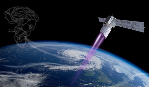
Aeolus
This is currently the only technology that can provide direct wind profile observations in clear air, inside thin clouds
News - General News
Go-to guide to Third Party Mission data offering
Data Access Guide has been published, providing technical details and information on available data collections for all current
Event - Meeting

VH-RODA and CEOS SAR workshop
The workshop provided an open forum for the presentation and discussion of current status and future developments related
News - Success Stories
Aeolus enhances volcanic ash forecasts for aviation safety
Current projects supporting PANGEA include the D-TECT ERC, the PANGEA4CalVal TWINNING and the L2A+, ACPV ESA studies.
Mission - Earth Explorers
Aeolus Data
Aeolus Quality Control Reports on L1B/Instrument, L2A and L2B products are currently available to Aeolus Cal/Val teams and
Mission - Earth Explorers
ALADIN
Aeolus Quality Control Reports on L1B/Instrument, L2A and L2B products are currently available to Aeolus Cal/Val teams and
Activity - Instrument characterisation and algorithm studies

ESA satellites and instruments calibration landing page
Data Outages: Information currently not available online.
Event - Workshop

SEASAR 2012
Aouf 14:00 - 14:20 Towards consistent inversion of wind, waves and surface current from SAR Bertrand Chapron (IFREMER, France
Mission - Heritage Missions
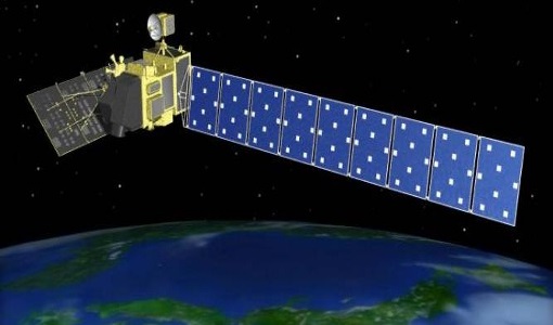
PALSAR
A small percentage of ALOS-1 PALSAR products processed by the current installed ESA IPF are affected by a known quality issue
Mission - Heritage Missions

PALSAR Processor Releases
The current ALOS-1 PALSAR IPF integrated within the ESA On-The-Fly system is v4.16p9, installed on 24 January 2017.
Document - Proceedings

SEASAR-2012-sessions-summaries-seed-questions-recommendations.pdf
This document gathers together the sessions summaries with seed questions discussion and recommendations of the SEASAR 2012 workshop.
Document - Product Document

ALOS-PALSAR-Quality-Disclaimer.pdf
This document provides a quality disclaimer for an ALOS PALSAR IPF failure.
Document - General Reference

The Earth Observation Handbook, 2010 Update - Key Tables
This is the 2010 update of the CEOS Earth Observation Handbook. You can browse the live database at http://database.eohandbook.com/ or download the printable PDF of key tables based on the 2010 database contents for a handy reference.
Document - Product Document
Main-Processor-Improvements-Baseline-16
The document includes the main processor improvements for baseline 16 for the Aeolus mission.
Activity - Quality
SnowPEx
to bring together scientists and institutions working in seasonal snow pack monitoring in order to assess the quality of current
Tools - Visualisation
HEDAVI
ESA’s Heritage EO data currently cover more than 30 years of observations and enable the analysis of spatio-temporal dynamics
Document - Conference Presentation - Poster

3_towards_automated_classification.pdf
Toward automated classification of brightness fronts in RADARSAT-2 images of the ocean surface Christopher Jones (Dalhousie University Halifax, Canada)
Document - Product Document
Aeolus-L2B-2C-Input-Output-DD-ICD.pdf
ADM-Aeolus Level-2B/2C Processor Input/Output Data Definitions Interface Control Document
News - Thematic area articles

Satellite data central to ocean monitoring
microwave monitoring instruments, optical imagers, and infrared radiometers, which can map ocean variables related to ocean currents
