- All Categories (15530)
- Data (2)
- News (31)
- Missions (27)
- Events (29)
- Tools (2)
- Activities (12)
- Documents (15427)
Document - General Reference

WATS - Water Vapour and Temperature in the Troposphere and Stratosphere.pdf
This report describes the WATS mission, one of the candidate Earth Explorers in the second cycle in 2001.
Document - Technical Note

WALES - Water Vapour Lidar Experiment in Space
This report describes the WALES mission, one of the candidate Earth Explorers in the second cycle in 2001.
Document - Software Verification Plan/Report

Verification Report SGP OL v5-0 SCIAMACHY Level 1b to 2 processing
Mission - Earth Watch
Vegetation (VGT) Quality Control Reports
months and provide information about: Absolute and inter-band radiometric accuracy Multi-temporal radiometric accuracy Dark current
Mission - Earth Watch
Vegetation (VGT) Processor Releases
The current processor software version, used for a full reprocessing of the PROBA-V archive and also for the operational
Mission - Earth Watch
Vegetation (VGT) Cal/Val
Greenland (only during June/July): during one week daily acquisitions in uncompressed mode Weekly Calibration acquisition Dark current
Document - Product Cal/Val Plan/Report

Validation Report following the 3rd MERIS data reprocessing
This document prepared by the MERIS Quality Working Group (QWG) corresponds to the Validation Report following the 3rd MERIS data reprocessing. It aims at qualifying and quantifying the accuracy of the MERIS L2 products generated with the version 8.0 of MERIS Ground Segment prototype (MEGS), delivered to the whole community through the ODESA software (http://earth.eo.esa.int/odesa/). It is equivalent to version 6.0 of the Instrument Processing Facilities (IPF) at ESRIN.
Document - Product Cal/Val Plan/Report
VALID Final Report 2008-2010
Report of VALID project: Final Report 2008-2010
Document - Product Cal/Val Plan/Report
VALID Annual Report 2008
Validation of GOMOS version ozone profiles using ground-based lidar observations
Activity - Cal/Val activities

UV nadir viewing galleries
Download chart A new perspective on the current state of the ozone layer derived using the merged total ozone data record
Document - User Guide

User Documentation for (A)ATSR 4th Reprocessing Level 1B Products
This document provides a guide for users of (A)ATSR 4th reprocessing products, giving easily viewed format details, highlighting differences from previous reprocessed products, noting technical features inherent in the products, and giving notification of remaining Open Issues.User Documentation for (A)ATSR 4th Reprocessing Level 1B Products
Document - Technical Note
Update-on-AATSR-Visible-Channel-Long-Term-Trends.pdf
This document contains calibration guidance for the AATSR instrument.
News - Thematic area articles

Transforming space data into climate action
By combining high-quality data from both current and previous missions, scientists are improving their understanding of the
News - Success Stories
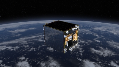
Trailblazing ERS-2 mission enables climate change applications
Varied elevations of Bachu in western China InSAR is currently one of the most accurate methods to generate digital elevation
News - Thematic area articles
Tracking the world’s forests from space
Deforestation in Brazil Scientist’s understanding of the health of the world’s forests is being further improved through current
Document - General Reference
Towards More Efficient Use of Radar-Altimeter Data
Twenty years ago, experimental altimeters on NASA's Skylab and Geos-3 were already demonstrating the potential of such instrumentation. This led in turn to the development and launch by NASA in July 1978 of the Seasat oceanographic satellite mission. Both Geos-3 and Seasat were very successful in their pioneering missions, but were limited somewhat by poor coverage in the case of Geos-3 and an abnormally short mission duration in Seasat's case.
Document - General Reference
Third Party Missions Brochure
This brochure summarises ESA's Third Party Missions programme, providing a timeline and examples of content related to some of the missions.