- All Categories (6)
- Data (2)
- News (3)
- Missions (1)
Data - Sample Data (Open)
Vision-1 sample data
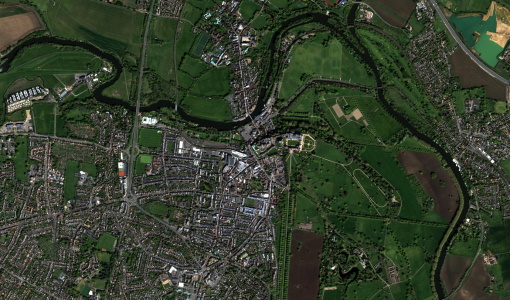
Download free Vision-1 sample datasets to preview products available for this mission.
News - Infographics
An overview of the very high-resolution Vision-1 satellite
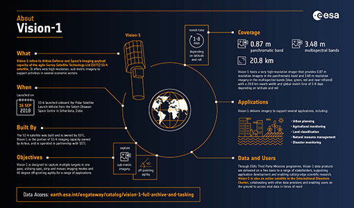
Learn about Vision-1, which joined ESA's Third Party Missions programme in May, in our new infographic.
News - Data Release news
Vision-1 data now open to users
In the framework of the Third Party Missions programme, ESA is offering, for scientific research and application development, access to archive and new tasking data from the Vision-1 mission upon submission and acceptance of a project proposal.
News - Success Stories

Vision-1 to enable cutting-edge science and spur innovation
Vision-1 – which is the result of a collaboration between Airbus Defence and Space and Surrey Satellite Technology Ltd. (SSTL) – provides sub-metric imagery to support activities across many industries, including urban planning, agricultural monitoring, land classification, natural resource management and disaster monitoring.
Data - Project Proposal (Restrained)
Vision-1 full archive and tasking
Vision-1 provides very high resolution optical products, with 87cm resolution in Panchromatic mode and 3.48m in Multispectral Mode. Products are in DIMAP format; the image is in GeoTiff format with 16 bit encoding; the applied geographical projection is WGS84 UTM. Spectral band combination options: Panchromatic (PAN): includes data contained within a single high resolution black and white band, with product pixel size of 0.87m Multispectral (MS4): includes four multispectral (colour) bands: Blue, Green, Red and Near Infrared. The product pixel size is 3.48m Bundle (BUN): provides both the 4-band multispectral, and the panchromatic data from the same acquisition in a single, non-merged product. Data is provided as 16-bit GeoTiffs with pixel sizes of 3.48m and 0.87m for MS and PAN data respectively Pansharpened (PSH): single higher resolution 0.87 colour product obtained by the combination of the visual coloured information of the multispectral data with the details provided in the panchromatic data. Two different geometric processing levels are: Projected (level 2): The product is mapped onto the Earth cartographic system using a standard reference datum and projection system at a constant terrestrial altitude, relative to the reference ellipsoid. By default, the map projection system is WGS84/UTM. The image is georeferenced without the application of a Digital Elevation Model (DEM) and supplied with the RPC model file. Pansharpened are not available as projected product Standard Ortho (level 3): georeferenced image in Earth geometry, including the application of a Airbus World DEM for Ortho and GCPs (using Airbus Intelligence One Atlas BaseMap as reference). The orthorectification procedure eliminates the perspective effect on the ground (excluding buildings) to restore the geometry of a vertical shot. Only the basic radiometric processing is available providing the radiance value. As per ESA policy, very high-resolution imagery of conflict areas cannot be provided.
Mission - Third Party Missions
Vision-1
Launched on 16 September 2018, Vision-1 offers orthorectified products with resolution up to 87 cm in panchromatic mode and 3.48 in multispectral mode as standard.