- All Categories (88)
- Data (26)
- News (23)
- Missions (3)
- Events (24)
- Tools (2)
- Campaigns (2)
- Documents (8)
NEWS
Discover the latest news on the European Space Agency's Earth Observation activities. Learn all about new data availability and how ESA's missions are performing.
News - General News
 8 Apr 2024
ESA's improved Earth system data records: what is in store for the future?
Fundamental Data Records (FDRs) are instrumental in advancing our understanding of Earth systems and for addressing societal challenges effectively. These long-term records contain uncertainty-quantified, calibrated and geo-located multi-instrument/multi-platform satellite sensor data spanning several decades to support climate-related applications.
News - Infographics
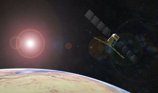
21 Feb 2024Showcasing the NovaSAR-1 radar satellite
Learn about the NovaSAR-1 mission in our new infographic.
News - Data Release news
31 Jan 2024New FLEX-related campaign datasets released
New datasets have been released for three campaigns, covering activities supporting the upcoming FLEX mission.
News - Announcement of Opportunity updates
23 Jan 2024ESA encourages S-band applications with NovaSAR-1 Announcement of Opportunity
ESA is offering possibilities to develop new applications in the S-band microwave frequency range, with a new Announcement of Opportunity for NovaSAR-1 data, via ESA’s Third Party Mission programme.
News - General News
 17 July 2023
SMOS Tools updates
Updates for two SMOS tools have been released, offering new features and improvements.
News - Spotlight on EO community
 4 July 2023
An overview of the SMOS mission
In this video, Klaus Scipal - Biomass and SMOS Mission Manager - talks about ESA's Soil Moisture and Ocean Salinity mission.
News - Success Stories
29 June 2023ESA missions help to reveal worldwide lake water loss trend
Climate change, human consumption and sedimentation are depleting more than half of the world’s biggest lakes of water, according to a ground-breaking analysis that drew on three decades of satellite data.
News - Success Stories
24 May 2023SMOS data reveal ecosystems' resistance to drought
Climate change is rapidly altering the world’s ecosystems, causing extreme weather conditions, such as droughts, to become increasingly frequent. Understanding the factors that contribute to ecosystem resilience to extreme events is vital to develop more effective strategies for climate adaptation and mitigation.
News - Success Stories
8 May 2023PROBA-V data improve surface albedo products in Africa
As ESA’s PROBA-V satellite marks its 10-year launch milestone, data tasked during the mission’s lifetime are still being used to assess changes in land cover.
News - Infographics
4 May 2023Key facts about SMOS Level-1 and Level-2 science data
Learn about data products from the SMOS mission in our latest infographic.
News - Events and Proceedings
21 Apr 2023Scientists to showcase value of Earth observation data at EGU
Remote sensing scientists are getting ready to present innovative and exciting applications of satellite data at the European Geosciences Union general assembly which will take place from 24 to 28 April in Vienna, Austria.
News - Data Release news
11 Apr 2023PROBA-V ‘Collection 2’ - Reprocessed Dataset available
The improved PROBA-V data (Collection 2) has been released. Data is available via the PROBA-V MEP and Terrascope platforms so users can freely exploit the data using Virtual machines, Jupyter Notebooks, and the new viewing application.
News - Thematic area articles
3 Mar 2023Monitoring water on Earth's surface
ESA's Earth observation satellites are playing a leading role in furthering our understanding of how Earth's terrestrial hydrosphere is being influenced by humankind.
News - Success Stories
 17 Jan 2023
Pléiades unlocks information about rock glaciers in central Himalaya
As climate change accelerates the melting of glacial ice, remote sensing scientists are tapping into the potential of Pléiades data to help vulnerable mountainous communities.
News - Events and Proceedings
14 Dec 2022ESA invites scientists to submit abstracts for EGU 2023
ESA is calling for researchers to submit abstracts for sessions at the next General Assembly of the European Geosciences Union (EGU 2023).
News - Thematic area articles
9 Dec 2022Global understanding of Earth's land surfaces greatly boosted by satellite data
ESA perform land surface monitoring with a range of instruments onboard satellites acquiring optical and radar data. Collections of data from these missions are freely available for research purposes.
News - Data Release news
 19 Oct 2022
New Drift4SKIM campaign dataset released
A new dataset has been released for the Drift4SKIM campaign, which took place in 2018 in the Atlantic Ocean.
News - Thematic area articles
 2 Feb 2022
Satellite data boost global understanding of land surface
Understanding our changing land surface is essential in the study of climate change. Satellites are used to monitor changes to the material that covers Earth’s surface, so-called land cover, such as vegetation and water.
News - Events and Proceedings
 25 Oct 2021
Φ-Week Triumphs
In its fourth edition, Φ-Week presented the scientific community with amazing opportunities and projects—thus running alongside innovation at 360 degrees.
News - Success Stories
 22 Dec 2020
Using Satellite Data to Predict Floods and Droughts
Scientists are turning to remote sensing to fill the in-situ data gap in hydrological data models in some parts of the world.