- All Categories (87)
- Data (13)
- News (34)
- Missions (4)
- Events (25)
- Tools (1)
- Activities (2)
- Campaigns (6)
- Documents (2)
NEWS
Discover the latest news on the European Space Agency's Earth Observation activities. Learn all about new data availability and how ESA's missions are performing.
News - General News
 8 Apr 2024
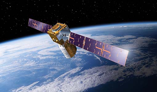
ESA's improved Earth system data records: what is in store for the future?
Fundamental Data Records (FDRs) are instrumental in advancing our understanding of Earth systems and for addressing societal challenges effectively. These long-term records contain uncertainty-quantified, calibrated and geo-located multi-instrument/multi-platform satellite sensor data spanning several decades to support climate-related applications.
News - Data Release news
8 Mar 2024FDR4ALT - ESA unveils new cutting-edge ERS/Envisat Altimeter and Microwave Radiometer Datasets
The European Space Agency (ESA) has developed a comprehensive suite of innovative Earth system data records as part of the Fundamental Data Records for Altimetry project - FDR4ALT.
News - Operational News
 12 Feb 2024
Temporary interruption to Envisat AATSR dissemination service
A planned downtime will affect the access to the ftp dissemination server for the Envisat AATSR data during the period 13-15 February 2024.
News - Events and Proceedings
14 Dec 2023ESA Earth observation event supports quality of New Space data
In the context of a rapidly growing New Space economy, ESA’s traditional position as an Earth Observation (EO) data provider is interchanged with new additional roles, such as customer, partner or enabler, as set out at the VH-RODA workshop.
News - Data Release news
24 Aug 2023Envisat MIPAS data now available on new ESA Dissemination Server
The latest reprocessed Envisat MIPAS Level 1 and Level 2 datasets have now been migrated from simple FTP access to the new Online Dissemination service for ESA Heritage Missions (HM) Atmospheric data.
News - Infographics
5 July 2023Focusing on Envisat MERIS Full Resolution Level-2 data
ESA's Envisat mission continued and expanded upon the legacy of its predecessors, the ERS (European Remote Sensing) satellites. Operating between 2002 and 2012, the satellite's 10 instruments acquired a decade of data for many applications.
News - Infographics
8 June 2023Overview of the Aeolus Level-1B wind product
Learn about the Aeolus Level-1B wind product, which supports applications for the weather, atmospheric processes and climate research, in our latest infographic.
News - Success Stories
23 May 2023Aeolus enhances volcanic ash forecasts for aviation safety
A new study, using wind data from ESA’s Aeolus mission, highlights the importance of using satellite missions like Aeolus to improve volcanic ash forecasting and ensure aviation safety in the future.
News - Events and Proceedings
21 Apr 2023Scientists to showcase value of Earth observation data at EGU
Remote sensing scientists are getting ready to present innovative and exciting applications of satellite data at the European Geosciences Union general assembly which will take place from 24 to 28 April in Vienna, Austria.
News - Operational News
 20 Apr 2023
New Aeolus Processing Baseline 16 now activated
The new Aeolus processing baseline 16 was activated on Tuesday 18 April 2023.
News - Spotlight on EO community
 19 Apr 2023
An overview of the Aeolus mission
In this overview video, ESA's mission manager, Tommaso Parrinello, describes the successes and challenges of this amazing mission, whose impacts will live long beyond its lifetime in space.
News - Operational News
 12 Apr 2023
GOSAT – TANSO-FTS observations unavailability
Due to an inclination control manoeuvre of the JAXA GOSAT-1 satellite, the TANSO-FTS sensor observations have been suspended.
News - Success Stories
4 Apr 2023Envisat data show how volcanoes communicate with each other
Using radar data from ESA’s Envisat mission, scientists have recently proven the elastic interaction between two Hawaiian volcanoes.
News - Infographics
16 Mar 2023Showcasing the atmosphere-studying Odin mission
Learn about the Odin mission in our new infographic.
News - Announcement of Opportunity updates
 14 Mar 2023
Researchers called to explore new applications of SAOCOM data
ESA has invited Earth observation experts to devise and propose innovative applications for data delivered by Argentinian remote sensing constellation SAOCOM.
News - Data Release news
17 Feb 2023TanSat AGCS and CAPI products now available for users
In the framework of Earthnet’s Third Party Missions Programme, ESA is opening a new TanSat collection to users, freely accessible and available worldwide upon submission of a fast registration.
News - Success Stories
7 Feb 2023ESA’s wind mission helps investigate the nature of volcanic plumes
An analysis that drew on wind profiles from ESA’s Aeolus mission has resulted in an unexpected discovery concerning the structure and behaviour of plumes emanating from the eruption of the Raikoke volcano in 2019.
News - Success Stories
 16 Dec 2022
Atmosphere-studying Odin mission enjoys ongoing success
More than two decades after it began operations, the Odin remote sensing satellite is continuing to make strong contributions to high-impact atmospheric science.
News - Success Stories
 24 Nov 2022
Drones join the campaign to validate Aeolus data
In June and September 2022, the Askos component of the Joint Aeolus Tropical Atlantic Campaign (JATAC), organised by ESA and its international partners, was expanded with new ground-based, drone and radiosonde measurements. The main objective of this campaign was to calibrate and validate Aeolus satellite observations.
News - Spotlight on EO community
 22 Sept 2022
Meet a young researcher who studies the behaviour of volcanoes worldwide
Researcher Camila Novoa Lizama, of the University of Leeds, recently analysed how the use of Synthetic Aperture Radar (SAR) imagery over the Puyehue Cordón-Caulle Volcanic Complex, in Chile, acquired by ALOS-1, Envisat and the Copernicus Sentinel-1 satellites, helped her team to better comprehend the temporal and spatial behaviour of ground displacements before, during and after the volcano’s last eruption.