- All Categories (328)
- Data (8)
- News (25)
- Missions (2)
- Events (22)
- Tools (11)
- Activities (4)
- Campaigns (2)
- Documents (254)
News - Events and Proceedings
Workshop celebrates end of long-running PROBA-1 satellite
In January, ESA will mark the end of its long-running CHRIS sensor onboard the PROBA-1 satellite in a special workshop.
Document - Product Cal/Val Plan/Report
Validation Report following the 3rd MERIS data reprocessing
This document prepared by the MERIS Quality Working Group (QWG) corresponds to the Validation Report following the 3rd MERIS data reprocessing. It aims at qualifying and quantifying the accuracy of the MERIS L2 products generated with the version 8.0 of MERIS Ground Segment prototype (MEGS), delivered to the whole community through the ODESA software (http://earth.eo.esa.int/odesa/). It is equivalent to version 6.0 of the Instrument Processing Facilities (IPF) at ESRIN.
News - Thematic area articles
Tracking the world’s forests from space
As human activities continue to threaten the planet’s forests, data delivered by satellites are boosting global efforts to conserve these crucial natural resources.
Document - Proceedings
Topographic mapping from small satellites- a case study of CHRIS-PROBA data
This paper presents a study on the use of various empirical models for satellite orientation and terrain modelling using multidirectional CHRIS data, and evaluates the potential of small satellites with multidirectional viewing capabilities for topographic mapping.
Document - User Guide
Third Party Missions, Cat-1 Data Availability
This brochure gives a quick overview on the availability of the Third Party Missions IRS-P3, JERS-1, NIMBUS, Proba, Landsat, KOMPSAT-1, SCISAT-1, Terra/Aqua, NOAA, QSCAT, OrbView, SPOT-1,-2,-3,-4, ALOS.
Document - General Reference
The PROBA-CHRIS Mission- A Low-Cost Smallsat for Hyperspectral, Multi-Angle, Observation of the ---
Document - General Reference
The Compact High Resolution Imaging Spectrometer (CHRIS)- The Future of Hyperspectral Satellite ---
Document - Campaign Report
SPARC-2004-data-acquisition-report.pdf
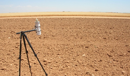
SPARC-2004 campaign objective was to collect a CHRIS/PROBA reference dataset for SPECTRA-related studies.
Campaign
SPARC
ESA's SPectra bARrax Campaign (SPARC) activity was part of the preparatory study for a proposed ESA Earth Explorer mission called SPECTRA. The objective was to collect a CHRIS/PROBA reference dataset for SPECTRA-related studies.
Data - Campaigns (Open)
SPARC
ESA's SPectra bARrax Campaign (SPARC) activity was part of the preparatory study for a proposed ESA Earth Explorer mission called SPECTRA. The objective was to collect a CHRIS/PROBA reference dataset for SPECTRA-related studies.
News - Thematic area articles
Space helps monitor Earth’s changing biosphere
Earth’s biosphere is continually changing. Through its pioneering Earth observation missions, ESA is making critical contributions to monitor these changes and their impacts on Earth’s water and carbon cycles.
News - Thematic area articles
Space data support Earth’s ecosystems
ESA’s Earth observation (EO) missions are making a critical contribution to monitoring transformations in our planet’s ecosystems, helping track changes in the vegetation, soil, and ocean that affect these systems.
Tools - Analysis
SNAP
SNAP is a common architecture for all Sentinel Toolboxes. It is ideal for Earth observation processing and analysis.
Activity - Quality
SEOM CAWA
The Advanced Clouds, Aerosols and WAter vapour products for Sentinel-3/OLCI project aims to develop and improve the advanced atmospheric retrieval algorithms developed for MERIS and OLCI instruments.
Tools - Analysis
Sentinel-3 Toolbox
The Toolbox consists of a set of visualisation, analysis and processing tools for the exploitation of OLCI and SLSTR data.
Campaign
SEN3EXP
The main objective of Sen3Exp (Sentinel-3 Experimental Campaign) was to provide a comprehensive dataset that covers all Sentinel-3 OLCI and SLSTR bands that is to be used for the algorithm prototype and ground segment processor development.
Data - Campaigns (Open)
SEN3EXP
The main objective of Sen3Exp (Sentinel-3 Experimental Campaign) was to provide a comprehensive dataset that covers all Sentinel-3 OLCI and SLSTR bands that is to be used for the algorithm prototype and ground segment processor development.
Document - Product Readme Note
Retrieving-Canopy-Structure-from-Hyperspectral-Multi-Angular-Satellite-Data.pdf
This article was presented at the 5th EARSeL SIG IS workshop Imaging Spectroscopy : Innovation in Environmental Research held on 23-25 April 2007 in Bruges, Belgium, ed. By I. Reusen and J. Cools. EARSEL, 2007. 7 p.
News - Data Release news
Release of Envisat MERIS 4th reprocessing data
The data from the 4th MERIS reprocessing has been released to users and is now freely available from the new ESA Online Dissemination Service for MERIS.


