- All Categories (87)
- Data (2)
- News (11)
- Missions (14)
- Events (6)
- Tools (7)
- Activities (8)
- Campaigns (2)
- Documents (37)
Event - Workshop

Workshop on International Cooperation in Spaceborne Imaging Spectroscopy
The workshop aimed to recommend future international coordination permitting cooperation in the deployment, operation, and exploitation of space-based imaging spectrometers for terrestrial and coastal scientific and operational applications.
Campaign

WISE
The objective of WInd and Salinity Experiment 2001 (WISE 2001) campaign was to get more data points and better wind speed measurements.
Document - Product Cal/Val Plan/Report

Validation Report following the 3rd MERIS data reprocessing
This document prepared by the MERIS Quality Working Group (QWG) corresponds to the Validation Report following the 3rd MERIS data reprocessing. It aims at qualifying and quantifying the accuracy of the MERIS L2 products generated with the version 8.0 of MERIS Ground Segment prototype (MEGS), delivered to the whole community through the ODESA software (http://earth.eo.esa.int/odesa/). It is equivalent to version 6.0 of the Instrument Processing Facilities (IPF) at ESRIN.
Document - Product Cal/Val Plan/Report
Validation of GOMOS version ozone profiles
Validation of GOMOS version ozone profiles using ground-based lidar observations
Event - Workshop
URBIS24
URBan Insights from Space (URBIS24) Workshop will offer an insightful exploration of urban challenges and innovative EO-integrated solutions.
News - Data Release news

Updated Precise Orbit data (POD) for the full ERS-1 and ERS-2 mission available
The Precise Orbit files (ERS.ORB.POD) for the entire ERS-1 and ERS-2 mission periods have been reprocessed with up-to-date standards.
Mission - Third Party Missions
TanSat
The TanSat mission is one of the Earth Observation projects managed by the Ministry of Science and Technology of China and is dedicated to detecting and monitoring carbon dioxide in the atmosphere.
News - Success Stories

Spotlight on sea-level rise
Scientists to share findings on how satellite has revealed changes in the height of the sea, ice, inland bodies of water and more.
Tools - Processing
SMOS Toolbox
SMOS Toolbox for SNAP (SMOS-Box) supports those using data acquired by ESA’s Soil Moisture and Ocean Salinity (SMOS) mission.
News - Data Release news

SMOS L2 Sea Surface Salinity products documentation updates
SMOS L2 Sea Surface Salinity product validation report is now available.
Tools - Analysis

SMOS Comparison Tool
SMOS Comparison Tool (SCoT) software can be used to produce comparison plots, statistics and histograms between two SMOS products of the same type.
Mission - Earth Explorers

SMOS
The Soil Moisture and Ocean Salinity (SMOS) mission is dedicated to making global observations of soil moisture over land and salinity over oceans.
Document - User Guide

SHARP-Level-2-User-Guide.pdf
This document provides the user with detailed description of data treatment performed during NOAA SHARP Level-2 generation and explanation and examples of how to read SHARP Level-2 data and extract information.
Activity - Quality
SEOM CAWA
The Advanced Clouds, Aerosols and WAter vapour products for Sentinel-3/OLCI project aims to develop and improve the advanced atmospheric retrieval algorithms developed for MERIS and OLCI instruments.
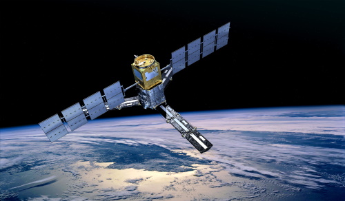
Mission - Third Party Missions
SCISAT-1
SCISAT-1 is designed to make observations of Earth's atmosphere and its main instruments are an optical Fourier transform infrared spectrometer and an ultraviolet spectrophotometer.
Tools - Processing

SciaL1C Command-line Tool
The SCIAMACHY Calibration and Extraction Tool (SciaL1c) is an application to process SCIAMACHY Level 1b products. It allows you to select specific calibrations to apply to Level 1b data.
Document - Product Readme Note

Retrievals-for-the-Atmospheric-Chemistry-Experiment-Fourier-Transform-Spectrometer.pdf
This paper describes the approach developed for the retrieval of atmospheric temperature and pressure from the troposphere to the lower thermosphere as well as the strategy for retrievals of volume-mixing ratio profiles of atmospheric species.
News - Data Release news

Release of new GOSAT FTS L1 products
New release of GOSAT FTS L1 products v220.220 - GOSAT data can be retrieved from the dissemination server at ftp://gosat-ds.eo.esa.int
Activity - Instrument characterisation and algorithm studies
QA4EO-RUT
The ‘RUT' tool project has the overall objective is to define a generic software implementable methodology for assessing the radiometric uncertainty per pixel of the TOA radiance/reflectance products.
Activity - Instrument characterisation and algorithm studies
QA4EO-ATLAS
A pulsed Tuneable Laser system for the characterisation of Spectrometers