- All Categories (24756)
- Data (74)
- News (100)
- Missions (29)
- Events (41)
- Tools (13)
- Activities (14)
- Campaigns (9)
- Documents (24476)
Data - Fast Registration with approval (Restrained)
EarthCARE ESA L2 Products for Cal/Val Users
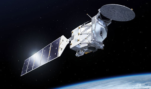
This EarthCARE collection is restrained, and contains the following data products: Level 2a: Single-Instrument Geophysical Products These products are derived from individual instrument data onboard EarthCARE. They provide detailed geophysical parameters and properties specific to each instrument's capabilities for example cloud and aerosol properties derived solely from radar or lidar measurements, offering high-resolution insights into atmospheric phenomena. Level 2b: Synergistic Geophysical Products Synergistic Geophysical Products Level 2b products leverage data from multiple EarthCARE instruments to generate comprehensive, synergistic geophysical datasets. By combining measurements from instruments like radar, lidar, and radiometers, these products offer a more integrated view of cloud-aerosol interactions and atmospheric dynamics. Synergistic products provide enhanced accuracy and depth compared to single-instrument outputs, enabling detailed studies of complex atmospheric processes.
Data - Fast Registration with approval (Restrained)
EarthCARE JAXA L2 Products for Cal/Val Users
This EarthCARE collection is restrained, and contains the following data products: Level 2a: Single-Instrument Geophysical Products These products are derived from individual instrument data onboard EarthCARE. They provide detailed geophysical parameters and properties specific to each instrument's capabilities for example cloud and aerosol properties derived solely from radar or lidar measurements, offering high-resolution insights into atmospheric phenomena. Level 2b: Synergistic Geophysical Products Level 2b products leverage data from multiple EarthCARE instruments to generate comprehensive, synergistic geophysical datasets. By combining measurements from instruments like radar, lidar, and radiometers, these products offer a more integrated view of cloud-aerosol interactions and atmospheric dynamics. Synergistic products provide enhanced accuracy and depth compared to single-instrument outputs, enabling detailed studies of complex atmospheric processes.
Data - Fast Registration with approval (Restrained)
EarthCARE ESA L2 Products for the Commissioning Team
This EarthCARE collection contains the following data products: Level 2a: Single-Instrument Geophysical Products These products are derived from individual instrument data onboard EarthCARE. They provide detailed geophysical parameters and properties specific to each instrument's capabilities for example cloud and aerosol properties derived solely from radar or lidar measurements, offering high-resolution insights into atmospheric phenomena. Level 2b: Synergistic Geophysical Products Level 2b products leverage data from multiple EarthCARE instruments to generate comprehensive, synergistic geophysical datasets. By combining measurements from instruments like radar, lidar, and radiometers, these products offer a more integrated view of cloud-aerosol interactions and atmospheric dynamics. Synergistic products provide enhanced accuracy and depth compared to single-instrument outputs, enabling detailed studies of complex atmospheric processes.
Data - Fast Registration with approval (Restrained)
EarthCARE L0 and L1 Products for the Commissioning Team
This EarthCARE collection for the Commissioning Team contains the following data products: Level 0: Annotated Raw Instrument Source Packets These packets contain unprocessed data as generated by EarthCARE's instruments, annotated with basic metadata in front of each packet Level 1b: Fully Calibrated and Geolocated Instrument Measurements Level 1b products are fully processed, calibrated, and geolocated measurements from EarthCARE's instruments. Each measurement is aligned with the native instrument grid. For the Broadband Radiometer (BBR), measurements are also spatially integrated to various ground pixel sizes. Level 1C (MSI only): MSI Level 1b Data Interpolated to a Common Spatial Grid Specifically for the Multi-Spectral Imager (MSI), Level 1c data involves interpolating Level 1b measurements onto a standardised spatial grid that is consistent across all MSI bands. This grid closely matches the spacing used in MSI Level 1b data. Level 1D: Joint Standard Grid (JSG) for all Instruments and ECMWF Meteorological Fields Level 1d data provide a spatial grid to enable easy collocation and synergistic use of the data from all EarthCARE instruments, named the "joint standard grid." Additionally, this level incorporates ECMWF (European Centre for Medium-Range Weather Forecasts) meteorological fields limited to the EarthCARE swath, enabling comprehensive analysis and modelling of atmospheric conditions within the satellite's coverage area.
Data - Fast Registration with approval (Restrained)
EarthCARE L1 Products for Cal/Val Users
This EarthCARE collection is restrained, and contains the following data products: Level 1B: Fully Calibrated and Geolocated Instrument Science Measurements Level 1b data represents the fully processed, calibrated, and geolocated measurements from EarthCARE's instruments. Each measurement is aligned with the native instrument grid. For the Broadband Radiometer (BBR), measurements are also spatially integrated to various ground pixel sizes. Level 1C (MSI only): MSI Level 1b Data Interpolated to a Common Spatial Grid Specifically for the Multi-Spectral Imager (MSI), Level 1c data involves interpolating Level 1b measurements onto a standardised spatial grid that is consistent across all MSI bands. This grid closely matches the spacing used in MSI Level 1b data. Level 1D: Joint Standard Grid (JSG) for all instruments with ECMWF Meteorological Fields. Level 1d data provides a spatial grid to enable easy collocation and synergistic use of the data from all EarthCARE instruments, named the "joint standard grid." Additionally, this level incorporates ECMWF (European Centre for Medium-Range Weather Forecasts) meteorological fields limited to the EarthCARE swath, enabling comprehensive analysis and modelling of atmospheric conditions within the satellite's coverage area.
Data - Fast Registration with approval (Restrained)
EarthCARE JAXA L2 Products for the Commissioning Team
This EarthCARE collection contains the following data products: Level 2a: Single-Instrument Geophysical Products These products are derived from individual instrument data onboard EarthCARE. They provide detailed geophysical parameters and properties specific to each instrument's capabilities for example cloud and aerosol properties derived solely from radar or lidar measurements, offering high-resolution insights into atmospheric phenomena. Level 2b: Synergistic Geophysical Products Level 2b products leverage data from multiple EarthCARE instruments to generate comprehensive, synergistic geophysical datasets. By combining measurements from instruments like radar, lidar, and radiometers, these products offer a more integrated view of cloud-aerosol interactions and atmospheric dynamics. Synergistic products provide enhanced accuracy and depth compared to single-instrument outputs, enabling detailed studies of complex atmospheric processes.
Data - EO Sign In Authentication (Open)
EarthCARE ESA L2 Products
This EarthCARE collection contains the following data products: Level 2a: Single-Instrument Geophysical Products These products are derived from individual instrument data onboard EarthCARE. They provide detailed geophysical parameters and properties specific to each instrument's capabilities for example cloud and aerosol properties derived solely from radar or lidar measurements, offering high-resolution insights into atmospheric phenomena. Level 2b: Synergistic Geophysical Products Level 2b products leverage data from multiple EarthCARE instruments to generate comprehensive, synergistic geophysical datasets. By combining measurements from instruments like radar, lidar, and radiometers, these products offer a more integrated view of cloud-aerosol interactions and atmospheric dynamics. Synergistic products provide enhanced accuracy and depth compared to single-instrument outputs, enabling detailed studies of complex atmospheric processes.
Data - EO Sign In Authentication (Open)
EarthCARE L1 Products
This EarthCARE collection contains the following data products: Level 1b: Fully Calibrated and Geolocated Instrument Science Measurements Level 1b data represents the fully processed, calibrated, and geolocated measurements from EarthCARE's instruments. Each measurement is aligned with the native instrument grid. For the Broadband Radiometer (BBR), measurements are also spatially integrated to various ground pixel sizes. Level 1c (MSI only): MSI Level 1b Data Interpolated to a Common Spatial Grid Specifically for the Multi-Spectral Imager (MSI), Level 1c data involves interpolating Level 1b measurements onto a standardised spatial grid that is consistent across all MSI bands. This grid closely matches the spacing used in MSI Level 1b data. Level 1d: Joint Standard Grid (JSG) for all instruments with ECMWF Meteorological Fields. Level 1d data provides a spatial grid to enable easy collocation and synergistic use of the data from all EarthCARE instruments, named the "joint standard grid." Additionally, this level incorporates ECMWF (European Centre for Medium-Range Weather Forecasts) meteorological fields limited to the EarthCARE swath, enabling comprehensive analysis and modelling of atmospheric conditions within the satellite's coverage area. CPR level 1b: C-NOM products is generated and provided by JAXA. This product is used as input, in combination with the X-MET aux file, for different processors in the EarthCARE production chain. AUX_MET_1D: meteorological analysis and forecast fields X-MET provided by ECMWF. This product is used as input, in combination with the C-NOM product, for different processors in the EarthCARE production chain.
Data - Fast Registration with approval (Restrained)
EarthCARE Auxiliary Data for Cal/Val Users
EarthCARE data products encompass essential supporting auxiliary (AUX) and orbit data critical for accurate sensor data processing and analysis. AUX data includes datasets used outside the primary Space Segment stream to apply corrections to sensor data. This comprises previously derived calibration parameters, ground control data, and digital elevation data. Calibration parameters ensure measurement accuracy, while ground control data aids in data validation, and digital elevation data enables precise geolocation. Orbit data consists of on-board satellite data and orbital information. For EarthCARE, this includes Reconstructed Orbit and Attitude Files, which provide detailed satellite positioning and orientation information. The integration of AUX and orbit data into EarthCARE's data processing workflow ensures the production of high-quality, scientifically valuable datasets for atmospheric research, climate modelling, and environmental monitoring.
Data - EO Sign In Authentication (Open)
EarthCARE Orbit Data
EarthCARE data products encompass essential supporting auxiliary (AUX) and orbit data critical for accurate sensor data processing and analysis. Orbit data consists of on-board satellite data and orbital information predicted or determined by the Flight Operations Segment (FOS). For EarthCARE, this includes Reconstructed Orbit and Attitude Files, which provide detailed satellite positioning and orientation information. The integration of AUX and orbit data into EarthCARE's data processing workflow ensures the production of high-quality, scientifically valuable datasets for atmospheric research, climate modelling, and environmental monitoring.
Data - EO Sign In Authentication (Open)
EarthCARE JAXA L2 Products
This EarthCARE collection contains the following data products: Level 2a: Single-Instrument Geophysical Products These products are derived from individual instrument data onboard EarthCARE. They provide detailed geophysical parameters and properties specific to each instrument's capabilities for example cloud and aerosol properties derived solely from radar or lidar measurements, offering high-resolution insights into atmospheric phenomena. Level 2b: Synergistic Geophysical Products Level 2b products leverage data from multiple EarthCARE instruments to generate comprehensive, synergistic geophysical datasets. By combining measurements from instruments like radar, lidar, and radiometers, these products offer a more integrated view of cloud-aerosol interactions and atmospheric dynamics. Synergistic products provide enhanced accuracy and depth compared to single-instrument outputs, enabling detailed studies of complex atmospheric processes.
News - Operational News
GOSAT-2 FTS-2 observations suspended from 10 to 31 May 2024
Due to an upcoming inclination control manoeuvre to be conducted by JAXA on the GOSAT-2 satellite, the FTS-2 sensor observations will be suspended from Friday 10 May to Friday 31 May 2024.
News - General News
ESA's improved Earth system data records: what is in store for the future?
Fundamental Data Records (FDRs) are instrumental in advancing our understanding of Earth systems and for addressing societal challenges effectively. These long-term records contain uncertainty-quantified, calibrated and geo-located multi-instrument/multi-platform satellite sensor data spanning several decades to support climate-related applications.
News - Operational News
Transition from FTP to FTPS for SMOS, Aeolus and Campaign data dissemination systems
As of 15 April 2024 access to the SMOS, Aeolus and Campaign data will be changed from simple FTP to FTPS.
News - Operational News
SMOS data distribution resumed
SMOS data distribution to end users was resumed on 12 March 2024 after confirmation of the adequate quality of the current data.
Document - Newsletter
Earth Online Newsletter - 08 March 2024
This issue of the Earth Online Newsletter covers a selection of the latest news and events from ESA.
News - Data Release news
FDR4ALT - ESA unveils new cutting-edge ERS/Envisat Altimeter and Microwave Radiometer Datasets
The European Space Agency (ESA) has developed a comprehensive suite of innovative Earth system data records as part of the Fundamental Data Records for Altimetry project - FDR4ALT.
Data - EO Sign In Authentication (Open)
Sea Ice Thematic Data Product [ALT_TDP_SI]
This is the Sea Ice Thematic Data Product (TDP) V1 resulting from the ESA FDR4ALT project and containing the sea ice related geophysical parameters, along with associated uncertainties: snow depth, radar and sea-ice freeboard, sea ice thickness and concentration. The collection covers data for the ERS-1, ERS-2 and Envisat missions, and bases on Level 1 data coming from previous reprocessing (ERS REAPER and the Envisat V3.0) but taking into account the improvements made at Level 0/Level 1 in the frame of FDR4ALT (ALT FDR). The Sea Ice TDP provides data from the northern or southern hemisphere in two files corresponding to the Arctic and Antarctic regions respectively for the winter periods only, i.e., October to June for the Arctic, and May to November for the Antarctic. For many aspects, the Sea Ice TDP is very innovative: First time series of sea-ice thickness estimates for ERS Homogeneous calibration, allowing the first Arctic radar freeboard time series from ERS-1 (1991) to CryoSat-2 (2021) Uncertainties estimated along-track with a bottom-up approach based on dominant sources ERS pulse blurring error corrected using literature procedure [Peacock, 2004] The FDR4ALT products are available in NetCDF format. Free standard tools for reading NetCDF data can be used. Information for expert altimetry users is also available in a dedicated NetCDF group within the products. Please consult the FDR4ALT Product User Guide before using the data. The FDR4ALT datasets represent the new reference data for the ERS/Envisat altimetry missions, superseding any previous mission data. Users are strongly encouraged to make use of these datasets for optimal results.
Data - EO Sign In Authentication (Open)
Ocean and Coastal Topography Thematic Data Product [ALT_TDP_OC]
This is the Ocean and Coastal Topography Thematic Data Product (TDP) V1 resulting from the ESA FDR4ALT project and containing improved sea surface height anomaly data records both at 1 Hz and 20 Hz resolution to address climate and/or coastal areas studies. The collection covers data for the ERS-1, ERS-2 and Envisat missions. Note that a dedicated processing to coastal zones has been applied for coastal distances below 200 km. Compared to existing datasets, the Ocean and Coastal Topography TDP demonstrates notable improvements in several aspects: Up-to-date orbit and geophysical corrections applied Adaptive retracker for Envisat The FDR4ALT products are available in NetCDF format. Free standard tools for reading NetCDF data can be used. Information for expert altimetry users is also available in a dedicated NetCDF group within the products. Please consult the FDR4ALT Product User Guide before using the data. The FDR4ALT datasets represent the new reference data for the ERS/Envisat altimetry missions, superseding any previous mission data. Users are strongly encouraged to make use of these datasets for optimal results.
Data - EO Sign In Authentication (Open)
Ocean Waves Thematic Data Product [ALT_TDP_WA]
This is the Ocean Waves Thematic Data Product (TDP) V1 resulting from the ESA FDR4ALT project and containing Significant Wave Height estimates for the ERS-1, ERS-2 and Envisat missions. Compared to existing datasets, the Ocean Waves TDP demonstrates notable improvements in several aspects: Great improvements for Envisat due to noise reduction from Adaptive retracker and High-Frequency Adjustment (HFA) All variables are given at 5 Hz The FDR4ALT products are available in NetCDF format. Free standard tools for reading NetCDF data can be used. Information for expert altimetry users is also available in a dedicated NetCDF group within the products. Please consult the FDR4ALT Product User Guide before using the data. The FDR4ALT datasets represent the new reference data for the ERS/Envisat altimetry missions, superseding any previous mission data. Users are strongly encouraged to make use of these datasets for optimal results.
