- All Categories (516)
- Data (7)
- News (10)
- Missions (6)
- Events (2)
- Tools (7)
- Activities (6)
- Documents (478)
Document - Publication - Paper
Uniqueness of the ERS Scatterometer for nowcasting and typhoon forecasting
Paper presented to IGARSS-2005: Uniqueness of the ERS Scatterometer for nowcasting and typhoon forecasting
News - Thematic area articles
Transforming space data into climate action
ESA’s Earth observation activities are playing a key role in the revitalised global drive to combat climate change.
Document - Publication - Paper
Tracking of tropical cyclones with the ERS Scatterometer
Presented at IGARSS 1999: Tracking of tropical cyclones with the ERS Scatterometer
Activity - Projects
TOLEOS
The TOLEOS (Thermosphere Observations from Low-Earth Orbiting Satellites) project will produce thermosphere mass density observations from the accelerometer measurements of the GRACE, GRACE-FO, and CHAMP satellites.
Document - Publication - Paper
THE ERS-2 SCATTEROMETER- INSTRUMENT AND DATA PERFORMANCES ASSESSMENT SINCE THE BEGINNING OF THE MISSION
Scatterometer performances presented to ERS-ENVISAT Symposium Montreux 2007 (paper): ERS-2 Scatterometer - Instrument and data performances assessment since the beginning of the mission
Document - Publication - Paper
The Advanced Scatterometer Processing System for ERS Data- Thirteen Years of Ocean Winds from Space
Tools - Other
Swarm-Aurora
Swarm-Aurora, a web-based tool, was designed to facilitate and drive the use of Swarm in-situ measurements in auroral science.
News - Announcement of Opportunity updates
Swarm DISC Deadline Extension
Swarm DISC Invitation to Tender deadline extension for SD-ITT-4.4: Swarm for Space Weather
Mission - Earth Explorers
Swarm
Swarm is dedicated to creating a highly detailed survey of Earth’s geomagnetic field and its temporal evolution as well as the electric field in the atmosphere using a constellation of three identical satellites.
Document - Publication - Paper
Stability of Amazon Backscatter at C-band- ERS1-2 and RADARSAT-1
Stability of Amazon Backscatter at C-band: Spaceborne Results from ERS-1/2 and RADARSAT-1
Mission - Heritage Missions
SPOT 5
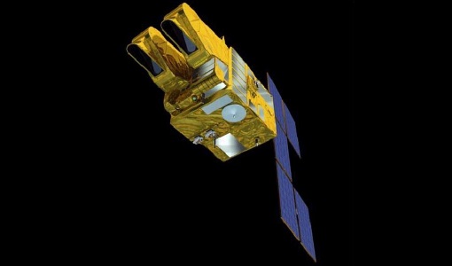
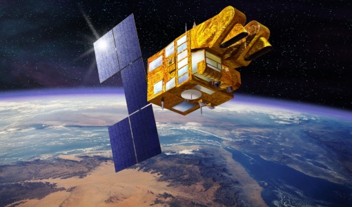
SPOT 5, like all the SPOT missions, was aimed at supplying high-resolution, wide-area optical imagery.
News - Data Release news
SPOT 4-5 Take 5 ESA archive online dataset
ESA is pleased to announce the availability of SPOT 4-5 Take 5 products to the scientific community.
Data - Fast Registration with approval (Restrained)
SPOT 1-5 ESA archive
The ESA SPOT 1-5 collection is a dataset of SPOT 1 to 5 Panchromatic and Multispectral products that ESA collected over the years. The HRV(IR) sensor onboard SPOT 1-4 provides data at 10 m spatial resolution Panchromatic mode (-1 band) and 20 m (Multispectral mode -3 or 4 bands). The HRG sensor on board of SPOT-5 provides spatial resolution of the imagery to < 3 m in the panchromatic band and to 10 m in the multispectral mode (3 bands). The SWIR band imagery remains at 20 m. The dataset mainly focuses on European and African sites but some American, Asian and Greenland areas are also covered. Spatial coverage: Check the spatial coverage of the collection on a map available on the Third Party Missions Dissemination Service. The SPOT Collection
Mission - Heritage Missions
SPOT
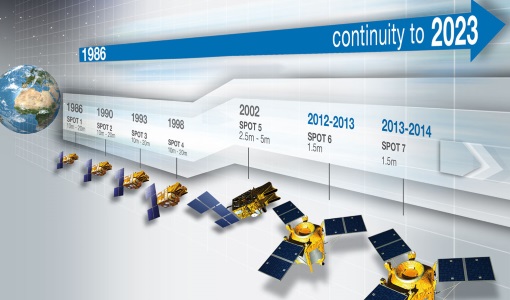
The SPOT (from French "Satellite pour l'Observation de la Terre") series of missions has been supplying high-resolution, wide-area optical imagery since 1986.
Tools - Analysis
SNAP
SNAP is a common architecture for all Sentinel Toolboxes. It is ideal for Earth observation processing and analysis.
Tools - Analysis
Sentinel-1 Toolbox
The Toolbox consists of: processing tools, data product readers and writers and a display and analysis application to support the archive of SAR data from ESA and 3rd party missions.
Activity - Quality
SCIRoCCo
The SCIRoCCo project is an interdisciplinary cooperation of scatterometry experts aimed at promoting the continuing exploitation of ESA's unique 20 years' worth of ERS Scatterometer data.
Document - General Reference
SCI-GLS-14-0001-v01-Scatterometry-Glossary-1.2.pdf
The Scatterometry Glossary defines the commonly agreed terminology to use in all the documents generated by the SCIRoCCo Consortium.


