- All Categories (487)
- Data (2)
- News (2)
- Missions (3)
- Events (1)
- Tools (2)
- Campaigns (1)
- Documents (476)
Data - Announcement of Opportunity (Restrained)
Announcement of Opportunity for S3VT (Sentinel-3 Validation Team)
In the framework of a Copernicus collaborative agreement ESA and EUMETSAT invite interested groups and individuals to support the Sentinel-3 Validation Team (S3VT).
News - Success Stories
How Envisat helped to shape global understanding of Earth’s systems
Twenty years have passed since a ground-breaking European spacecraft designed to deliver unprecedented insight into the planet’s changing environment was lofted into orbit.
Tools - Apps
Heritage Missions app for Android
Download the Heritage Missions application to discover what the missions were about, how it worked and what the elements of the space and ground segment that make these missions unique.
Document - General Reference
GOCE-Facts-and-Figures.pdf
This fact sheet gives a quick and complete overview of the GOCEmission.
Document - Proceedings
2nd-International-GOCE-User-Workshop.pdf
This document describes the proceedings of the 2nd International GOCE User workshop held at the ESA-ESRIN Site, Frascati, Italy, 8-10 March 2004.
Mission - Earth Explorers
Swarm
Swarm is dedicated to creating a highly detailed survey of Earth’s geomagnetic field and its temporal evolution as well as the electric field in the atmosphere using a constellation of three identical satellites.
Mission - Earth Explorers
GOCE
ESA's Gravity field and Ocean Circulation Explorer (GOCE) mission mapped Earth's geoid very accurately, opening a window into Earth's interior structure as well as the currents circulating within the depths of its oceans.
Mission - Heritage Missions
ERS
The ERS programme was composed of two missions, ERS-1 and ERS-2, which together observed the Earth for 20 years, from 1991 to 2011.
Data - Campaigns (Open)
AfriScat
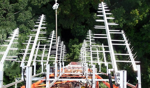
AfriScat campaign, a follow on to TropiSCAT campaign, was to acquire long-term P-Band radar data in an African tropical forest.
Tools - Other
Swarm-Aurora
Swarm-Aurora, a web-based tool, was designed to facilitate and drive the use of Swarm in-situ measurements in auroral science.
Campaign
AfriScat
AfriScat campaign, a follow on to TropiSCAT campaign, was to acquire long-term P-Band radar data in an African tropical forest.
News - Success Stories
ESA's Earth Explorers surpassing expectations
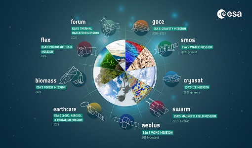
In this video, learn how each Earth Explorer mission is contributing to Earth science, and changing the way we look at our beloved planet.
Event - Workshop
Fringe 2007 Workshop
Fringe 2007 was the third International Workshop on Envisat ASAR interferometry and fifth International Workshop on ERS SAR Interferometry.
Document - General Reference
A-Jewel-in-ESAs-Crown-GOCE-and-its-Gravity-Measurement-Systems.pdf
This article is extracted from ESA Bulletin Nr. 133
Document - Software Verification Plan/Report
An-assessment-of-ERS-SAR-Low-Resolution-Imagery.pdf
The objective of this technical note is to describe and to analyse the various concepts associated with the ERS SAR low resolution imagery. This study is done in order to evaluate a range of products, to consider the trade-offs involved in product specification and to propose some recommendations fro low resolution imagery of quality suitable for a broad range of potential applications.
Document - Software Verification Plan/Report
An-investigation-of-the-error-characteristics-of-the-GOCE-geoid-models.pdf
This report presents an initial investigation into the error characteristics of the GOCE gravity field models as they are realised in the calculated geoid anomalies.
Document - Software Verification Plan/Report
GUT-Tutorial.pdf
The objective of the GUT tutorial, together with the GUT Algorithm Description and User Guide (RD3), is to assist you in getting acquainted with the GOCE User Toolbox, whose objective is to help you take major benefit from the GOCE data for your own application.
Document - Technical Note
GOCE-Preparation-of-the-GOCE-Level-1-to-Level-2-Data-Processing-Final-Report.pdf
The objective of the work in this contract is the design of theoverall architecture of the GOCE level 1 to 2 data processing system with special emphasis on the detailed identification and definition of all interfaces. Furthermore, the work will also coverthe detailed definition of the Level 2 products which are adequate to meet the requirements for further added value products (i.e.Level 3 and beyond).
Document - Technical Note
GOCE-Preparation-of-the-GOCE-Level-1-to-Level-2-Data-Processing-Executive-Summary.pdf
The objective of this document is the design of the overall architecture of the GOCE level 1 to 2 data processing system with special emphasis on the detailed identification and definition of all interfaces. Furthermore, the work covers also the detailed definition of the Level 2 products which are adequate to meet the requirements for further added value products (i.e. Level 3 and beyond).
Document - Technical Note
GOCE-Ground-Segment-Concept-and-Architecture.pdf
This document describes the GOCE Ground Segment covering missionobjectives and overview, ground segment assumptions andconstraints, ground segment architecture and functions, missionplanning, data processing, scientific data distribution,calibration and maintenance, time correlation, orbit and attitudecontrol, data circulation, ground segment validation, testing,operations and implementation.


