- All Categories (25)
- News (10)
- Events (7)
- Tools (3)
- Activities (1)
- Campaigns (1)
- Documents (3)
News - Operational News

SMOS Winds Product data gap recovery
From 28 January 2024 to 9 February 2024, several Level 1 products used as an input to the SMOS winds processor were flagged with a warning.
News - Thematic area articles
Space data support Earth’s ecosystems
ESA’s Earth observation (EO) missions are making a critical contribution to monitoring transformations in our planet’s ecosystems, helping track changes in the vegetation, soil, and ocean that affect these systems.
News - Events and Proceedings
Scientists to showcase value of Earth observation data at EGU
Remote sensing scientists are getting ready to present innovative and exciting applications of satellite data at the European Geosciences Union general assembly which will take place from 24 to 28 April in Vienna, Austria.
News - General News

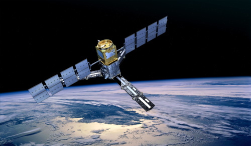
Overachieving SMOS mission primed for continued success
ESA’s Soil Moisture and Ocean Salinity mission (SMOS) was the second Earth Explorer launched in 2009. Over 13 years on, having already vastly exceeded its predicted lifetime and initial objectives, the mission has been further extended until at least the end of 2025.
News - Thematic area articles
Remote sensing data underpin research on soil
Environmental data disseminated by ESA’s Earth observation programmes provide knowledge about the stresses on Earth’s soils – aiding many applications such as crop management, drought and flood forecasting, and ecosystem protection.
News - General News
Pioneering science missions: Summarising ESA’s Earth Explorers
Designed for research purposes, ESA's Earth Explorer missions are dedicated to monitoring parts of Earth’s system. Learn more about the Earth Explorers in this video.
News - Thematic area articles
Satellites expand research on Space Weather and Sun-Earth Interactions
Earth observation data provide vital warnings about the impact of solar activity and strive to unravel the influence the Sun has on Earth’s system.
News - Thematic area articles
Global understanding of Earth's land surfaces greatly boosted by satellite data
ESA perform land surface monitoring with a range of instruments onboard satellites acquiring optical and radar data. Collections of data from these missions are freely available for research purposes.
Event - Training

EO Summer School 5
ESA's series of summer schools, on Monitoring of the Earth System, aims to promote the exploitation of Earth observation data.
News - Thematic area articles

Satellite data boost global understanding of land surface
Understanding our changing land surface is essential in the study of climate change. Satellites are used to monitor changes to the material that covers Earth’s surface, so-called land cover, such as vegetation and water.
Event - Conference

EGU General Assembly 2019
The annual European Geoscience Union (EGU) General Assembly brings together geoscientists from all over the world to one meeting to cover all disciplines of the Earth, planetary, and space sciences.
Event - Workshop

Space and the Arctic 2009 Workshop
Temperatures in the Arctic are rising at an unprecedented rate. This workshop looked at the needs and challenges of working and living in the rapidly changing Arctic and explore how space-based services might help to meet those needs.
Activity - General activities

EO Science for Society
ESA's Earth Observation Science for Society programme aims to promote scientific exploitation of satellite data, forges new scientific discoveries and pioneers new services, stimulating downstream industrial and economic growth.
Campaign
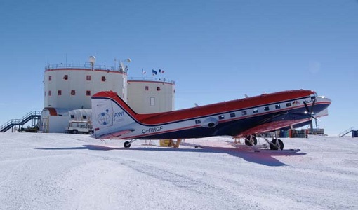
DOMECair (GOCE)
The airborne survey DOMECair 2013 and its instrumentation was designed to obtain calibration and validation data for two different satellite missions of ESA’s Earth Explorer mission, for satellites SMOS and GOCE.
Tools - Analysis

RWAPI
The Read-Write Application Programming Interface tool can be used to read, extract and write information from any kind of SMOS Level 1 or Level 2 soil moisture and sea surface salinity data products in Matlab.
Tools - Processing
SMOS Toolbox
SMOS Toolbox for SNAP (SMOS-Box) supports those using data acquired by ESA’s Soil Moisture and Ocean Salinity (SMOS) mission.
Event - Meeting

World Ocean Circulation User Consultation Meeting 2019
The World Ocean Circulation User Consultation Meeting took place in 2019 with the aim to prepare a roadmap for new initiatives on ocean circulation research and applications.
Event - Conference

Living Planet Symposium 2019
ESA's Living Planet Symposia are amongst the biggest Earth observation conferences in the world. Scientists present their latest findings on Earth's environment and climate.
Tools - Analysis
SMOS Comparison Tool
SMOS Comparison Tool (SCoT) software can be used to produce comparison plots, statistics and histograms between two SMOS products of the same type.
News - Success Stories

ESA's Earth Explorers surpassing expectations
In this video, learn how each Earth Explorer mission is contributing to Earth science, and changing the way we look at our beloved planet.