- All Categories (24758)
- Data (29)
- News (83)
- Missions (8)
- Events (11)
- Tools (10)
- Activities (3)
- Campaigns (10)
- Documents (24604)
Event - Workshop

Workshop on International Cooperation in Spaceborne Imaging Spectroscopy
The workshop aimed to recommend future international coordination permitting cooperation in the deployment, operation, and exploitation of space-based imaging spectrometers for terrestrial and coastal scientific and operational applications.
News - Infographics

What is CRYO2ICE?
Learn about CRYO2ICE, an innovative campaign producing near simultaneous acquisitions over Antarctica from the CryoSat and ICESAT-2 missions, in this new infographic.
Tools - Analysis
VtCryoSat
VtCryoSat is a tool for easily browsing and downloading CryoSat products through an interactive and graphical web interface.
News - Data Release news

Updated CryoSat magnetometer data now available with new baseline 0201
An improved version of the CryoSat magnetic field data is now available on the Swarm Dissemination Server with new baseline 0201.
News - Data Release news

Updated CryoSat magnetometer data now available
An improved version of the CryoSat magnetic field data (version 0102) is now available in the "#CryoSat-2" folder of the ESA FTP server.
News - Thematic area articles

Transforming space data into climate action
ESA’s Earth observation activities are playing a key role in the revitalised global drive to combat climate change.
Document - General Reference

The first of ESA's first Opportunity Missions- CryoSat
This article was published in the Earth Observation Quarterly nr 63 which appeared in 1999 and describes the CryoSat Mission. In the same issue of EOQ there are various articles giving a general presentation of the ESA Living Planet programme.
Document - General Reference
The European Space Agency's Earth Explorer Mission CryoSat- Measuring Variability in the Cryosphere
This paper provides an overview of the mission and the measurement characteristics of the new SIRAL instrument: examples of data acquired on recent preparatory campaigns are presented, preparatory plans for calibration and validation of CryoSat data are also described.
Document - General Reference
The CryoSat System - the satellite and its radar altimeter
This article was published in the ESA Bulletin Nr. 122 and describes the elements of the satellite that are to be launched into space.
Document - General Reference
The CryoSat Data Products- their generation, in-situ validation and applications
This article was published in the ESA Bulletin Nr. 122 and describes those parts of the overall system that will not be launched into space
Document - General Reference
Taking-the-Measure-of-Earth-Fifteen-Years-of-Progress-in-Radar-Altimetry.pdf
This article is extracted from ESA Bulletin Nr. 128.
News - Data Release news

Systematic swath elevation and monthly DEMs over the Greenland Ice Sheet margin from CryoSat
The CryoTEMPO-EOLIS (Elevation Over Land Ice from Swath), the first of the CryoTEMPO products, is now available.
News - Data Release news

Systematic swath elevation and monthly DEMs over the Antarctica Ice Sheet margin from CryoSat 2
Land-ice is declining globally, raising sea levels worldwide and impacting glacial risks and access to fresh-water in high-mountain glaciers regions.
News - General News
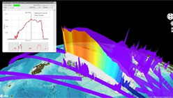
Stunning new features for ESA and NASA altimetry portal cs2eo.org
Working with combined ESA and NASA altimetry data is easier than ever thanks to a range of handy new features on cs2eo.org.